
LUBBOCK, Texas (KCBD) – Lubbock officially recorded its coldest temperature of the season.
Temperatures at the airport dropped to 32 degrees around 6:10 am and held at the freezing mark for at least 5 minutes.
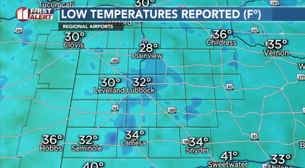 Low temperatures recorded this morning(KCBD)
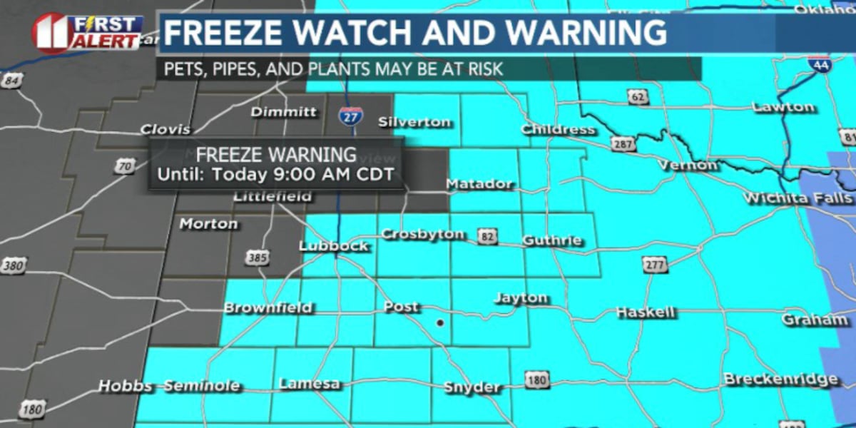
Freeze Warning remains in effect until 9 am for parts of the region. Clear skies, calm winds, and a lingering pocket of cold air have allowed temperatures to tumble well below freezing in some spots
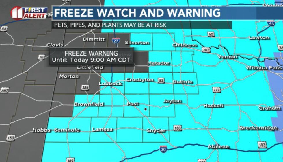 Freeze warning in effect until 9 AM(KCBD)
Sunshine returns in full force today, and a ridge of high pressure building to our west will help kick out the upper-level low that’s been keeping things cold.
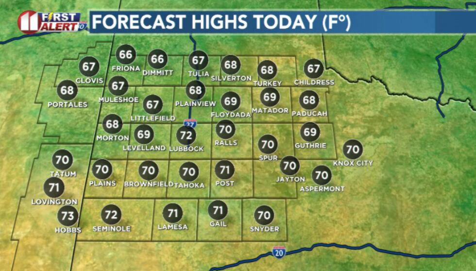 Highs today(KCBD)
With a light breeze developing this afternoon, temperatures will rebound into the upper 60s and low 70s, marking the start of a gradual warm up.
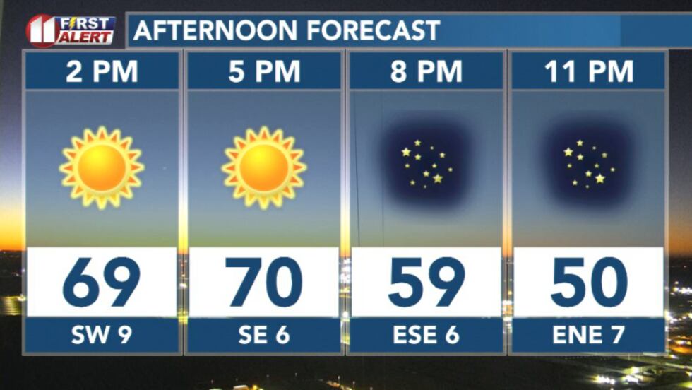 Afternoon forecast(KCBD)
By Friday winds will shift more southeasterly as a weak storm system form over the Rockies that’ll pull more moisture into the region and nudge highs closer to the 70s again.
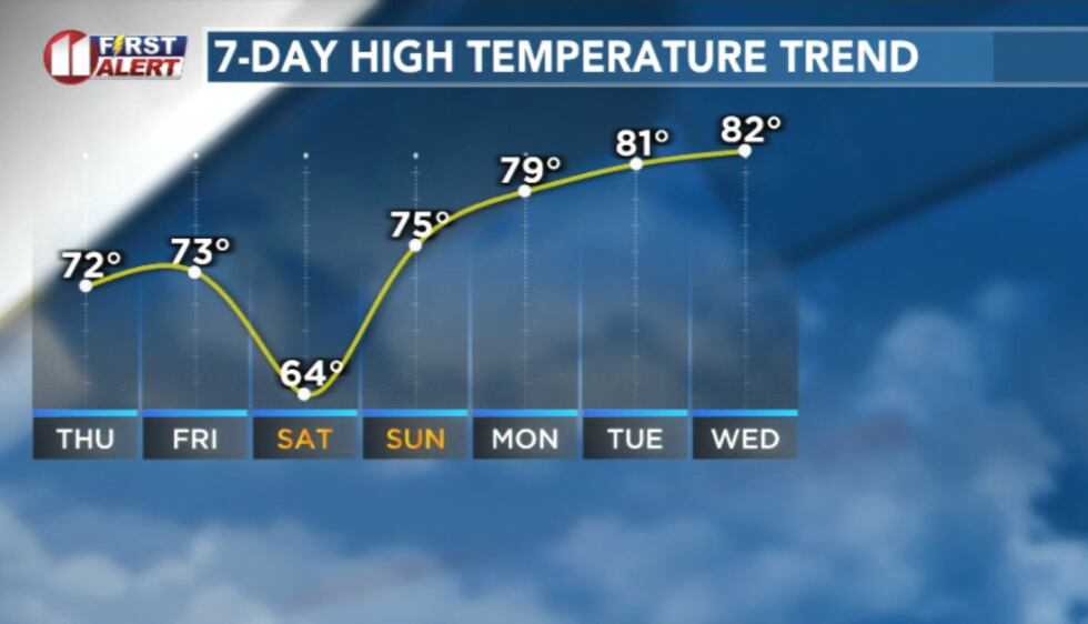 Temperature trend this week(KCBD)
If you’re headed out for trick-or-treating Friday afternoon, expect calm conditions, light winds, and cool but pleasant temperatures. Around sunset temperatures sit near 65 degrees, dropping into the 50s by mid-evening.
Another weak front Friday night will bring brief cool down for Saturday, with afternoon temperatures in the 60s
By Sunday a stronger ridge of high pressure takes over meaning warmer weather through next week. Expect highs to climb back into the low to mid 70s
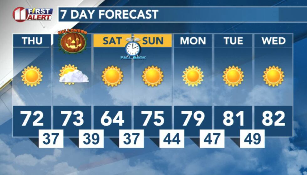 7 day forecast(KCBD)
Copyright 2025 KCBD. All rights reserved.