
May the 4th be with you on this Monday!
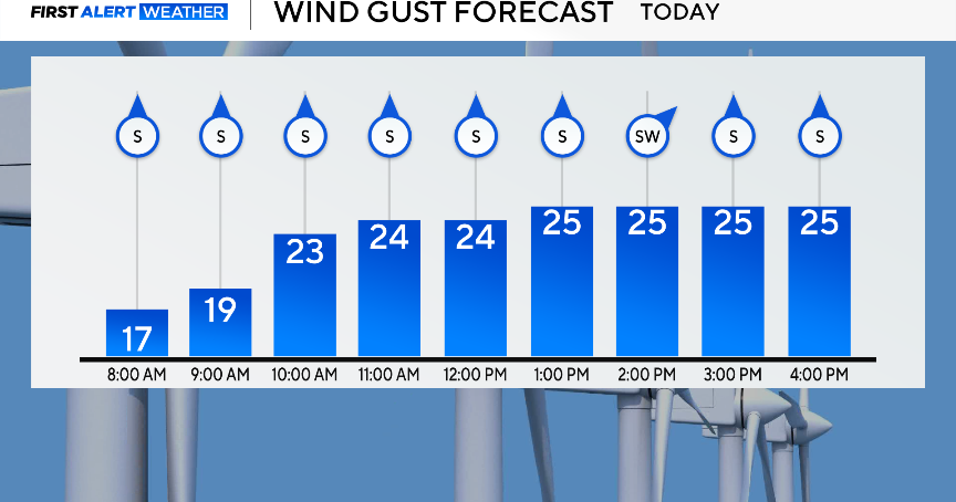
We are off to a mild start this morning with temperatures in the 50s and 60s. To start the workweek, expect partly cloudy skies and breezy winds this afternoon gusting up to and possible over 30 mph at times. These southerly winds will help to warm us up into the middle 80s.
CBS News Texas
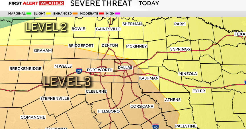
There is a chance for a few isolated (10% chance) storms across our Red River Counties later this evening as a dryline sets up to the west however with a strong CAP in place the chances look slim. There is a low-end severe threat across Montague, Cooke, Grayson, North Wise & Northern Denton counties.
CBS News Texas
Looking ahead to Tuesday, it is a First Alert Weather Day due to the threat for late day strong to severe storms as a dryline continues to set up and a front moves in from the north which will impact the timing of the storms. As of now it looks like most of the daylight hours should remain dry. There’s even a scenario where the front could move through later and our storms may not move in until as late as 9pm. Our storm chances will linger on Wednesday morning and possibly into the afternoon for our southeast counties as that front lingers south of the Metroplex. Wind and hail would be the two main threats.

CBS News Texas

CBS News Texas
The rest of the workweek will be fairly quiet with temperatures briefly falling below average on Thursday and then warming back up to the 80s on Friday. Another chance for isolated storms returns for Mother’s Day.

CBS News Texas