
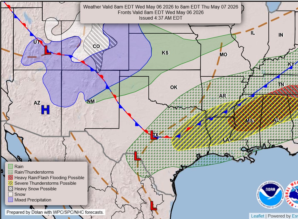
A dry line separating arid and humid air masses, and an approaching cold front, will stretch across Texas and create conditions favorable for a few strong to severe storms, especially in parts of Central and East Texas.
Weather Prediction Center
May marks the peak of severe weather season across Texas, when storm activity typically ramps up and tornadoes become more common across the Lone Star State.

So far in 2026, Texas has recorded only about 20 tornadoes, with more than half occurring last month in North Texas near the Dallas-Fort Worth area. That’s a stark contrast to last year, when 162 tornadoes were reported statewide, showing just how quickly activity can ramp up once we move into peak season.
Article continues below this ad
This month is already beginning to live up to its reputation. Another round of active weather is expected Wednesday, bringing the potential for large hail, damaging winds, isolated tornadoes and heavy downpours to parts of Central Texas and areas east of Interstate 35.
The National Weather Service’s Storm Prediction Center is placing a good portion of East and Central Texas under a level 1 to 2 (out of 5) risk of scattered severe thunderstorms on Wednesday, especially in the late afternoon and throughout the evening.
Storm Prediction Center
Uncertainty about Wednesday weather
Wednesday will be a classic case of the “haves and have-nots” when it comes to rain and thunderstorms. However, all of Central Texas will feel the heat, with afternoon temperatures topping out in the upper 80s.
Article continues below this ad
A cold front will move south into Central Texas, while a dry line separating dry and humid air masses out west pushes into the Hill Country and toward the I-35 corridor. In theory, both features should bring a good chance for scattered thunderstorms. However, if either system slows down or doesn’t advance as far east toward Austin as forecast models suggest, storm chances will be more limited.
Then, if morning clouds linger through much of the day — coupled with smoke in the atmosphere from agricultural burns in Mexico — it could be a sign that the capping inversion, or atmospheric lid, will remain strong and limit thunderstorm development.
Three weather forecast models offer different projections for how much storm development we could see Wednesday afternoon, but all agree that wet weather is possible across parts Texas.
Pivotal Weather
A few forecast models show higher probabilities for storms by late Wednesday, as a cold front moves in from the north behind the dry line. This could provide better lift, pushing air upwards to allow showers and storms to develop. However, if the cold front slows down or stalls, storm potential will remain limited.
Article continues below this ad
Keep in mind that any activity would be isolated at best, with rain chances staying low, around 20% to 30%. That said, any storm that can sustain a strong updraft could produce large hail and possible damaging winds. The National Weather Service’s Storm Prediction Center has Austin under a low-end level 1 out of 5 risk for isolated severe thunderstorms, but parts of Williamson County are under a level 2 out of 5 threat of scattered severe thunderstorms for Wednesday evening.
What to expect from the cold front
What the cold front lacks in rain and storms on Wednesday, it may make up for with cooler temperatures through the rest of the work week. Peak daytime temps on Thursday will be in the lower 70s, followed by the upper 70s on Friday.
An upper-level atmospheric disturbance, or trough of low pressure, will move toward Texas by this weekend, extending rain chances through at least Friday. However, the timing of these potential storms remains uncertain.
Article continues below this ad
“The cooler air behind the front provides a ramp for moist flow to rise atop the denser air and trigger showers and storms, which could occur along the front Thursday morning and behind the front on the subsequent days,” weather service meteorologists wrote in their forecast for Austin on Tuesday. “The timing of those rains hinges heavily on when the trough ejects east and moves over our area.”
The cooler air won’t last long though, as temperatures climb back into the 80s by the weekend.