
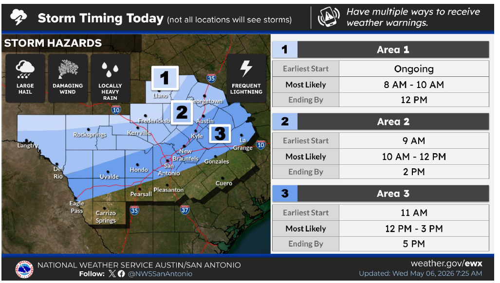
It’s cold front day across Central Texas, and the front is arriving faster than expected, with strong to severe thunderstorms already firing up across the Hill Country with half-dollar-size hail and 60-mph winds.
In anticipation of these strong to severe storms, the National Weather Service has placed much of the Texas Hill Country and areas along the Interstate 35 corridor under a severe thunderstorm watch until 1 p.m. Wednesday.
Counties included in the watch are:
• Bastrop
• Burnet
• Caldwell
• Gillespie
• Hays
• Llano
• Travis
• Williamson
Keep in mind that the watch could be extended if the cold front slows down or if more storms develop behind the front.
While this event won’t be a widespread rain maker like last week, it will bring pockets of heavier thunderstorms to portions of Central Texas. Currently, there is a 30% to 50% chance of storms across the region between 11 a.m. and 5 p.m.
Later this afternoon, the storm threat will shift east of Austin and the Interstate 35 corridor. Beyond today, more showers could develop after midnight and into early Thursday morning as cooler air filters into the region behind the cold front.
Thursday is expected to be the coolest day of the week, with morning temperatures near 60 degrees and afternoon temps only reaching the upper 60s to lower 70s. Enjoy the brief taste of cooler weather while it lasts, because warmer temperatures and more rain chances are expected to return as early as Friday and continue through the weekend.
Rainfall totals through the weekend look promising, with some areas near Houston potentially picking up an inch to 2 inches of rain between Wednesday and Sunday.