
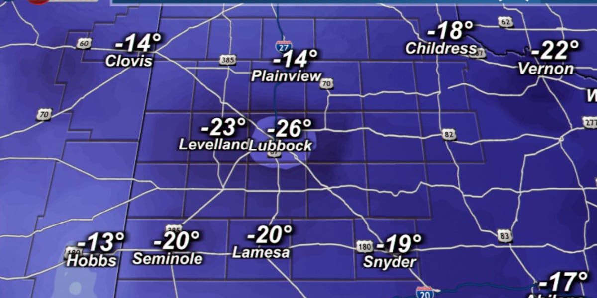
LUBBOCK, Texas (KCBD) – It was a very cold start to Wednesday morning due to our cold front. Temepratures were about 15° to 20° colder for most.
 KCBD(KCBD)
A quasi-stationary (nearly constant or stable front—over a specific period) front currently near the Texas/New Mexico state line will move back eastward Wednesday, but where it stalls is still uncertain, according to the latest forecast models.
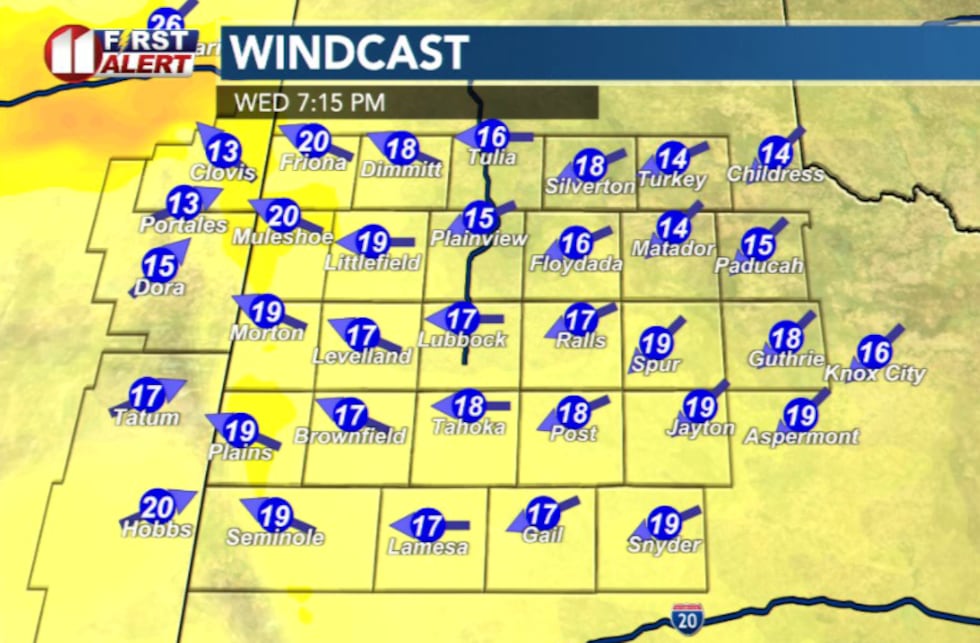
The front is expected to retreat to around the US-385 corridor, leaving much of the area split into two weather zones. East of the corridor, cooler temperatures and persistent easterly winds will dominate.
To the west, warmer conditions and breezy west winds are possible this afternoon, particularly across the western/ southwestern South Plains.
 KCBD(KCBD)What to Expect Today
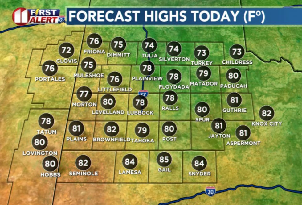
Low stratus clouds will persist throughout the region Wednesday, keeping temperatures cooler. There may be partly cloudy condiitions periodically throughout the afternoon. Highs will range from the low 70s in the north to the low 80s southward.
 KCBD(KCBD)
The latest model guidance shows the front lingering on the Caprock throughout the day, with easterly winds developing from east to west. These winds will continue to saturate lower atmospheric levels, maintaining some cloud coverage and moderating temperatures.
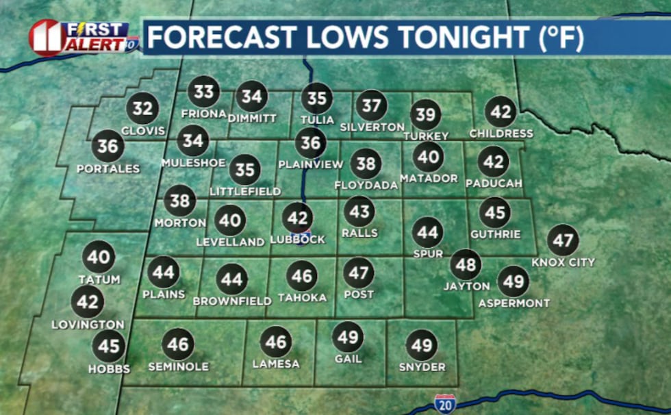
Freeze Threat Thursday Morning
A light freeze or frost is possible Thursday morning in the northwestern portion of the viewing area. Residents in that area should monitor conditions closely and take precautions for sensitive plants and other outdoor preparations.
 KCBD(KCBD)Warming Trend Ahead
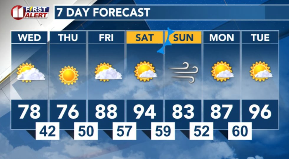
Relief is on the way. Much warmer temperatures are expected this weekend and into next week as the front moves out of the region.
 KCBD(KCBD)
Copyright 2026 KCBD. All rights reserved.