
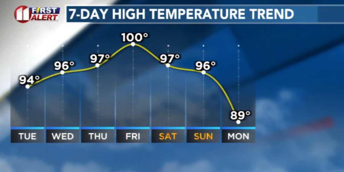
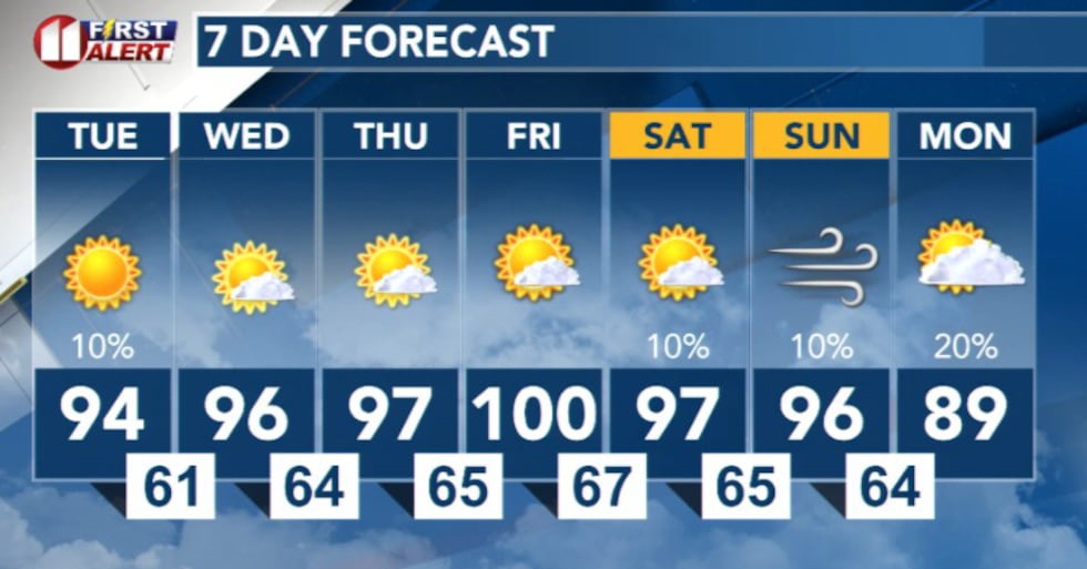
LUBBOCK, Texas (KCBD) – A significant warm-up is underway across the South Plains, with temperatures climbing into the mid-to-upper 90s Tuesday and remaining hot through the weekend.
 KCBD(KCBD)
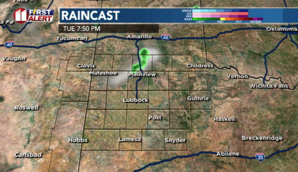
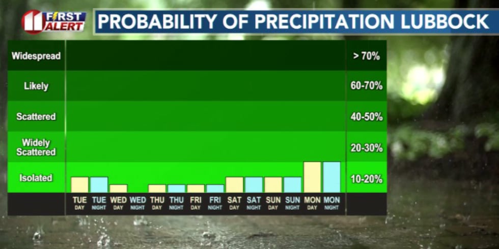
While the overall pattern remains dry, a very slight chance of isolated thunderstorms cannot be ruled out Tuesday afternoon near the northern South Plains. It is a slim chance, a 10% probability.
 KCBD(KCBD)
Any storms that develop would be high-based and capable of producing strong wind gusts up to 55 mph, however, coverage is expected to be extremely limited. The main threat today will be storms capable of producing damaging winds.
Heat continues through weekend
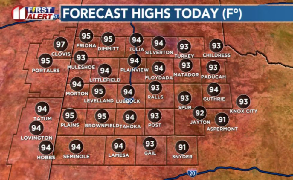
Highs Tuesday will range from the low-to-mid 90s east of Interstate 27, with areas west of the interstate reaching the mid-to-upper 90s. Some western locations could approach triple digits. Overnight lows Tuesday night will be mild, ranging from the mid-50s to mid-60s.
 KCBD(KCBD)
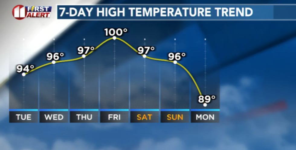
This hot pattern will persist through the weekend, with generally dry conditions expected through mid-week.
Isolated storms remain possible across each afternoon across the viewing area, with better storm chances returning this weekend as moisture increases.
 KCBD(KCBD)Fire Weather Concerns Return
Elevated fire weather concerns are expected to return by mid-to-late week as temperatures continue to climb and breezy conditions develop.
 KCBD(KCBD)
Copyright 2026 KCBD. All rights reserved.