
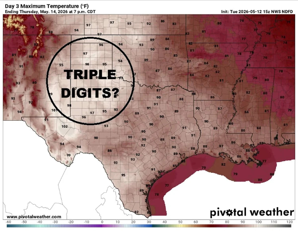
An unseasonable heat wave gripping the western United States is projected to expand into the nation’s heartland on Wednesday and Thursday, sending temperatures soaring across portions of Texas.
The Texas Panhandle, including cities like Amarillo and Lubbock, has yet to officially reach 100 degrees this year, but that could change in the coming days as highs climb into the upper 90s and low 100s, rivaling record highs.
On Wednesday, the record high in Amarillo is 95 degrees, set in 1960, while the forecast high is 94 degrees. On Thursday, Borger, about 40 miles northeast of Amarillo, will reach 101 degrees, which would easily surpass the town’s record high of 98 degrees set in 1996.
While this would mark the Panhandle’s first triple-digit temperatures of the year, other parts of Texas have already experienced extreme heat in 2026. Back in February, an unusual late-winter heat wave pushed temperatures above 100 degrees in deep South Texas, including Laredo, Cotulla, and Zapata.
What’s behind the heat?
A typical summertime weather pattern, featuring a strong ridge of high atmospheric pressure, is developing earlier than usual across the western two-thirds of the country.
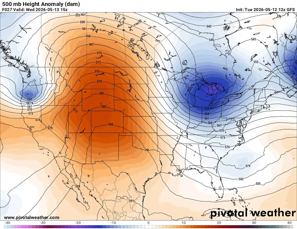
A ridge of high atmospheric pressure will settle over the desert Southwest, where the hottest temperatures are expected to develop. (Pivotal)
This “heat dome” produced by high pressure is expected to bring several days of intense heat as the system gradually shifts eastward toward the East Coast by the weekend.
The so-called heat dome is basically the result of high air pressure staying over a region for an extended amount of time. The increased atmospheric pressure does two things: It forces air to sink downward and the air heats up because of the compression near the surface. The sinking air prevents water vapor from rising high enough to form rain clouds and the drier air can heat up faster, sending temperatures to levels well above normal.
Over the past several days, this weather feature has sent temperatures in Death Valley, Calif., to 112 degrees, tying the daily record on Sunday, and Las Vegas topped out at 104 degrees, while Phoenix was a sizzling 109 degrees.
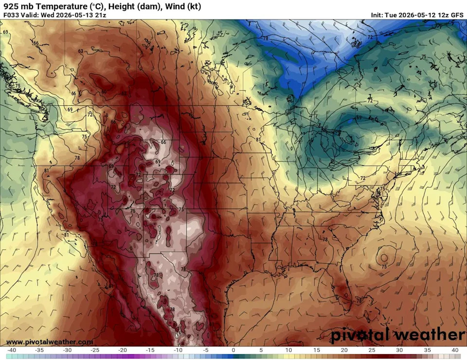
Heat will intensify beneath the atmospheric ridge of high pressure, sending temperatures soaring by as much as 20 degrees above normal. (Pivotal)
When will the fever break?
The ridge of high pressure is expected to weaken slightly and shift eastward by the weekend, allowing the Texas dry line that separates dry and humid air to become more active and bring chances for rain and thunderstorms from the Panhandle into West Texas. Until then, hot and dry weather will persist, while gusty winds on Wednesday and Thursday increase the threat of wildfires.
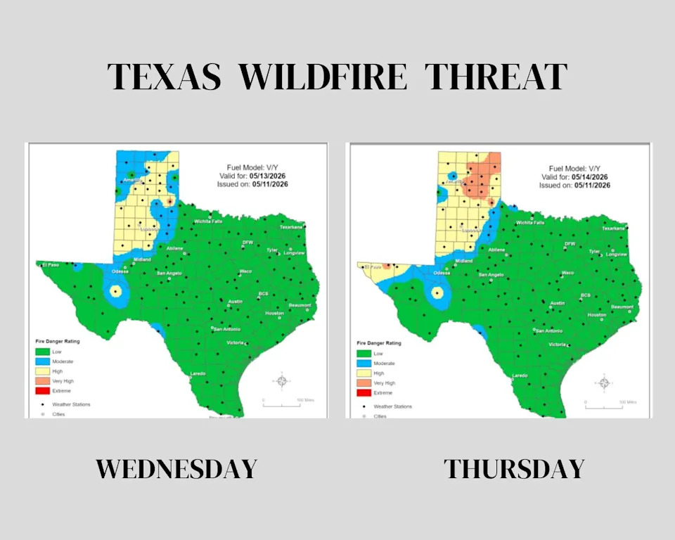
The threat of fast-spreading wildfires will pick up across the Texas Panhandle, where not much rain has been recorded in the past several weeks. (Texas A&M Forest Service)