
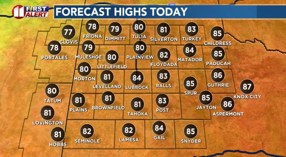
LUBBOCK, Texas (KCBD) – Highs in the 80s return to the South Plains region, driven in part by breezy southerly winds. The warm up will be dry, well, for most of the KCBD/FOX34 area.
A few rain showers, with an isolated thundershower or two, are likely to clip the northwestern corner of the viewing area until about midday. Elsewhere it will be sunny. The south-southeasterly wind will increase to about 10 to 20 mph, breezy, from late morning into early evening.
 A few showers may linger over the northwestern viewing area through midday, otherwise sunny, breezy, and warm this afternoon.(KCBD First Alert)
Temperatures will peak late this afternoon, with highs around seven to eight degrees above average for the date. That is quite warm. Lubbock’s October 14 average high is 76°. The record, by the way, is 97° on this date in 2020.
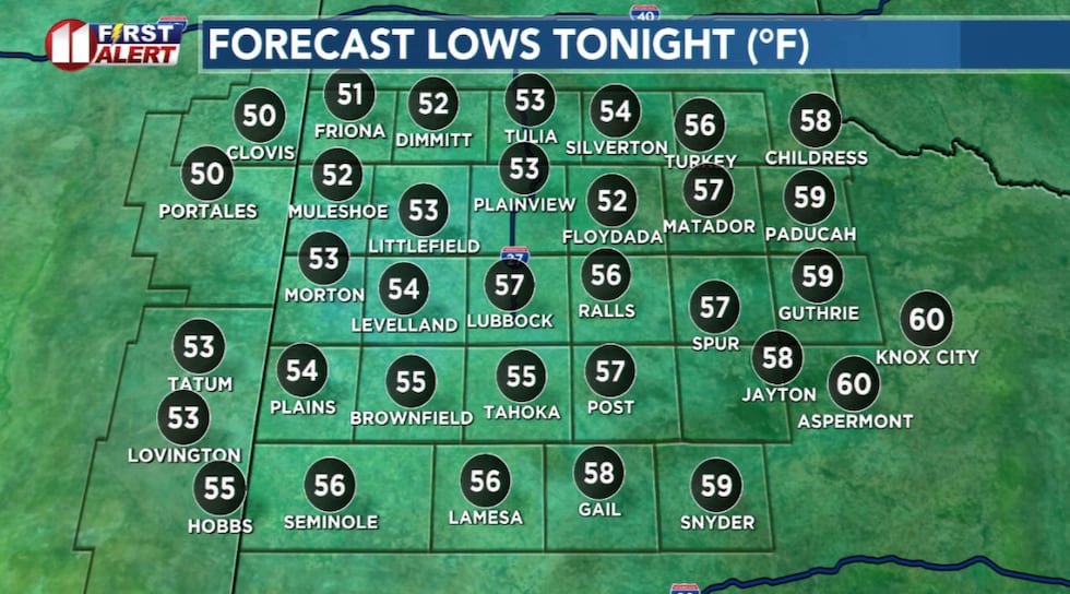
After a warm early evening, it will get cool tonight. Lows, however, will remain above average. Lubbock’s October 15 average low is 49°. The record low for the date is 31° in 1966.
 A bit of a chill greets those heading out early Wednesday morning.(KCBD First Alert)
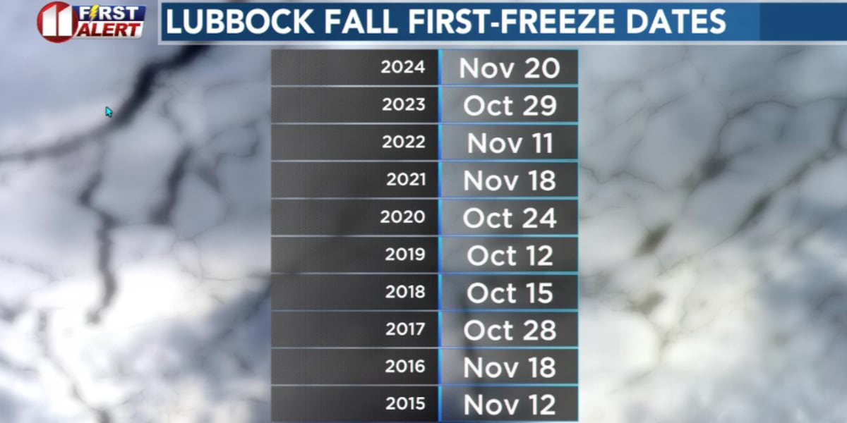
Here are a few hints about when Lubbock’s first Fall freeze may happen.
Lubbock’s earliest freeze in Fall occurred October 7, 1952. The low that morning was 31°. Lubbock’s latest Fall freeze occurred November 23, 2003. The average date of the first freeze? That’s October 31, Halloween.
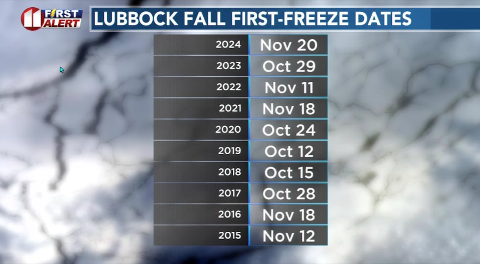 The dates of Lubbock’s first freeze in Fall for the ten most recent years.(KCBD First Alert)
Other than early morning clouds, Wednesday will be sunny, again breezy, and again with highs similar to today.
The area’s next chance of rain is late Thursday. As of today, it appears there is a slight chance of storms or showers over the far western viewing area, mainly near and west of the state line. At this time, I do not expect the rain to make it as far east as Lubbock or Plainview.
Dry, breezy, and seasonably warm weather is expected Friday and this weekend.
 A breezy, seasonably warm, and dry – for most – weather pattern. See the accompanying story for areas that may see rain.(KCBD First Alert)
A weak cold front – that is, there is not much cold air behind it – will drop temperatures only slightly this weekend. Mornings, in particular Sunday morning, will get a little chilly. Afternoons will be warm, with highs slightly above average for the time of year.
Copyright 2025 KCBD. All rights reserved.