
LUBBOCK, Texas (KCBD) – A cold that arrived in Lubbock around 3:30 a.m. Tuesday morning is the start of significant impacts to our weather pattern over the next several days.
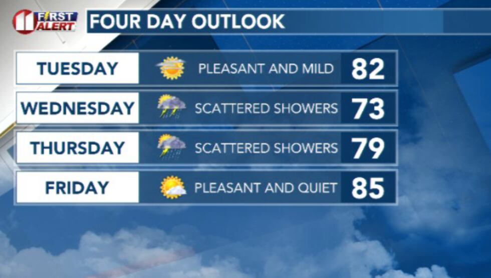 A much more mild and hopefully wetter forecast is in store for the coming days(Dylan Smith)
Daily rain chances and much more mild afternoon temperatures, along with less fire weather concerns are gracing the South Plains for the rest of the week.
TODAY
Temperature changes will be the most notable today compared to yesterday. Highs this afternoon will fall into the low to mid 80s for most, with some upper 70s as well.
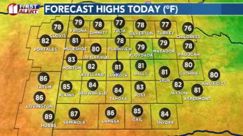 A morning cold front is going to impact high temperatures in a big way this afternoon(Dylan Smith)
A few isolated showers are possible, primarily for the southeastern counties this afternoon.
TONIGHT
Quiet and mild, overnight lows dip into the mid 50s tonight. Winds stay fairly relaxed.
WEDNESDAY
Temperatures continue to fall as more clouds and rain chances impact the area. High temperatures will drop into the 70s widespread.
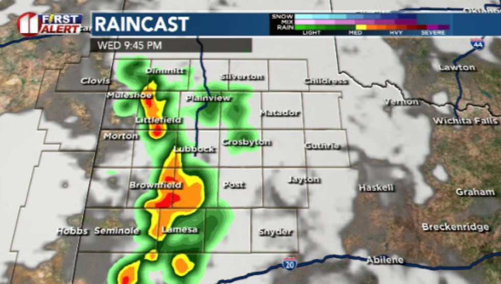 A line of showers and storms is expected to develop Wednesday afternoon/evening and push through the area(Dylan Smith)
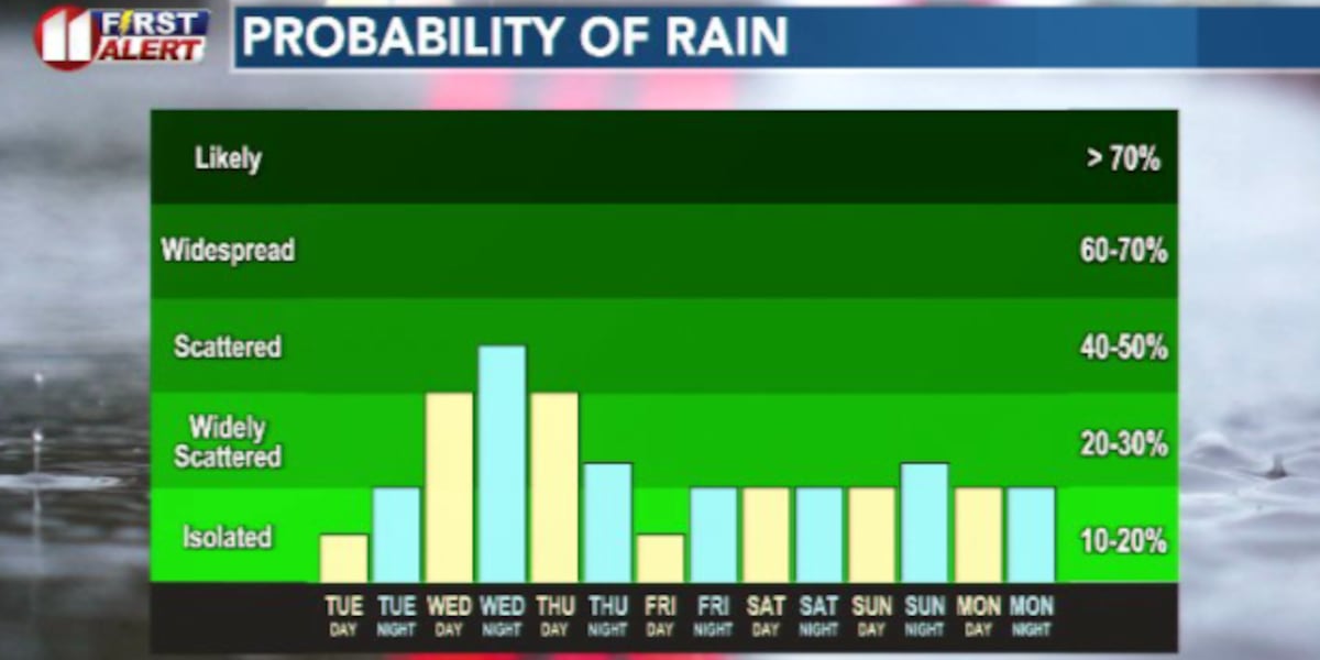
Our first of several days of decent rain chances ahead. Scattered showers and storms are expected to develop in the afternoon/evening hours out west and push into the area, possibly as a squall line that could reach strong to severe thresholds.
EXTENDED WEATHER PATTERN
We’ll continue scattered rain chances heading into Thursday before reducing those to more isolated shots of showers as we move towards next weekend.
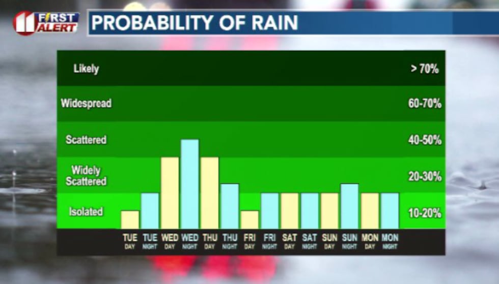 An unsettled weather pattern returns for the foreseeable future.(Dylan Smith)
Temperatures will continue to stay fairly subdued in the 70s and 80s for the rest of this forecast period.
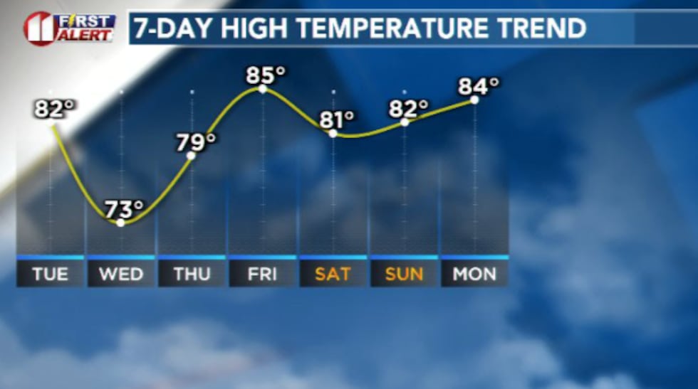 Temperatures will stay much cooler than those we had this past weekend(Dylan Smith)
Copyright 2026 KCBD. All rights reserved.