

Over the last few hours, scattered storms have developed across the Hill Country and just north of the Austin area along a cold front that is slowly moving south into Central Texas.
These slow-moving thunderstorms continue to pose a damaging hail and wind threat from the Trans-Pecos region, through the Hill Country, and now along the Interstate 35 corridor.
In anticipation of these strong to severe storms, the National Weather Service has placed the Texas Hill Country and areas along the Interstate 35 corridor under a severe thunderstorm watch until 1 a.m. Wednesday.
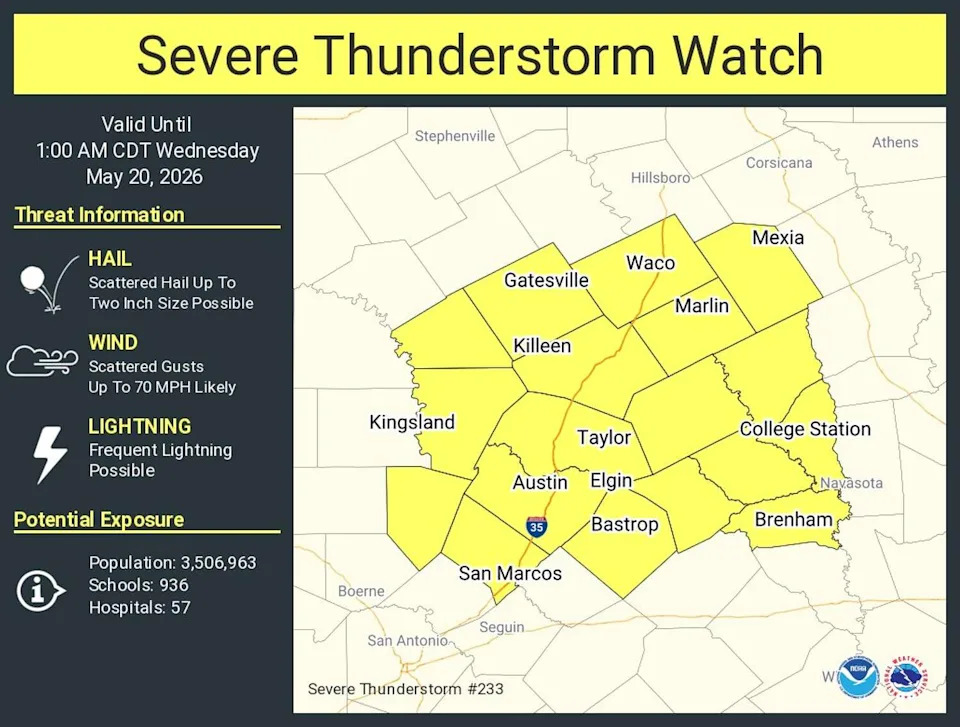
A severe thunderstorm watch has been issued for all of Central Texas until 1 a.m. (National Weather Service)
Central Texas counties included in the watch are: Bastrop, Blanco, Burnet, Hays, Lee, Travis and Williamson.
A very warm and humid air mass remains in place across Austin. While the official high temperature reached 94 degrees on Tuesday, humidity pushed heat index values, or “feels like” temps to around 102.
That warm, unstable atmosphere is providing plenty of fuel for storms moving into Central Texas. Some storms could strengthen or hold together as they move through the Austin area between 8 p.m.Tuesday and 2 a.m. Wednesday.
After a brief lull, a secondary round of storms is expected to move in between 4 a.m. and 7 a.m. Wednesday.
Nighttime storms can be especially dangerous since severe weather is harder to see while people are sleeping.
Before heading to bed:
Turn on emergency alerts.
Have multiple ways to receive warnings.
Move vehicles under cover if possible.
Know where to shelter if warnings are issued.