
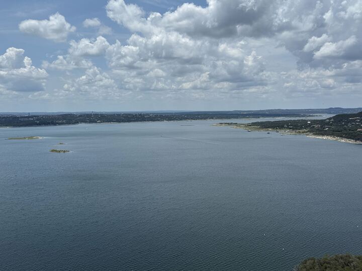
All recreational, commercial, and navigational uses of Lake Travis are currently banned.
Taylor Kamnetz
Summer is almost here, and that means lake days and tubing the river are just around the corner. Thankfully, because of recent scattered rainfall in Central Texas, several bodies of water in the region are nearly, if not already, full in time to beat the heat this Memorial Day weekend.

Seven popular Austin-area waterways have reached new water levels compared to last month, some higher than others, but the conditions all indicate a positive increase this year, with flows generally holding steady. Here’s a breakdown of current water levels at Austin swimming holes and their surrounding area lakes as of Friday, May 22.
Article continues below this ad
Lake Austin, pictured at at Mount Bonnell in March 2026.
Kelsey Thompson/MySA
Lake Austin
As of today, Lake Austin is 97.4% full, according to the Water Data for Texas website. Lake Austin is a water reservoir on the Colorado River in Austin. Its capacity is 23,972 acre-feet, and its current conservation storage is 23,065 acre-feet.
This time last year, in 2025, Lake Austin was 95.6% full, making this year’s water level a 1.8% increase, per its water data chart.
Article continues below this ad
All recreational, commercial, and navigational uses of Lake Travis are currently banned.
Taylor Kamnetz
Lake Travis
Barton Springs Pool is set to reopen on March 21 in Austin.
Courtesy of Austin Parks
Lake Travis is currently 75.2% full as of Friday, May 22, according to its state water data. Its capacity is 1,098,044 acre-feet, and its current conservation storage sits at 817,598 acre-feet.
Article continues below this ad
Lake Travis is a winding reservoir on the Colorado River located about 15 miles northwest of Austin.
Lake Georgetown
Lake Georgetown, north of Austin, is 100% full as of Friday, May 22, according to Water Data for Texas. Its capacity is currently the same number as its current conservation storage: 38,005 acre-feet.
Article continues below this ad
Lake Georgetown is a 1,297-acre reservoir situated on the San Gabriel River in Georgetown, located about 30 miles north of downtown Austin.
Granger Lake
Grange Lake, also north of Austin, is 100% full as of Friday, per its water data. The lake, located about 50 miles northeast of downtown Austin, has the same capacity and current conservation storage: 51,822 acre-feet.
Marble Falls sits picturesquely on the Colorado River, and is also nearby Lake LBJ, making for some insane views.
Emma Weidmann/MySA
Lake Marble Falls
Lake Marble Falls is 93.8% full of water, per its state water data. It has a capacity of 7,597 acre-feet, and the current conservation storage is 7,125 acre-feet. The lake is located in Marble Falls, about a 50-mile drive northwest of Austin.
Article continues below this ad
Lake Lyndon B. Johnson (LBJ)
Lake L. B. Johnson, aka Lake LBJ, is currently 96.9% full, according to its current water data chart. Its capacity is 112,778 acre-feet, and its current conservation storage sits at 109,254 acre-feet.
Lake LBJ and Lake Marble Falls are two separate, distinct reservoirs along the Texas Highland Lakes chain in Marble Falls. Water flows from Lake LBJ through the Wirtz Dam, which then directly feeds into Lake Marble Falls, according to the city’s website.
Article continues below this ad
Both are man-made reservoirs managed by the Lower Colorado River Authority (LCRA) in Austin.