
LUBBOCK, Texas (KCBD) – update 7:53 p.m. – Severe warnings continue over the Rolling Plains. These will continue moving east. A flash flood warning remains in place for SE Hale County, where very heavy rain fell.
Last hour we covered a tornado that moved between Hale Center and Abernathy in Hale County, north of Lubbock. We don’t have any reports of damage at this point. It looks like it stayed just west of the interstate, near FM 54.
update: 6:50 p.m. – Severe Thunderstorm Warning continues into Friday night.
update 6:26 p.m. – The National Weather Service says a severe thunderstorm capable of producing a tornado was located 7 miles north of Abernathy, moving southeast at 10 mph.
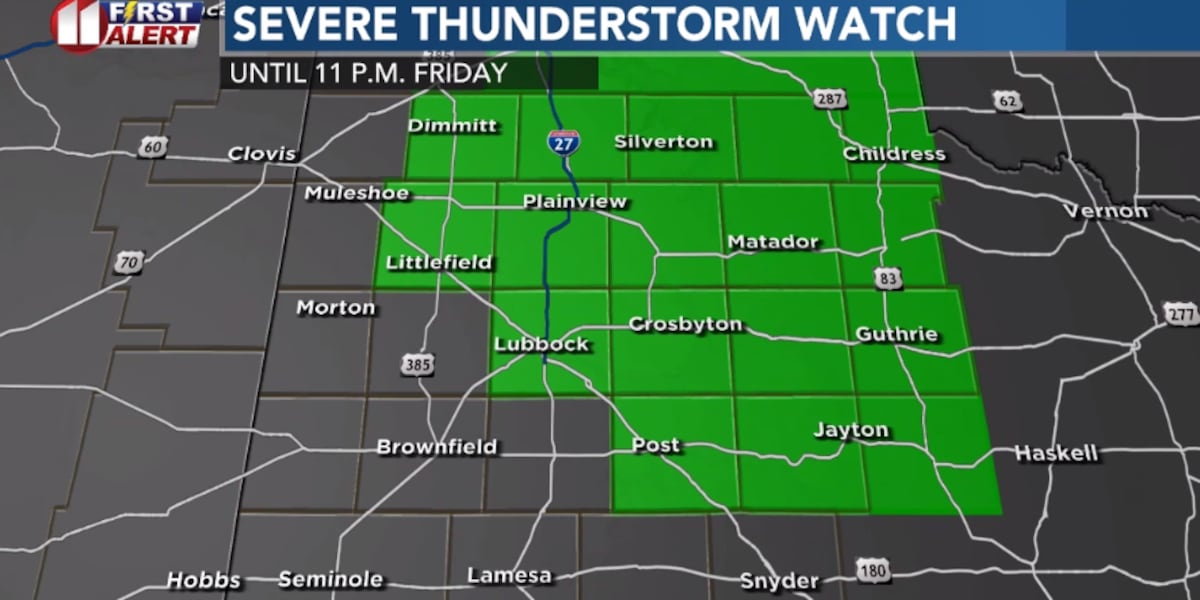
update 4:59 p.m. – A severe thunderstorm watch has been issued for Lubbock and locations north and east, shown in green below:
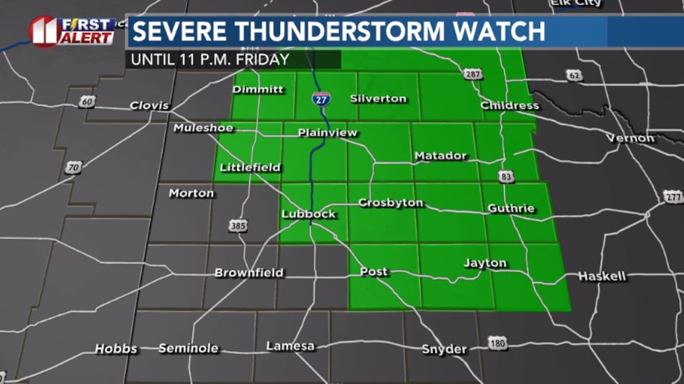 Severe thunderstorm watch in green(KCBD)
The watch is issued for the potential for storms to produce hail of at least 1″ diameter and some 60mph gusts.
Afternoon/evening storms today could bring some severe weather with them for some of the South Plains. A Slight (2/5) Risk for severe storms is in effect for the eastern half or so of the area for the afternoon/evening.
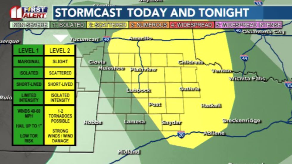 A Slight (2/5) Risk is in effect for the eastern 2/3rds of the South Plains this afternoon/evening.(Dylan Smith)
Scattered storms are likely to develop over the mid-afternoon hours, likely congealing into a line of storms that pushes through the eastern half of the area.
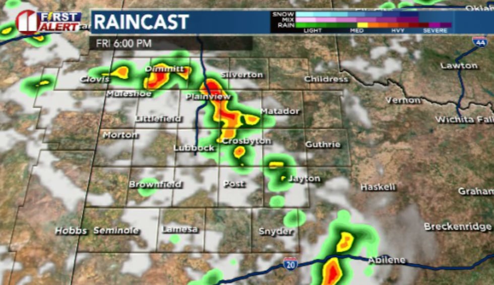 We’ll likely begin to see showers and storms develop throughout the afternoon and evening hours, likely developing into a broken line of storms as they move to the east(Dylan Smith)
Primary threats for the storms will be large hail (1-2″) and strong wind gusts (60-70 mph).
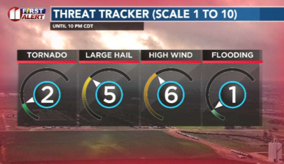 If we see severe storms, it’s most likely we see large hail and strong straight-line winds, with a small chance of a tornado or two(Dylan Smith)
TONIGHT
Quiet and mild, overnight lows remain in the 50s once again. Winds won’t be too much of a factor staying generally between 10-20 mph.
SATURDAY
High temperatures will remain in the mid 80s for the afternoon. We’ll see a return of isolated to scattered storms in the afternoon/evening hours.
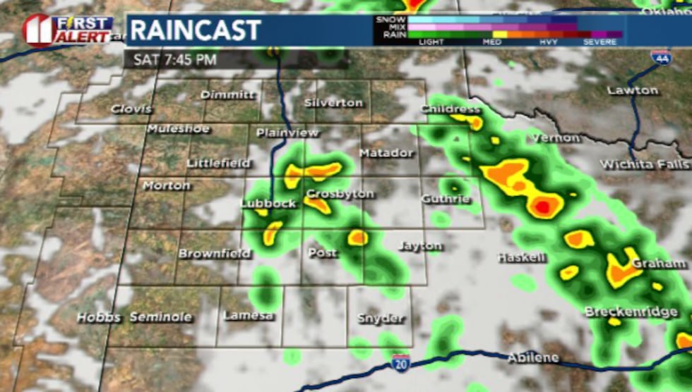 Another round of less strong to severe storms is anticipated for Saturday afternoon/evening.(Dylan Smith)
Currently we have a Marginal (1/5) Risk for severe storms for most of the area.
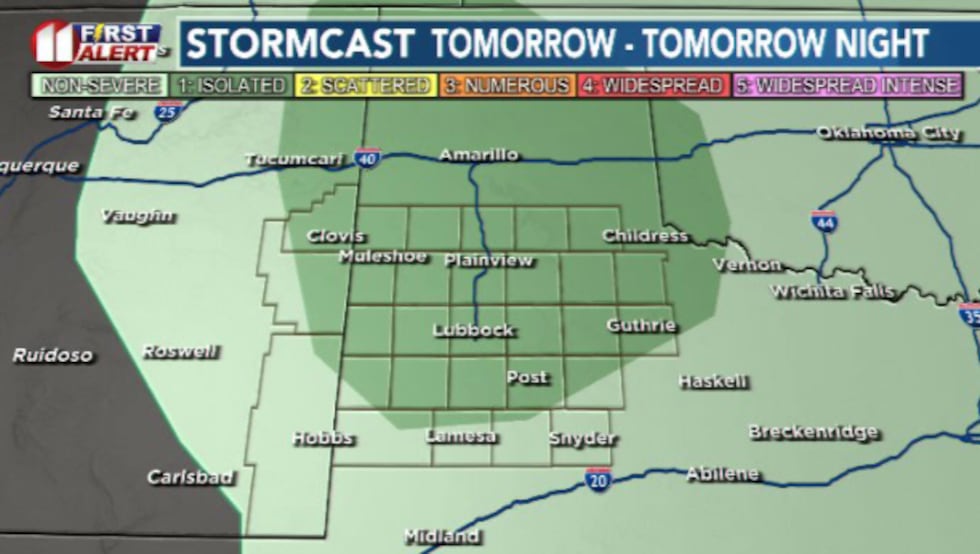 Another round of showers and storms could lead to more potential severe weather in the afternoon/evening hours Saturday(Dylan Smith)
SUNDAY
I’m anticipating a relatively quiet day on the rain chances front, but I’m not ruling it out completely.
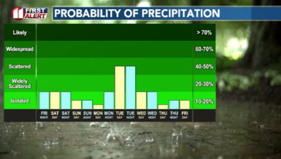 Rain is looking likely to peak heading into Tuesday next week, giving us a minor break in the daily rain chances we’ve been experiencing the last few days and for Memorial Day weekend.(Dylan Smith)
I’ve got a 10% chance for isolated showers and storms to develop for the afternoon hours. High temperatures will stay warm in the mid 80s for most.
MEMORIAL DAY (MONDAY)
A gorgeous day for Memorial Day. High temperatures are going to hover in the mid 80s once again.
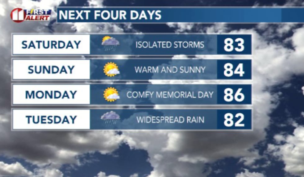 It’s shaping up to be a beautiful Memorial Day weekend ahead(Dylan Smith)
I don’t have a chance of rain in for now but with the way the weather pattern is setting up, we could potentially have a few pop-up showers in the peak-heating of the afternoon hours.
Copyright 2026 KCBD. All rights reserved.