
Watch a livestream of our coverage as well as radar, weather cameras and current conditions in the player above.
Latest watches and warnings | Submit your weather photos
LUBBOCK, Texas (KCBD) – update 10:22 p.m. – A new severe warning has been issued for eastern Lubbock, Floyd, Crosby and far NE Lynn counties. 1″ hail and 60mph gusts will be possible. Warning goes until 11:15.
A severe thunderstorm warning has been issued until 10:15 p.m. for Lubbock County and the central South Plains. This is for the potential for 60mph gusts and 1″ hail.
The Storm Prediction Center has issued a severe thunderstorm watch for Lubbock and roughly the northern half of the area until 11 p.m. Saturday.
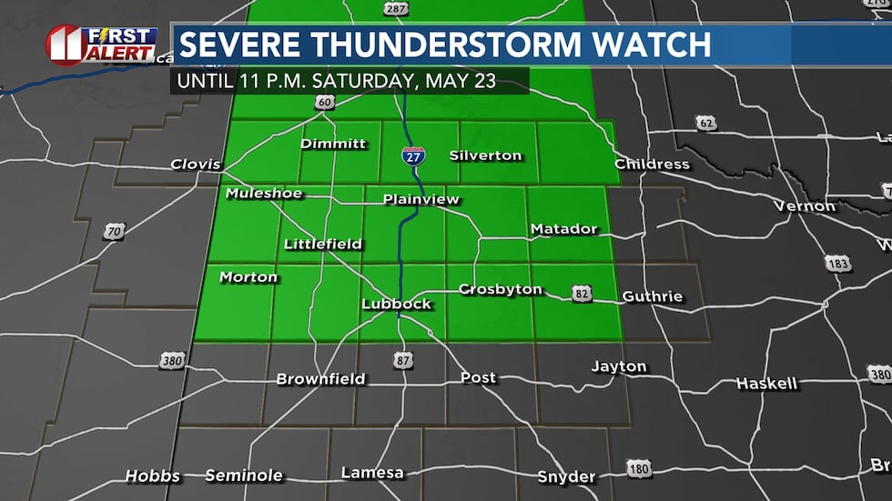 Severe thunderstorm watch in green, including Lubbock, until 11 p.m. Saturday, May 23.(KCBD)
The watch means where storms develop, they will be capable of producing large hail and damaging wind. Not every storm in the area will become severe. And not everyone in the watch area will get a storm or rain.
Scattered storms are anticipated heading into Saturday evening/early overnight hours.
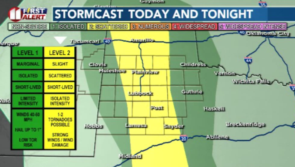 We could see some strong to severe thunderstorms later this evening and into the early overnight hours.(Dylan Smith)
Some of these storms could reach strong to severe thresholds of 1″ hailstones and 60mph gusts.
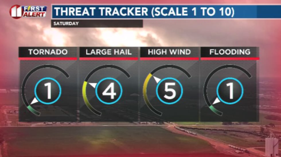 Hail and wind will be the primary threats from any severe storms we see this evening. A small chance for a brief/isolated tornado is possible.(Dylan Smith)
I don’t anticipate seeing much in the way of tornadoes, but an isolated one could be possible.
TONIGHT
Quiet weather tonight as storms wrap up in the late evening hours for the area.
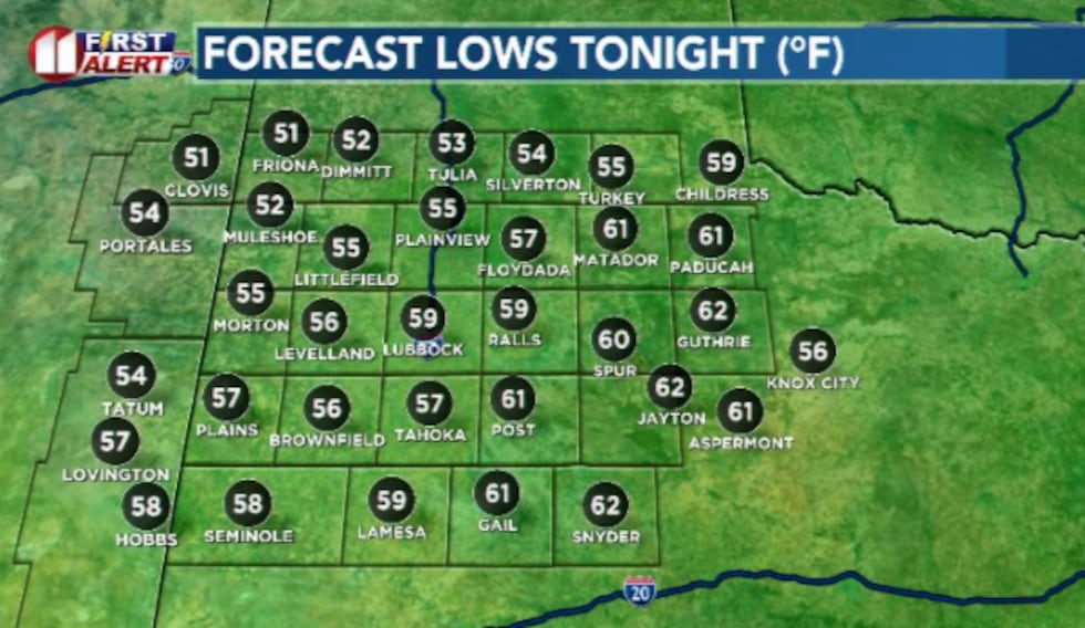 Temperatures will drop into the mid 50s and lower 60s tonight(Dylan Smith)
Overnight lows will drop into the 50s and lower 60s by Sunday morning.
SUNDAY
Generally a quiet day ahead. High temperatures will climb into the mid 80s once again.
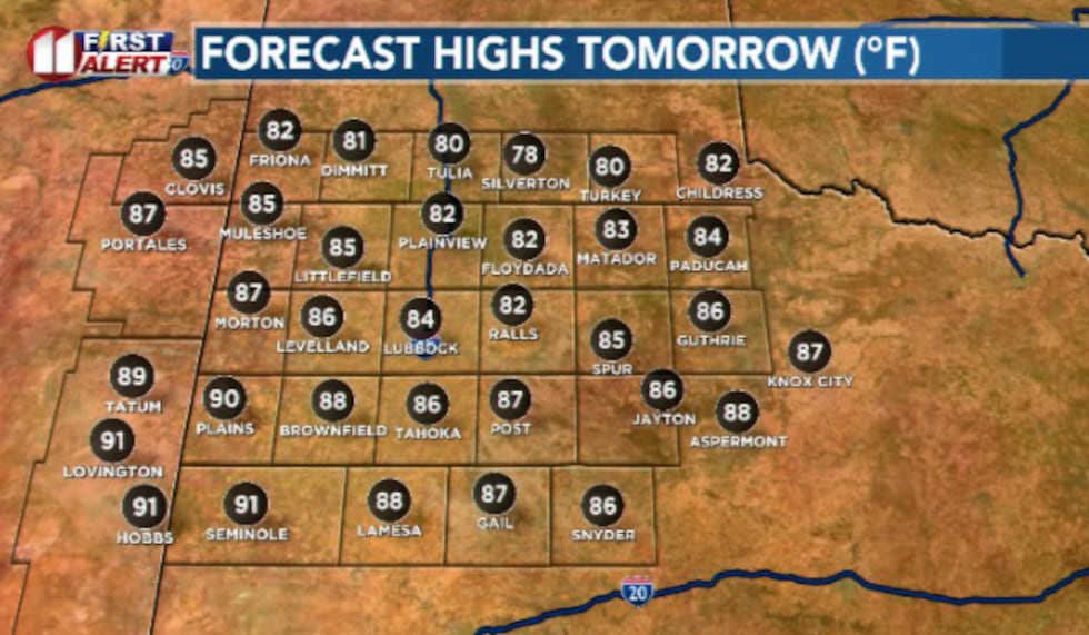 We’ll see high temperatures remain close to seasonal in the 80s and lower 90s.(Dylan Smith)
We have a chance for a few isolated showers in the afternoon/evening hours during the peak heating hours.
MEMORIAL DAY (MONDAY)
High temperatures for Memorial Day will reach into the mid 80s.
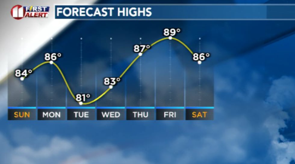 Temperatures will remain fairly seasonal/mild over the next 7 days.(Dylan Smith)
I’m expecting a pretty quiet day overall. Rain chances will start to pick up heading into the evening and overnight hours.
EXTENDED WEATHER PATTERN
Widespread rain chances are looking likely during the day Tuesday that could linger into Wednesday.
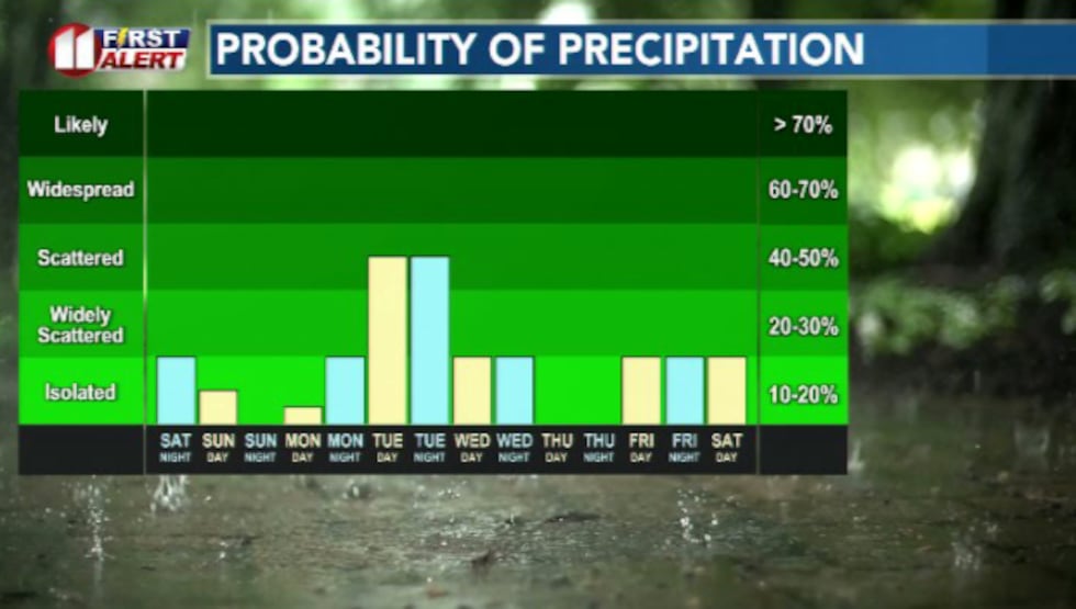 We could see a few storms this evening with more possible heading into Tuesday of next week(Dylan Smith)
High temperatures will remain fairly seasonal in the 80s for most of next week. Could be eyeing a cold front heading into next weekend.
Copyright 2026 KCBD. All rights reserved.