
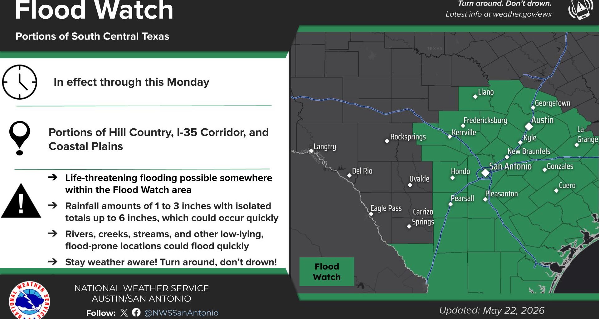
Central Texas was looking like it had settled into a classic stretch of active weather through the Memorial Day holiday, with daily chances for strong thunderstorms capable of producing torrential downpours, gusty winds that can knock out power, and dramatic lightning that can illuminate nighttime skies. But then, Mother Nature pulled a fast one and rain chances fizzled.
While the highest potential for organized thunderstorm activity was on Saturday, that doesn’t mean we can let our guard down on Sunday.
Right now, Sunday’s storm activity is more diurnally driven, meaning showers and thunderstorms are most likely to develop during the heat of the afternoon and in the evening, mainly across areas east of Interstate 35.
The atmosphere will remain similar to Saturday’s weather setup. While no widespread severe thunderstorm threat (large hail or damaging wind) is expected, a few isolated storms could still pack a punch, producing torrential downpours that could lead to localized flooding in some areas.
Rounds of thunderstorms from the last week have resulted in soils becoming saturated. For many parts of Central Texas, it won’t take much rainfall to produce excessive rain runoff.
“Models show low-level flow from the southeast to east through the short-term period keeping precipitable water near and above 1.5 inches from the Coastal Plains to Hill Country,” the weather service wrote in its forecast discussion for Central Texas. “Widespread rainfall totals of 1-3 inches are likely across the eastern half of the CWA (county warning area) and a few spots could receive up to 6 inches.”
Central Texas will remain locked in an active, wet weather pattern through the middle of next week as another frontal boundary moves across the Lone Star State. Memorial Day will be mostly dry, with only isolated storm chances, east of Interstate 35. Then, the next significant atmospheric disturbance, a shortwave of low pressure, will move across the region from Tuesday into Wednesday.
Given the time of year, some severe weather cannot be ruled out, but the primary threat so far is another round of heavy rainfall that could potentially lead to flash flooding.
Did you know that 30% of Texans have turned off wireless emergency alerts, potentially missing life-saving warnings during severe weather? Something as simple as making sure emergency alerts are turned on can help keep you informed — and could even save a life.
Here’s how to enable the alerts: