
LUBBOCK, Texas (KCBD) – Warm temperatures and spotty storm chances are settling into West Texas as we shift into a summer-like pattern.
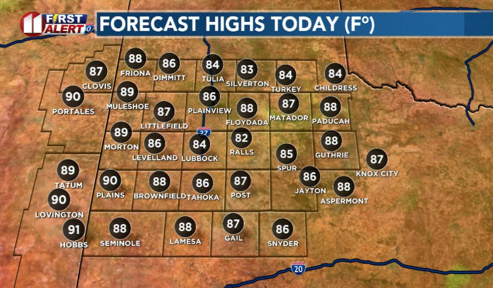 Highs today(KCBD)
Sunday will bring more sunshine and highs back into the 80s after Saturday’s storms.
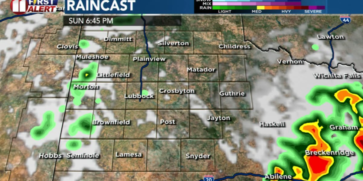
Isolated storms could develop near the Texas/New Mexico state line Sunday evening as storms fire over the higher terrain of New Mexico and drift east.
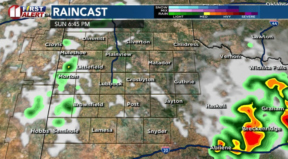 Future cast of potential rain later(KCBD)
Most communities will stay dry, and the severe threat appears low.
Memorial Day looks breezy, warm, and increasingly humid. Afternoon temperatures will climb into the upper 80s and low 90s with southeast winds continuing to pull moisture from the Gulf of Mexico into the region.
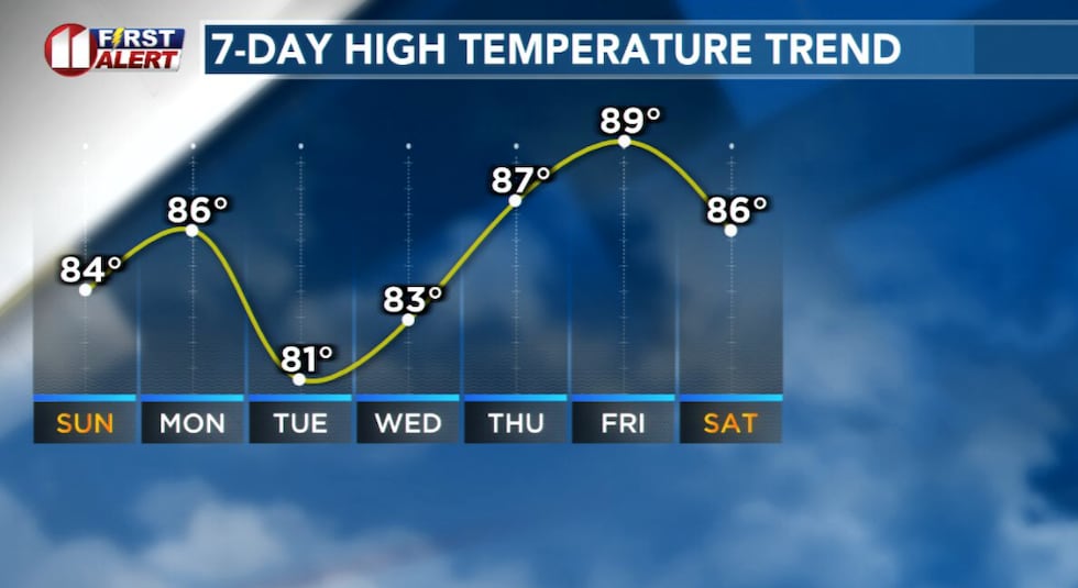 Temperature trend this week(KCBD)
The better chance for more widespread showers and storms arrives Tuesday as a stronger disturbance moves overhead.
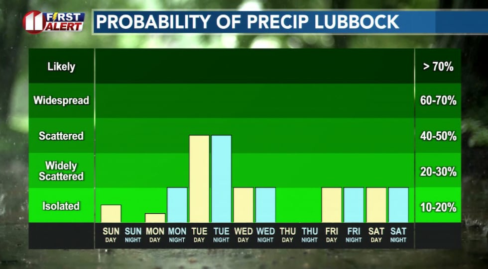 Rain chances(KCBD)
By the middle of next week, the overall pattern remains active with warm temperatures and periodic storm chances continuing across the region.
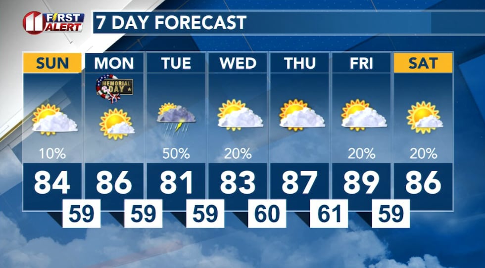 7 Day Forecast(KCBD)
Copyright 2026 KCBD. All rights reserved.