
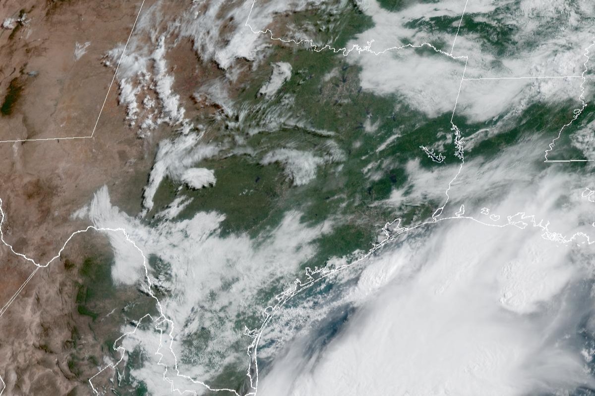
In this weather satellite photo of Texas taken around 9:15 a.m. Sunday morning, fewer clouds are covering the state. Sunnier skies are expected for the Memorial Day holiday on Monday.
Geostationary Operational Environmental Satellites/CIRA and NOAA
The rainy Memorial Day weekend we were warned about never quite materialized, and the National Weather Service ended its flood watch Saturday, about two days early. Instead, the holiday on Monday is expected to have plenty of sunshine.

But that doesn’t mean the rain threat is over for the week. Here’s what the weather service is projecting for the next few days:
Article continues below this ad
Memorial Day forecast
Memorial Day in Austin should be sunny, with temperatures getting close to 90 degrees, and likely reaching a high near 89. Skies should stay mostly clear at night, but overnight temps are expected to stay above a balmy 70 degrees into early Tuesday.
“Memorial Day itself has trended drier (in forecast models), but will still carry some low-end PoPs (probabilities of precipitation) over the Coastal Plains and northern I-35 Corridor in the event of a pop up shower or storm,” the weather service said in a forecast bulletin Sunday.
Rain chances return Tuesday into Wednesday
The threat of flooding wet weather that we expected over the Memorial Day weekend returns to the forecast for Tuesday and Wednesday.
Article continues below this ad
Although Austin on Tuesday has only a 20% chance of afternoon rain under otherwise mostly sunny skies, moisture-rich air carried by south-southeast winds will help ramp up storm chances to 80% after midnight. Tuesday’s temperatures will climb again into the upper 90s in the afternoon and bottom out in the lower 70s overnight.
“Tuesday and beyond get interesting again as an upper-level trough (of low atmospheric pressure) approaches from the west,” the weather service said, adding that forecast models show the “deepening trough dipping into west Texas on Tuesday afternoon and evening, sparking strong showers and storms along with the potential for additional locally heavy rainfall across a good chunk of South-Central Texas Tuesday night into Wednesday morning.”
Some models indicate precipitable water values of 1.5 to 1.8 inches over much of South and Central Texas, which essentially means the air would be saturated with enough water vapor to produce 1.5 to nearly 2 inches of liquid water.
Article continues below this ad
“This, in addition to enhanced vertical lift will play a role in the threat for a complex of storms to move into the region Tuesday night through Wednesday morning,” the weather service said in its forecast bulletin.
Flood forecasters at the Weather Prediction Center have placed most of South and Central Texas under a level 2 of 4 risk, or at least a 15% chance, of excessive rainfall that could produce flash flooding from Tuesday to Wednesday.
Weather Prediction Center/National Weather Service
Flood forecasters at the weather service’s Weather Prediction Center have placed most of South and Central Texas under a level 2 of 4 risk, or at least a 15% chance, of excessive rainfall that could produce flash flooding from Tuesday to Wednesday.
Austin on Wednesday has an 80% chance of showers and possible a thunderstorm, as daytime temperatures stay below 84 degrees in the rain-cooled air. South-southeast winds persist at 5 mph. Rain chances diminish to 40% at night, but skies remain mostly cloudy and help keep overnight temps above 72.
Article continues below this ad
“Beyond Wednesday, our pattern may remain active, but medium-range guidance starts to diverge and confidence is quite low in rain chances for the latter half of the upcoming week,” the weather service said.
Thursday and beyond
Forecasters said they are expecting warmer and drier weather at the end of the work week and into next weekend.
Article continues below this ad
Austin on Thursday has only a 20% chance of afternoon rain under otherwise partly sunny skies. Daytime temperatures will rebound to levels closer to 90 degrees, likely peaking near 89. Rain chances linger into the night, when predawn temps bottom out around 75 degrees.
Friday should be mostly sunny, forecasters said, with afternoon temperatures reaching 92 degrees.