
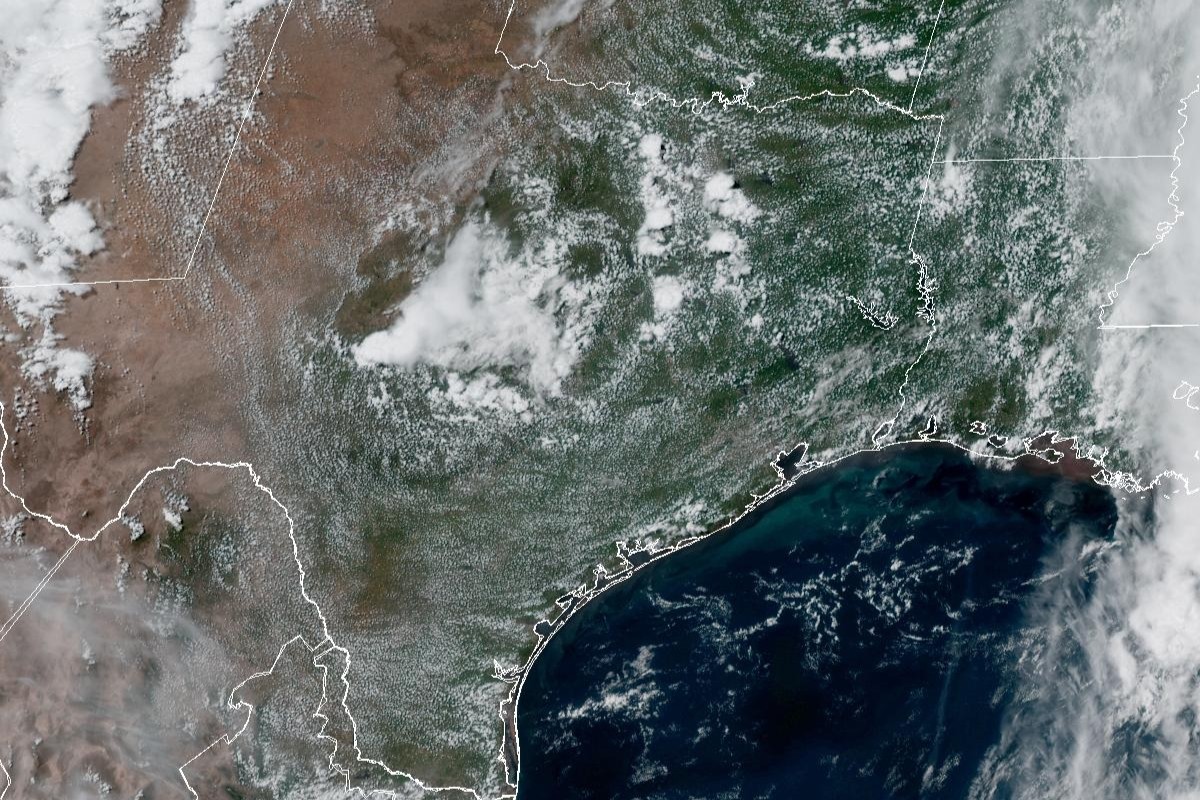
Much of Texas enjoyed mostly clear skies on Memorial Day, as seen in this weather satellite photo taken around 2:30 p.m. Monday. Houston will be mostly dry Tuesday before rain is expected overnight.
Geostationary Operational Environmental Satellites/CIRA and NOAA
Late Tuesday marks the start of another stretch of wet weather for Southeast Texas, with the main threats being gusty winds and an elevated risk of flooding, according to the National Weather Service.
Expect another atmospheric disturbance, a low pressure system moving in from the west, to trigger showers overnight into early Wednesday. Forecasters said they then anticipate less active weather toward the end of the work week. Here’s what we know so far:
Influx of moisture Tuesday
Houston on Tuesday will start the day with patchy fog through 10 a.m. The city has, at most, a 20% chance of rain during the day under otherwise mostly sunny skies. As afternoon temperatures flirt with 90 degrees, likely reaching 88, light and variable winds out of the southeast at 5 to 10 mph will deliver more moisture-rich air out of the Gulf of Mexico.
Article continues below this ad
The Weather Prediction Center, which provides threat assessments for excessive rainfall, has placed all of Southeast Texas under an elevated level 2 of 4 risk, or at least a 15% chance, of excessive rainfall that could lead to flooding Wednesday.
Weather Prediction Center/National Weather Service
“Eyes then turn to the west again as yet another shortwave trough (of low air pressure) begins approaching the region,” the weather service said in a forecast bulletin Monday. “(Forecast model) guidance is in still in pretty good agreement showing another complex of storms pushing across Southeast Texas late Tuesday night and Wednesday.”
Rain chances in Houston ramp up to 40% Tuesday night, especially after midnight. The persistent southeast winds that brought in more humid air means more clouds overnight, with temps bottoming out at a balmy 75 degrees before dawn Wednesday.
The increase in southerly air flow, hence, atmospheric moisture also means that the air could be saturated enough to produce up to 2 inches of rain. Isolated showers are likely Tuesday afternoon along the coast, but forecasters said they expect heavier rainfall overnight into Wednesday morning.
Article continues below this ad
“This deeper moisture, along with broad upper diffluence aloft should set the stage for some healthy thunderstorm activity and a possibility for regenerating/training cells,” the weather service said, adding that it was “too early to pin down the specifics, but something we’ll be keeping an eye on.”
Wednesday flood risk
Forecasters said the main period for rainfall will be after midnight into Wednesday morning as the low pressure system slides through Southeast Texas.
The weather service has given Houston a 100% chance of showers and possibly storms on Wednesday. So, yes, you are guaranteed to get wet and you should bring an umbrella with you throughout the day. Rain-cooled air will help keep temperatures steady from dawn to dusk, wavering between 75 in the morning and 77 degrees in the afternoon.
Although rain chances diminish to 50% at night, the lingering overcast skies and southeast winds will help keep overnight temps above 73 degrees before sunrise Thursday.
Article continues below this ad
The weather service’s Weather Prediction Center, which provides threat assessments for excessive rainfall, has placed all of Southeast Texas under an elevated level 2 of 4 risk, or at least a 15% chance, of excessive rainfall that could lead to flooding Wednesday.
Thursday’s lower chances for rain
Houston on Thursday starts the day with a 50% chance of rain that withers away to 20% at night. Daytime temperatures rebound into the upper 80s under partly sunny skies.
However, forecasters worry that atmospheric moisture and afternoon heating could trigger more isolated showers on Thursday, prompting the Weather Prediction Center to place areas east of the Brazos River under a level 1 of 4 risk of excessive rainfall.
Article continues below this ad
On Friday and Saturday, Houston’s rain chances stay at a slight 20%, while temperatures easily approach or break into the lower 90s
“The remainder of the week looks less eventful as some subtle mid-level ridging (of high atmospheric pressure) builds in,” the weather service said. “A mix of guidance tries to bring a weak backdoor front into portions of the region later this weekend.”