
Watch a livestream of radar, weather cameras and current conditions in the player above. There is no sound on this feed.
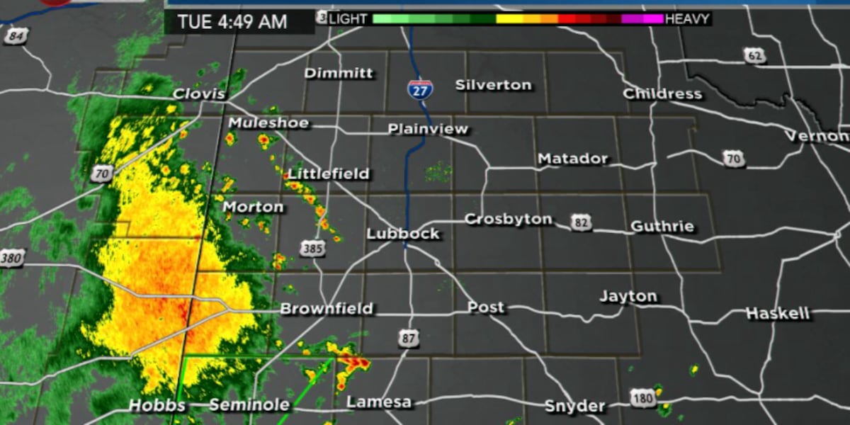
LUBBOCK, Texas (KCBD) – Showers and thunderstorms will move across the Caprock starting in the predawn hours Tuesday morning and continue into the afternoon, bringing heavy rainfall and the potential for localized flash flooding.
Most of the region can expect rainfall accumulations between 1 and 2 inches, with some areas receiving even higher amounts. Hourly rainfall rates could reach between a quarter to half an inch, with ponding of water expected in poor drainage areas and low-lying roadways.
While a low threat for severe weather exists, some storms may organize and produce strong-to-damaging winds between 50 and 60 mph along with hail up to quarter size. The primary concern, however, remains heavy rainfall rather than severe weather.
The storms will gradually increase in coverage across the South Plains through the early morning hours, with rain coverage expanding toward the east. Storm motion is expected to be toward the northwest.
What to expect
Much cooler temperatures are expected Tuesday due to the widespread rainfall. Residents should monitor conditions closely, particularly in areas prone to flooding. Short-term updates are being issued to track the general trends and rainfall rates.
There are no immediate concerns for flash flooding at this time, but trends are being monitored.
Looking ahead
Storm chances continue through Wednesday and into the upcoming weekend as additional moisture and atmospheric lift remain in place.
Copyright 2026 KCBD. All rights reserved.