
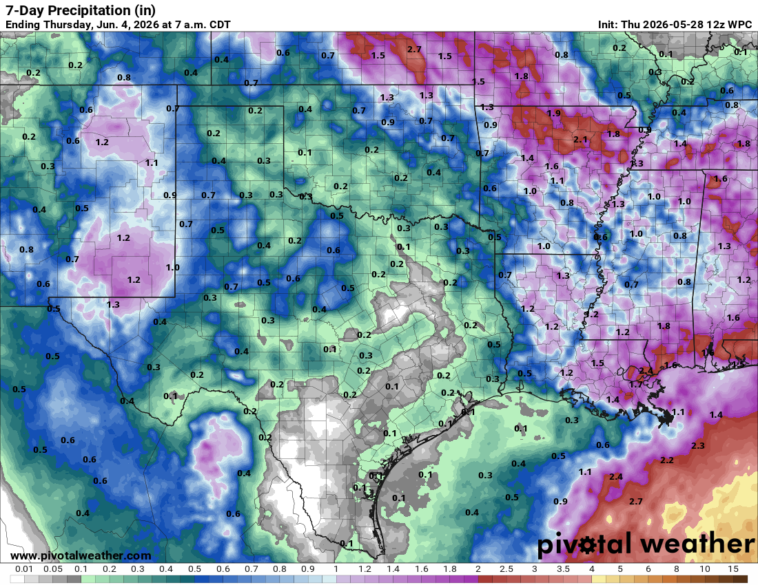
After a wet month across South Texas, the final weekend of May will turn dry, sunny and hot, with “feels like” temperatures nearing the 100-degree mark. The timing couldn’t be better, as kids are getting out of school and are ready to kick off summer vacation with long days at the pool or lake.
Our latest rain-maker is moving out of Texas, opening the door for a weak ridge of high atmospheric pressure to build in and bring a surge of warmer temperatures. This stretch of summer-like weather will last a few days before our next weather system arrives and brings daily rain chances back to the forecast next week.
So far this month, San Antonio International Airport has recorded nearly 6 inches of rain — about 2 inches above average for May. That has added to an already soggy meteorological spring, with 13.71 inches of rain recorded since March 1. That would put rainfall totals about 5 inches above normal for the season.
Friday will be dry and sunny across the region, but we could see a little patchy fog in the morning, thanks to the recent rainfall and saturated ground.
Morning temperatures will be near 70 degrees before climbing into the upper 80s and lower 90s by the afternoon. But heat index readings will range from 93 to 96 degrees.
“There will be some isolated to widely scattered rain and storms across West Texas and the Serranias del Burro mountains in Mexico along the dry line during Friday afternoon, but guidance suggests that activity will diminish as it advances,” meteorologists at the National Weather Service wrote in their daily forecast discussion on Thursday.
We’ll be sandwiched between an area of low atmospheric pressure along the East Coast and another area of low pressure over the West Coast, with a ridge of high pressure positioned in between. This setup is known as an Omega Block — a weather pattern in which the jet stream, a river of air that pushes storm systems eastward, buckles into a strong ridge in the middle, flanked by deep troughs on either side.
Think of it like a traffic jam in the atmosphere: The ridge acts as a roadblock, slowing or even stalling the typical west-to-east movement of weather systems. The pattern gets its name because, when viewed on a weather map, the jet stream resembles the Greek letter omega.
This weather pattern will keep the weekend dry across the Lone Star State with temperatures slightly above our late May average of 90 degrees. This is the time of year where we can start using the phrase “it’s not the heat, it’s the humidity” on a regular basis.
The ridge/trough weather pattern will shift and little next week. This will strengthen the west to southwesterly flow over Texas, which tends to lead to atmospheric disturbances moving across the region and bringing a small to moderate chance for rain on Monday and Tuesday.
“Uncertainty in the forecast increases entering midweek as the pattern will try to transition towards ridging once again but signs of some Gulf moisture (perhaps associated with the sea breeze) may keep daily low-end chances in play across portions of the region,” the weather service said.