
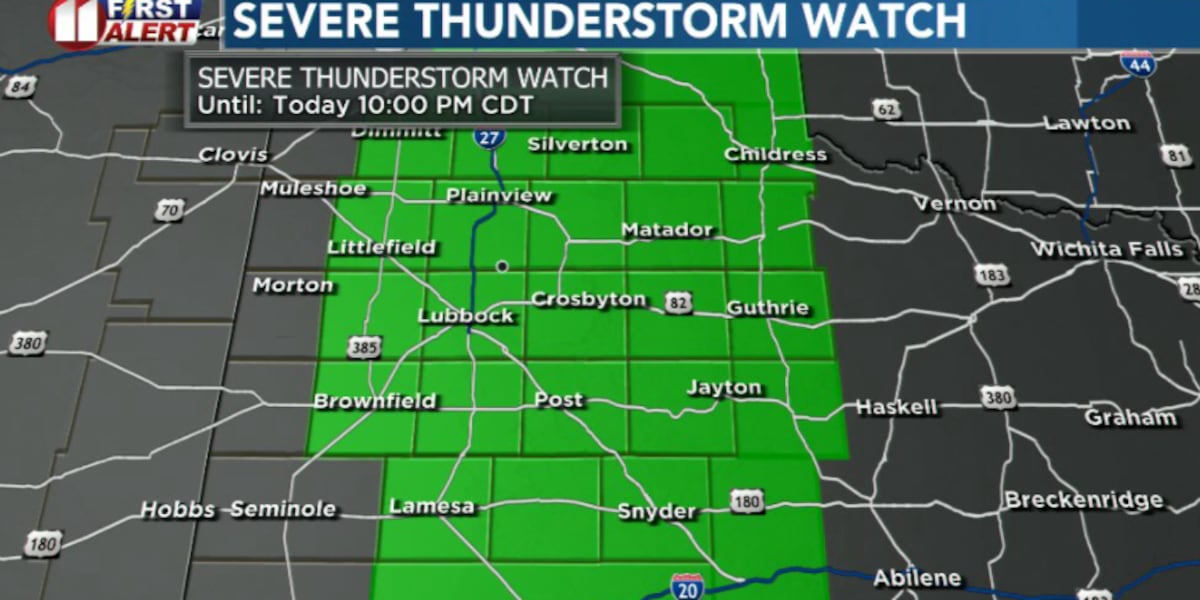
LUBBOCK, Texas (KCBD) -Storm chances are coming to an end this Friday evening.
The SEVERE THUNDERSTORM WATCH is canceled for all but two KCBD/FOX34 counties: Briscoe and Hall in the northeastern viewing area.
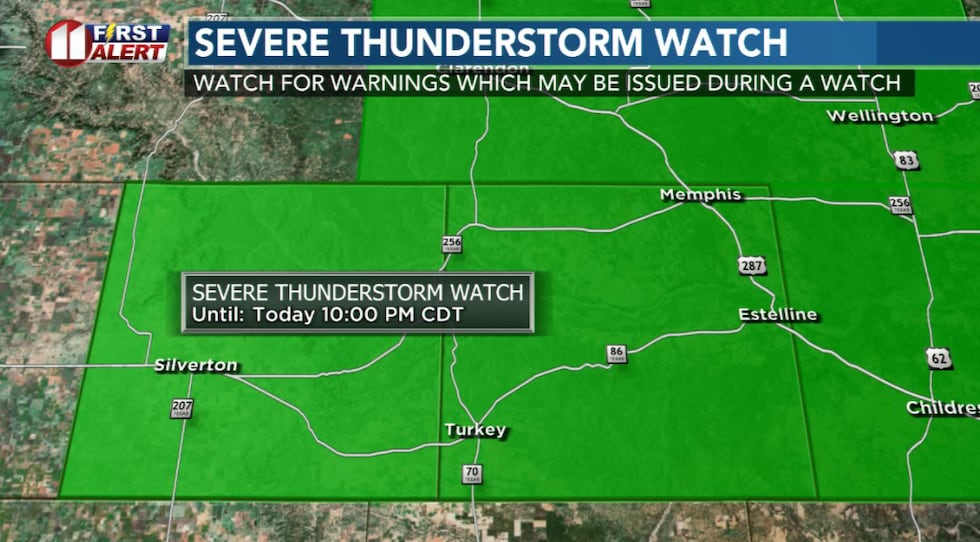 Only two counties remain in the Severe Thunderstorm Watch as of 9:24 PM CDT.(KCBD First Alert)
The image below shows all but the northeastern viewing area has been removed from the WATCH, which expires at 10 PM CDT.
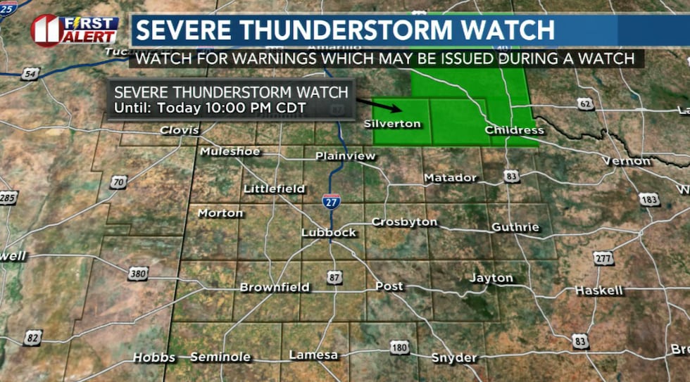 Only two counties remain in the Severe Thunderstorm Watch as of 9:24 PM CDT.(KCBD First Alert)
Earlier Story
The atmosphere has all the ingredients for strong storms. At the same time, there are several things working against widespread storm development.
The biggest one is cloud cover. If it hangs through the afternoon, it will block sunshine from reaching and warming the ground and storms will remain isolated.
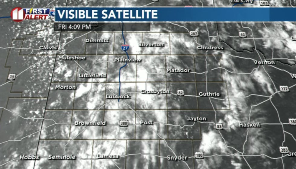 Cloud cover may limit how widespread storms become(KCBD)
However, if enough clearing occurs, scattered storms could quickly develop.
Some storms may turn severe, with the main threats being large hail, strong wind gusts, frequent lightning, and locally heavy rain.
Storm chances decrease overnight as drier air settles in.
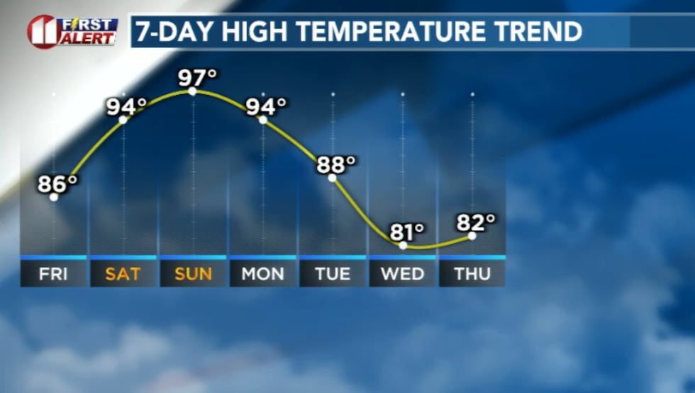 Temperatures heat up this weekend before falling next week(KCBD)
Most of the weekend looks hotter and quieter across the South Plains, though a few isolated storms could remain possible farther southeast into the Rolling Plains.
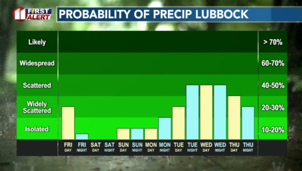 Rain chances continue into next week(KCBD)
Looking ahead, a more active pattern may return next week. Daily afternoon and evening storm chances are expected to gradually redevelop as moisture increases. Temperatures may also cool off by middle of next week.
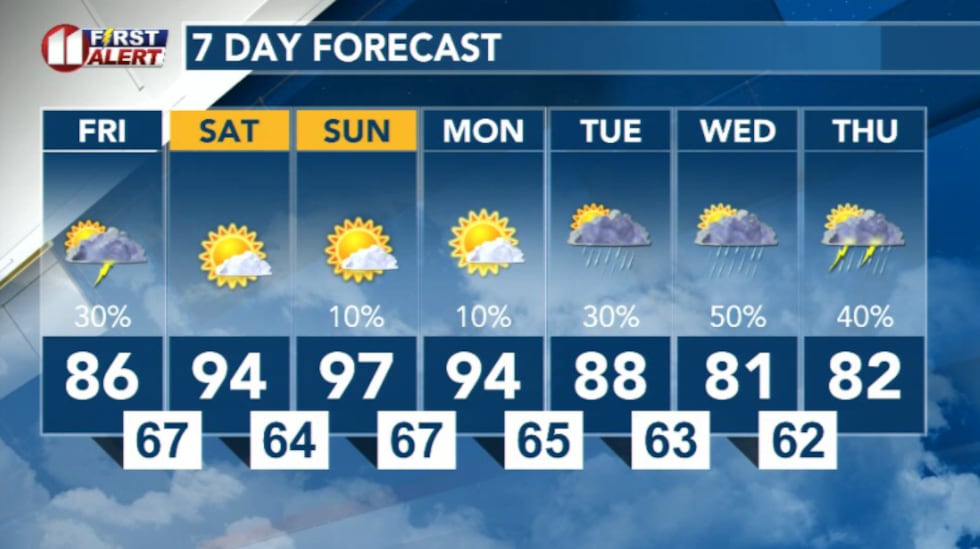 7 Day Forecast(KCBD)
Copyright 2026 KCBD. All rights reserved.