
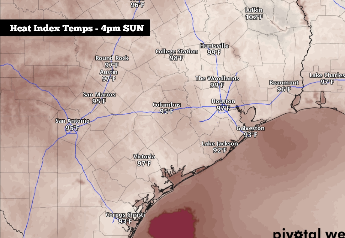
Shown are the potential heat index values across the region Sunday at 4 p.m.
Pivotal Weather
Sunday will be the last day of meteorological spring, and it was quite the active spring across Southeast Texas. Houston has recorded 17.72 inches of rain since March 1 – more than 40% more than the city’s typical spring rainfall. It was also Houston’s rainiest spring season in 10 years, since nearly 25 inches of rain fell during the spring of 2016.
Moving forward, some rain chances will continue into the first week of June. However, the incoming rainfall will be more isolated than what the area has experienced lately, likely keeping overall rain totals on the lower side. Here’s a breakdown of what you can expect.
Sunday’s forecast
Before the calendar flips to June, dry weather is expected for the last day of May on Sunday. The morning will start with mild temperatures, likely hovering in the mid- to upper 70s through 9 a.m. Partly cloudy skies are expected through the morning, along with high humidity levels.
Article continues below this ad
By the middle of the day, temperatures will rise steadily, hitting the upper 80s by 1 p.m. Late afternoon high temps are expected to top out at 90 to 92 degrees, near average for late May and early June. Throughout the day, partly cloudy skies are expected to continue, but rain chances will be less than 10%.
Humidity levels will be elevated throughout the day, leading to feels-like temperatures rising to between 95 and 97 degrees.
Rain chances return this week
High pressure is expected to weaken across Texas this week, leading to increasing rain chances. However, without a strong low-pressure system or cold front moving into the area, rain chances will stay rather scattered, not widespread.
On Monday, overall rain chances will be just 20% to 30% in the Houston metro area. Storms, if any, will likely be brief, lasting just 30 minutes or less. Humidity levels will continue rising, leading to heat index values close to 98 degrees.
Article continues below this ad
Higher chances for storms – about 40% to 50% – are expected by late Tuesday afternoon and evening, as a weak atmospheric disturbance moves in from the north. While storm coverage will likely be higher, storms are still expected to be relatively brief.
A few isolated showers and storms will stay possible Wednesday and Thursday, before rain chances rise higher again by Friday.
Shown are the potential rainfall totals over the next seven days, according to the National Blend of Models
Pivotal Weather
Because of the scattered nature of this week’s thunderstorms, rainfall totals are expected to stay quite low. According to the National Blend of Models, Harris County is projected to see near a half-inch of rainfall over the next seven days. However, that’s just an average. Some areas may stay completely dry throughout the week, while others could pick up more than an inch of rain.
Article continues below this ad
A few isolated storms could also be strong, especially on Tuesday. However, the overall severe weather threat – including the possibility of hail, damaging winds, and flooding – will be very low.
Temperatures will stay consistent and near-average throughout the week. Expect highs in the low 90s each day while low temperatures fall only into the mid- to upper 70s each morning.