
LUBBOCK, Texas (KCBD) -One more hot day before the weather pattern takes a turn. Temperatures Sunday will climb into the mid and upper 90s with a few spots crossing that triple digit threshold.
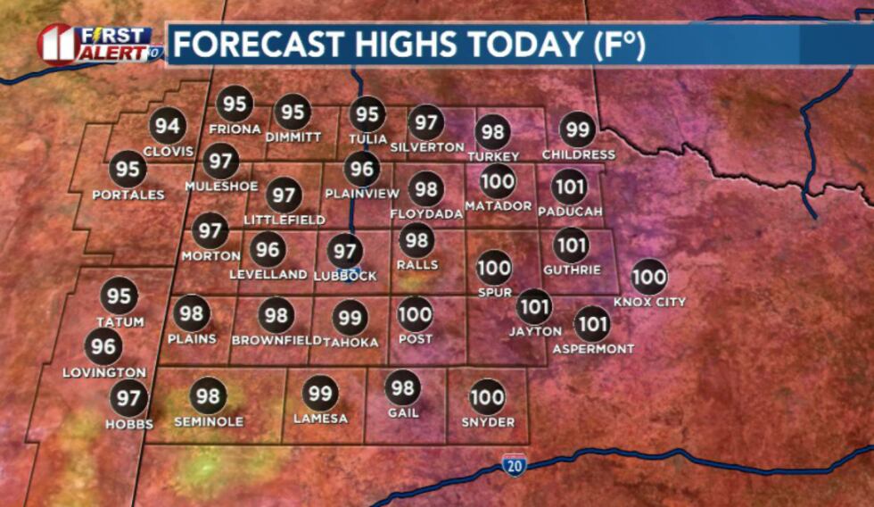 Highs Sunday(KCBD)
Lubbock is expected to top out around 97 degrees, while overnight lows range from the 50s to 60s.
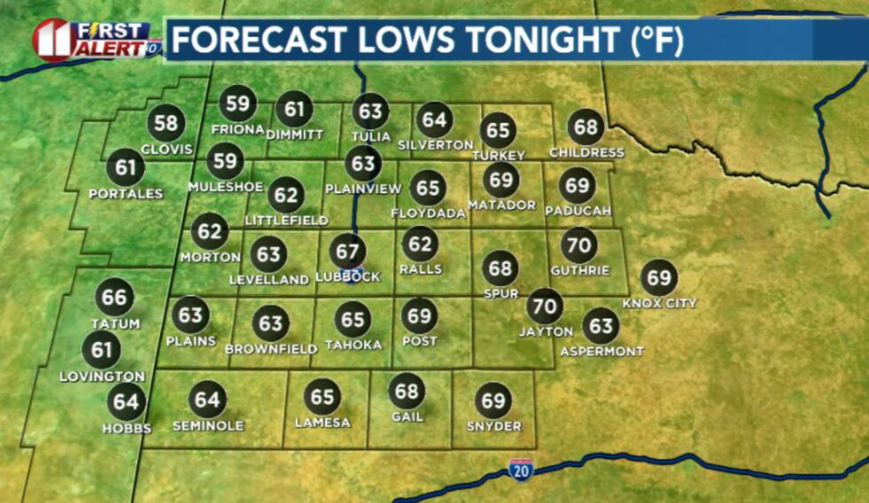 Overnight lows(KCBD)
There is a chance for isolated storms to develop late in the afternoon, generally southeast of Lubbock.
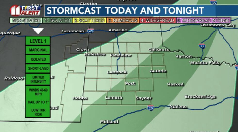 A few thunderstorms may become severe this afternoon and evening over southern portions of the South Plains and Rolling Plains. The primary hazards will be wind gusts up to 70 mph and hail up to about quarter size.(KCBD)
A few thunderstorms may become severe with the primary hazards wind gusts up to 70 mph and hail up to about quarter size.
Monday will bring another hot afternoon with highs in the mid 90s before a more active pattern begins to take shape.
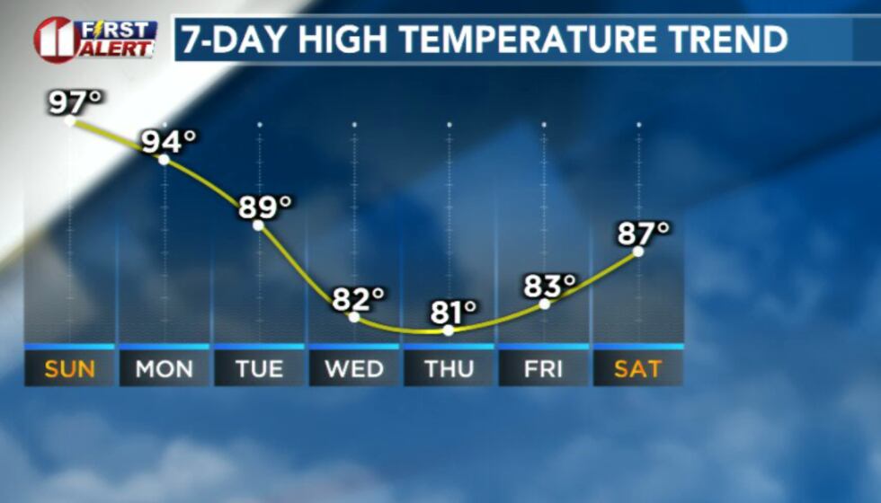 Temperatures will trend cooler this week(KCBD)
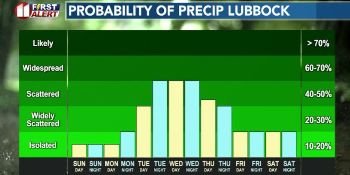
A storm system in northwestern Mexico will help pull moisture into West Texas and create daily chances for showers and thunderstorms beginning Tuesday and continuing through at least Friday.
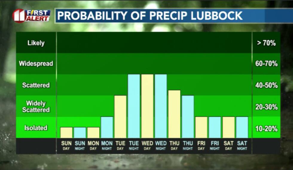 Rain chances become scattered to widespread this week(KCBD)
Tuesday through Wednesday currently looks to be the period with the greatest potential for widespread storms.
With the greatest risk being repeated storms over the same areas and flood potential.
However, this is still a few days out, so the details on severe potential will probably evolve quite a bit over the next 24-48 hours.
As clouds and rain become more common temperatures, temperatures will trend downward from the upper 90s early in the week into the 70s and low 80s by Wednesday and Thursday.
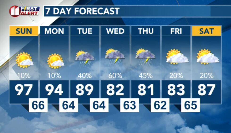 7 Day Forecast(KCBD)
Copyright 2026 KCBD. All rights reserved.