
LUBBOCK, Texas (KCBD) – Multiple rounds of thunderstorms and showers are expected on the South Plains through Saturday. While the severe threat remains low, locally heavy rain and some gusty winds are likely with some storms. Drier and hotter weather moves in starting Sunday.
Friday Evening
Scattered, slow-moving thunderstorms will continue, resulting in a continued flash flood risk across our area, until just after sunset. The pattern supports additional locally heavy rainfall, with rates possibly exceeding 2-3 inches per hour in spots.
The flash flood potential remains high with this activity through sunset.
Overnight Rain Chance
After these storms die down around sunset, another round of rain is possible overnight and may linger into Saturday morning.
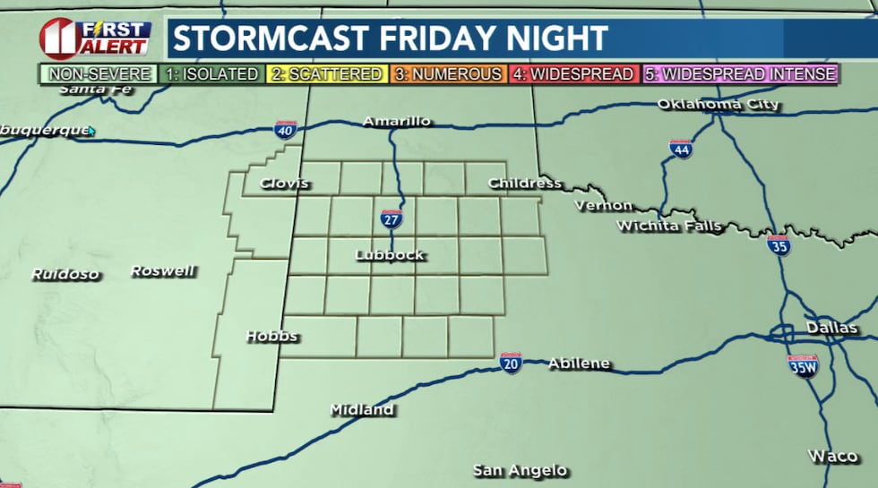 Another round of scattered showers and storms is expected late Friday night into early Saturday.(KCBD First Alert)
Once again, some storms may produce heavy downpours. Watch for flooded roads, especially at night when it is more difficult to see the danger. If you encounter flood water, remember: Turn Around, Don’t Drown. It’s not worth the risk.
The upper-level low pressure area fueling our storms will continue moving northeast overnight and reach the Permian Basin by daybreak. As it does, the atmosphere will remain moist and unstable enough for storms to develop and persist.
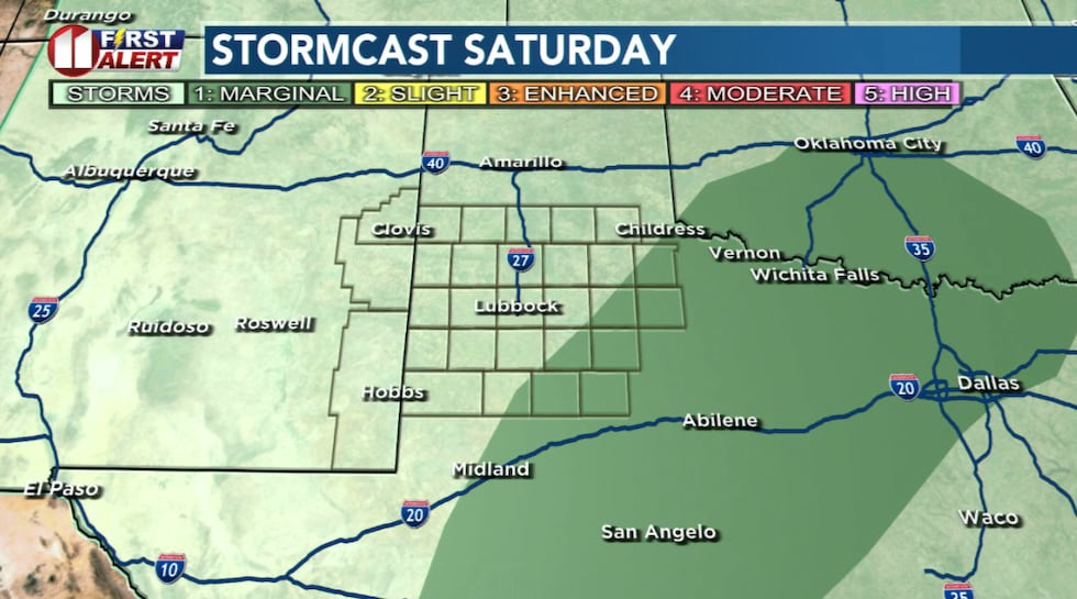 One more round of showers and thunderstorms may bring additional heavy rain late Saturday.(KCBD First Alert)
We wouldn’t be surprised to see more rain than our computer models are currently predicting. The combination of abundant moisture and the lift from the low could support efficient rain-producers.
One More Round
Another round of widely scattered thunderstorms and showers is expected Saturday afternoon and evening. Again, some may produce flooding downpours. The upper low will be moving slowly across the Rolling Plains during the day Saturday, keeping rain chances highest off the Caprock – the eastern KCBD/FOX34 viewing area.
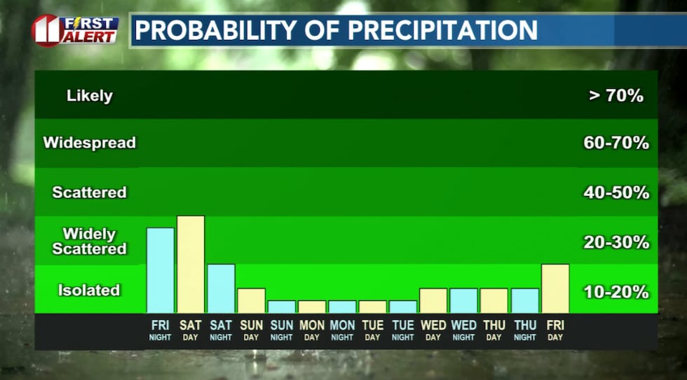 Scattered storms keep a chance of rain for Lubbock and the area through late Saturday.(KCBD First Alert)
The main threat remains heavy rain and localized flooding. The severe weather threat remains low.
Pattern Change
After Saturday night, the pattern shifts. The upper low departs and subsidence (sinking air) follows, which will begin to dry us out. And heat us up.
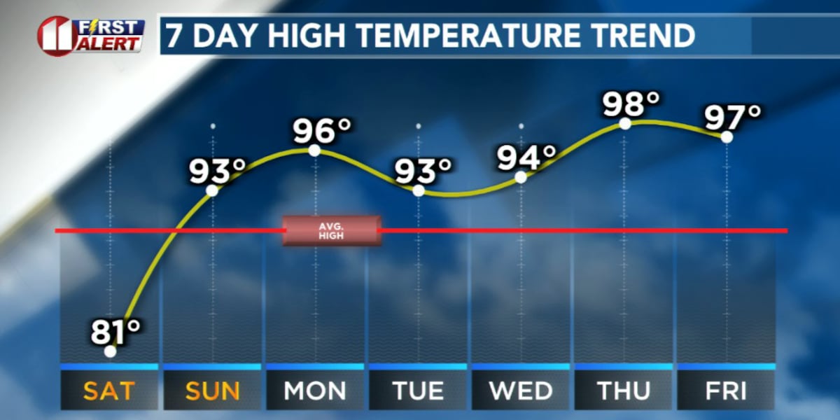
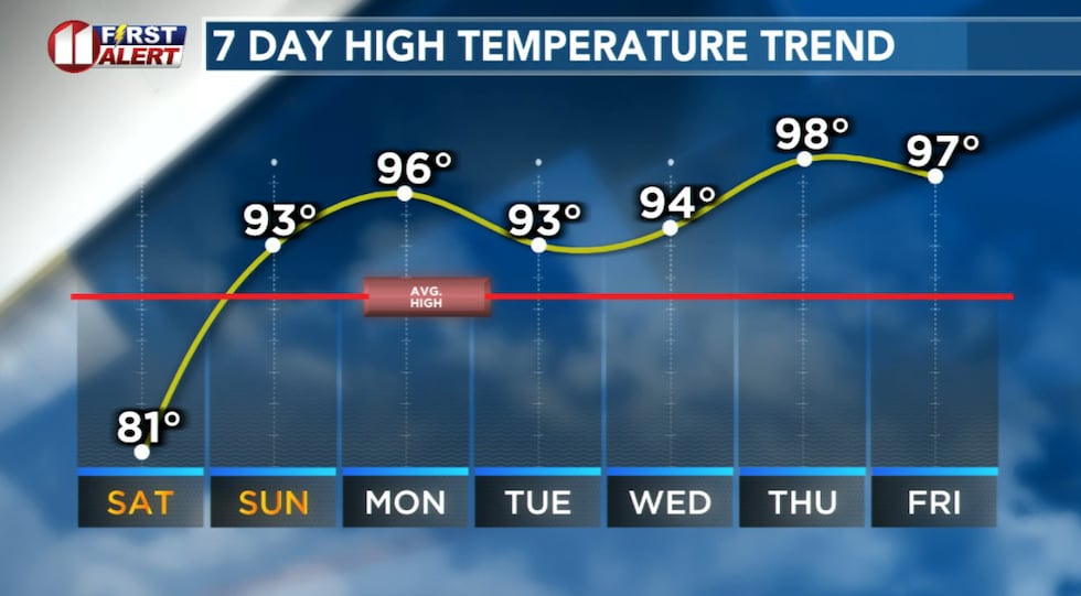 A pattern change brings summer heat beginning Sunday.(KCBD First Alert)
While a stray storm may pop up in the heat and humidity, we expect generally dry conditions Sunday through Wednesday. Temperatures will peak in the 90s each afternoon, with the hottest spots potentially hitting triple-digits.
Be Weather Aware
Keep an eye on the storms and watch for potential flooding. Stay with us for updates.
 First Alert Weather App(KCBD)
On This Date
On this date in 1961, six to possibly seven tornadoes occurred late in the day over parts of Dickens, Crosby, and Garza Counties. Some damage to utility poles and fence posts. Moderate structural damage occurred in Post where a home was destroyed and and the roofs blown off of two others. Storm Data officially lists this damage as straight line winds around 80 mph. No injuries were reported. Very large hail to baseball size knocked out all the windows of a home seven miles east of Post and hail as large as golf balls knocked out all north-facing windows in Cone and heavily damaged crops in the area. Up to three inches of rain accompanied some of these storms.
(Source: National Weather Service, Lubbock)
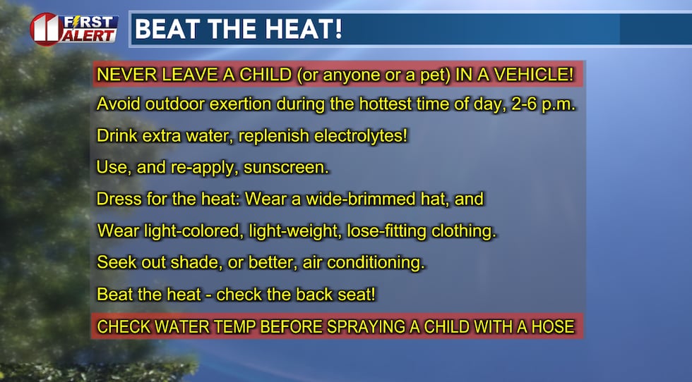 It’s the time of year to start implementing these heat safety tips.(KCBD First Alert)
Copyright 2026 KCBD. All rights reserved.