
South Texas has been locked into an active weather pattern over the last couple months, which has brought ample rain and helped to mitigate the drought over the region.
Since the start of April, 16.27 inches of rain has been recorded in San Antonio – more than double the typical rainfall total during that time.
Moving into the next week, however, the weather pattern is about to become more summer-like, as high atmospheric pressure develops over Texas. Rain chances will decrease significantly, and temperatures are expected to rise back to typical June levels. That said, the next chance of storms still may not be too far away. Here’s what to expect.
Sunday’s forecast
While rain chances will be low across the region, plenty of cloud-cover is still expected across the southern half of Texas. Sunday will start with mild and muggy conditions, with low temps expected to hover in the mid-70s under mostly cloudy skies. Temps will rise slowly, reaching the low 80s by 10 a.m.
San Antonio temperatures will steadily climb through the afternoon, with highs likely topping out in the upper 80s. However, the humidity will be oppressive as dew points rise to their highest levels of the year so far. “Feels-like” temperatures will reach the upper 90s to 100 degrees, even though skies will stay partly to mostly cloudy.
An isolated shower or weak thunderstorm is still not out of the question on Sunday, but most across the region will stay dry. San Antonio’s rain chances will be just 10% to 20%.
Hot weather this week
Monday will bring similar conditions to South Texas, except that more sunshine is expected across South-Central Texas. High temperatures in San Antonio will rise to around 90 degrees, with “feels-like” temps likely to push 101 degrees.
A few pop-up showers and thunderstorms will also be possible Monday afternoon, due to the Gulf of Mexico sea breeze. Rain chances are expected to be near 20% in the Alamo City.
From Tuesday through Thursday, temperatures are expected to inch a bit higher, with highs likely to top out at 91 to 92 degrees – near average for early June. Lows will stay very mild, only falling to the mid-70s each morning.
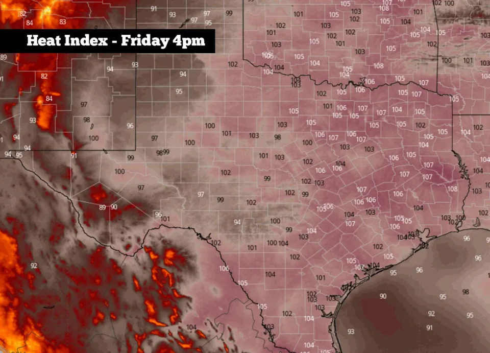
Shown are the potential heat index values across Texas on Friday, according to the National Blend of Models. (WeatherBell)
Rain chances will be even lower, as atmospheric high pressure begins to take a stronger hold over the area. Still, a spotty shower can’t be ruled out as atmospheric moisture levels stay high.
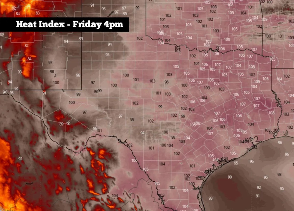
The hottest weather of the week is expected by Friday and Saturday, as high temperatures in San Antonio will likely rise into the mid-90s under partly to mostly sunny skies. Oppressive humidity will also continue, leading to “feels-like” temperatures that could push 104 degrees in the Alamo City.
Weather models suggest that high pressure will likely weaken by early next week. That could lead to the next chance of widespread rainfall, especially during the June 14-17 timeframe. Isolated flash flooding may also be possible during that time, so be sure to stay with expressnews.com/weather for the latest forecast details.
Subscribe
There’s more to San Antonio with the Express-News. Subscribe today for just 25¢.
This article originally published at South Texas weather pattern is shifting again. Here’s how hot temps will rise..