
After above-average rainfall in April and May, Houston has continued to experience quite the active weather pattern during the first week of June. With thunderstorms bringing heavy rain to parts of Southeast Texas on Saturday, Houston has now recorded measurable rainfall in five consecutive days.
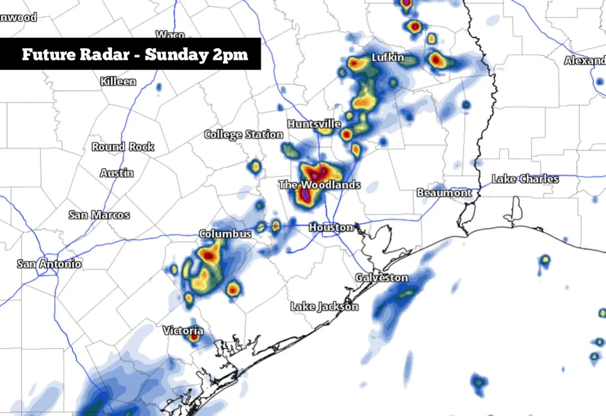
The streak could make it to six days on Sunday, as scattered storms are expected to move across parts of the region again. However, a major weather pattern shift is expected this week, as high atmospheric pressure will start to build over Texas. Rain chances will decrease and temperatures will rise significantly. Here’s what you can expect.
Sunday’s forecast
A few scattered showers and weak storms will be possible between 6 and 10 a.m. This activity, though, is expected to be isolated, giving Houston just a 20% to 30% chance of rainfall. Otherwise, expect a warm and muggy start to the day, with morning low temps in the mid- to upper 70s.
As moisture continues to stream in from the Gulf of Mexico, rain chances will pick up during the middle of the day, especially between noon and 5 p.m. Still, storms will be scattered in nature, so not everyone will see rainfall. Houston’s overall chance of rain will be around 40%.
Additional rainfall totals will stay rather low Sunday, with most areas expected to pick up a quarter-inch of rainfall or less. However, a few isolated totals of a half-inch to 1 inch of rain are still possible, especially from the north side of Houston to The Woodlands and Conroe.
Besides the chance of scattered storms, Sunday will stay warm and extremely humid across Southeast Texas. High temperatures are expected to top out in the mid- to upper 80s, but the “feels-like” temperature is likely to rise into the upper 90s.
Weather pattern shift coming
High atmospheric pressure is expected to develop across Texas this week, leading to more summerlike heat, as well as much lower rain chances. However, humidity levels will continue to be oppressively high throughout the region.
On Monday, Houston will start with morning low temperatures in the upper 70s, with temperatures rising into the upper 80s to near 90 degrees by the afternoon. An isolated, sea breeze-driven shower is not out of the question, but overall rain chances are expected to sty less than 20%.
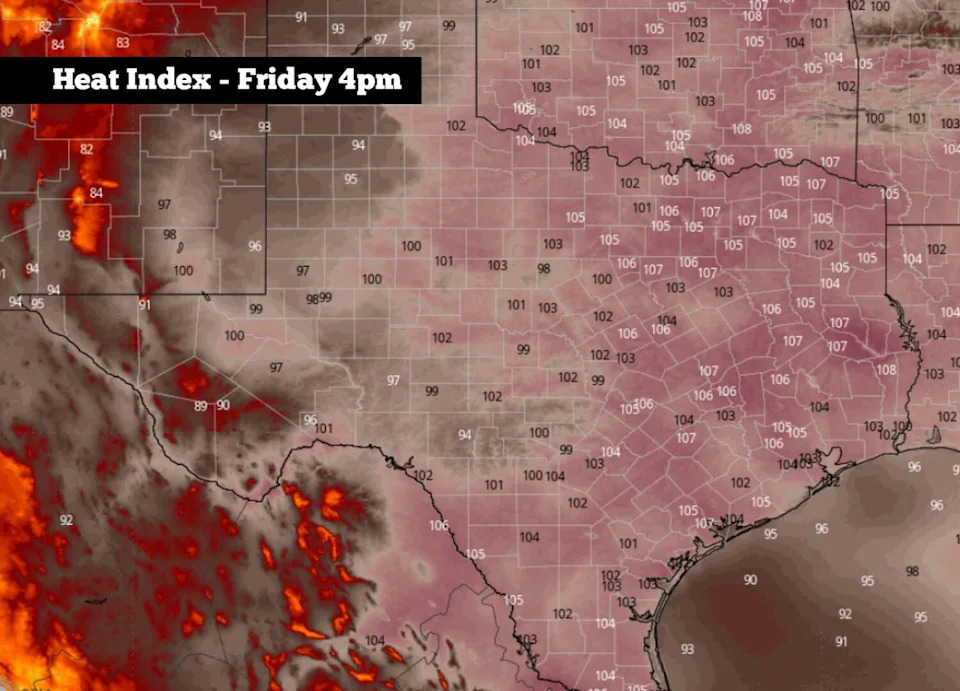
Shown are the potential heat index values across Texas on Friday 6/12, according to the National Blend of Models. (WeatherBell)
From Tuesday through Thursday, temperatures are expected to inch a bit higher, with highs likely to top out at 91 to 92 degrees – near average for early June. Lows will stay very mild, only falling to the upper 70s each morning.
As dew points are also expected to hover in the upper 70s, the expected “feels-like” temperatures will be at their highest levels so far this year, reaching up to 102 to 104 degrees by Wednesday and Thursday. Skies will stay partly cloudy, and isolated rain chances will stay below 20% each day.
The hottest temperatures of the week will arrive Friday and Saturday, as highs likely rise into the mid-90s, with “feels-like” temps topping out near the 105-degree mark. The next significant chance of rain is not expected until the June 15-17 timeframe, as high pressure weakens across Texas.
Subscribe
There’s more to Houston with the Chronicle. Subscribe today for just 25¢.
This article originally published at A few storms are possible in Houston on Sunday, but a major weather shift is on the way.