
Warmer and wetter weather is expected across Southeast Texas through June 22, according to NOAA’s Climate Prediction Center.
NOAA’s Climate Prediction Center / Pivotal Weather
Houston remains stuck in a familiar early-summer pattern Tuesday, with highs in the lower 90s and only isolated afternoon thunderstorms expected across the region.
Most communities will remain dry, but a handful of showers and storms could develop during the hottest part of the day, especially north and west of Houston. Any rain should be brief and localized before fading around sunset.
High atmospheric pressure remains the dominant weather feature across the Gulf Coast, keeping Southeast Texas in a familiar pattern of heat, humidity and isolated afternoon storms. It’s also helping to suppress tropical activity across parts of the Atlantic basin for now.
Article continues below this ad
Houston weather stays hot with only isolated storm chances
Tuesday will begin with partly cloudy skies and heat index values, or humidity-driven “feels like” temperatures, already in the mid-80s.
HOUSTON SIZZLES: When does Houston usually hit 100 degrees? The answer is changing.
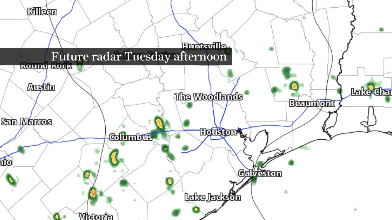
A muggy start could lead to a few showers and thunderstorms that develop during the afternoon as the sea breeze moves inland. The highest rain chances should remain inland, including portions of the Brazos Valley, while many communities across Southeast Texas remain dry.
Article continues below this ad
Scattered downpours are expected to develop inland Tuesday afternoon.
Pivotal Weather
If storms form, they could produce brief downpours, lightning and gusty winds before weakening during the evening. Coastal areas could see an occasional shower or sprinkle, but widespread rainfall is not expected.
Although humidity will continue making the weather feel warmer than the actual air temperature, the National Weather Service is unlikely to issue widespread heat advisories. Anyone spending extended time outdoors should still take precautions against the heat and stay hydrated.
The overall pattern is expected to change little through the rest of the work week. Afternoon temperatures should remain in the lower 90s each afternoon, with isolated to scattered thunderstorms developing during the heat of the day before fading after sunset.
Atlantic and Gulf of Mexico remain quiet
Hurricane season began June 1, but few signs of near-term tropical trouble have emerged for the Gulf Coast.
Article continues below this ad
Elsewhere, the eastern Pacific has already become active. Tropical Storm Boris recently formed off Mexico’s Pacific coast, while Hurricane Cristina strengthened over open waters farther offshore. Neither storm poses a threat to Texas, but both are reminders that tropical activity is beginning to increase as hurricane season ramps up.
The same pattern of high atmospheric pressure that’s keeping Houston’s weather relatively quiet is also contributing to suppressed tropical activity across portions of the Atlantic basin, according to NOAA’s Climate Prediction Center.
NOAA’s Climate Prediction Center
The latest outlook from NOAA’s Climate Prediction Center suggests below-average rainfall across portions of the Caribbean and tropical Atlantic during the next two to three weeks, a signal that generally points to a less favorable environment for tropical development in those regions.
At the same time, conditions could become more supportive of new tropical cyclone formation in parts of the eastern Pacific later this month.
Article continues below this ad
For Southeast Texas, the dominant ridge of high pressure is helping maintain both the local weather pattern and the lack of tropical concerns closer to home. The ridge is limiting widespread thunderstorm activity across the Gulf Coast while also helping keep the Gulf of Mexico free of tropical threats for now.
No tropical threats to Texas are currently on the horizon, but the busiest months of hurricane season are still ahead.