
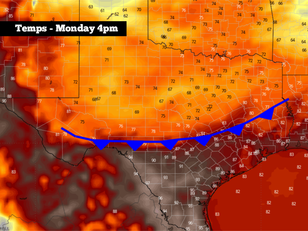
Next week, however, weather models are continuing to point to an unusual weather pattern for mid-June, as a cold front is likely to push through Texas between Sunday and Tuesday. For the San Antonio area, this front could send afternoon temps into the lower to mid-80s, while also bringing heavy rainfall and the potential of flooding into South-Central Texas. Here’s what you can expect.
Before the front arrives, the rest of this week is expected to stay hot, humid and mostly rain-free throughout South-Central Texas. Thursday morning will start with temperatures in the upper 70s, gradually rising into the mid-80s by noon.
By Thursday afternoon, San Antonio temperatures are expected to peak between 91 and 93 degrees under partly sunny skies. The humidity will continue to be elevated, leading to “feels like” temperatures rising into the triple digits across the metro area. An isolated shower remains possible but rain chances will only be near 10%.
Friday and the weekend: High atmospheric pressure over the region will begin to weaken, which will result in a 20% chance of scattered rain Friday and Saturday, possibly rising to a 30% chance on Sunday. Still, storms during this time will stay sporadic, keeping most across South Texas dry. For those that do see a weekend storm, it likely will be fairly short-lived.
Temperatures will continue to be especially warm, with afternoon temps rising consistently into the lower 90s through Sunday. The humidity will continue to be the main story, though, as heat index values will touch the triple digits each day as well.
The incoming front is expected to push through the Panhandle and parts of North Texas by Sunday night, continuing into Central and South Texas throughout the day on Monday.
Because the front will be moving into a very moisture-rich environment, widely scattered showers and storms are likely to develop alongside it. For San Antonio, the highest chances of rain are expected from Monday evening through the middle of the day on Tuesday. Overall rain chances have increased to around 60% during this time.
Flooding could be a concern in at least parts of South and Central Texas from Monday night through Tuesday. However, it’s too early to pinpoint exactly where and when the greatest risk will end up being. Be sure to stay with expressnews.com/weather for more forecast details as they become available.
According to the National Blend of Models, an inch to 3 inches of rainfall is likely for the San Antonio area over the next seven days, most of which is likely to fall between Monday and Wednesday next week.
Temperatures are also likely to decrease as the front passes. After temperatures top out in the lower 90s on Monday, afternoon highs might fall into the lower to mid-80s by Tuesday and Wednesday — which would be several degrees below average for the middle of June.