
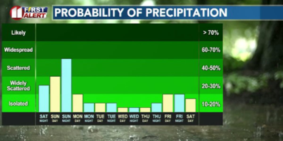
LUBBOCK, Texas (KCBD) – We’ve seen quite a bit of rain over the past couple of weeks for a large portion of the South Plains, and we’ve got more chances of rain as we move further into Sunday and early next week.
TONIGHT
Rain chances begin to ramp up overnight. We have a Slight (2/5) Risk for severe storms overnight and into the early morning hours Sunday.
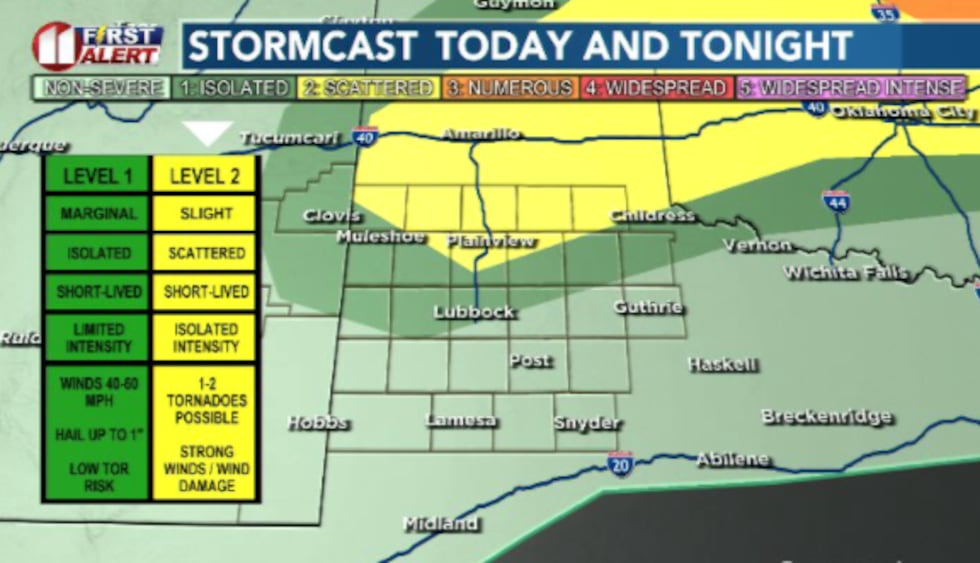 A Slight (2/5) Risk for severe storms persists for our northern counties overnight and into Sunday morning.(Dylan Smith)
Coverage will be scattered for tonight and expand to more widespread throughout Sunday/Sunday night. Some strong winds and large hail are the primary threats from any severe thunderstorm we end up seeing.
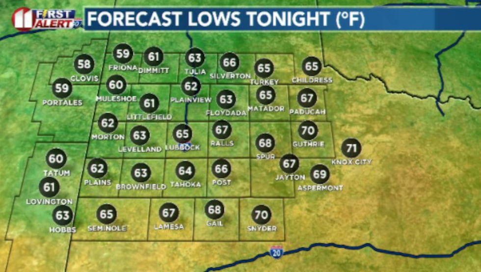 Cool for some, mild for most in the 60s mostly. Humid and sticky as well(Dylan Smith)
Low temperatures drop into the mid 60s.
SUNDAY
Scattered rain chances throughout the day-time hours will give way into widespread rain/storms Sunday night into Monday morning.
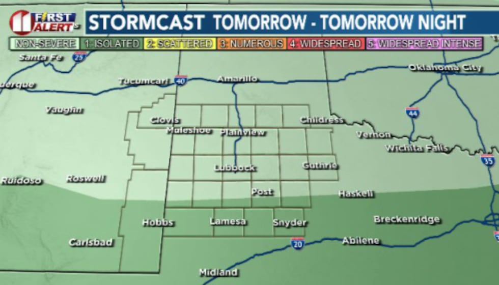 A Marginal (1/5) Risk for severe storms shifts to the south of Lubbock in the southern South Plains counties for the day tomorrow(Dylan Smith)
Currently we’ve got a Marginal (1/5) Risk for severe storms Sunday. High temperatures will likely stay subdued in the upper 70s and lower 80s.
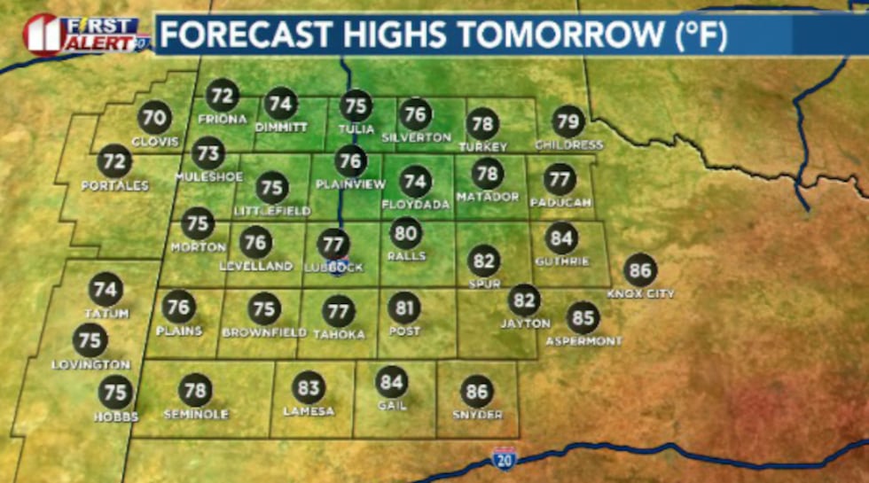 It’ll be a much more mild day tomorrow as cloud cover and on/off showers and storms roll through the South Plains(Dylan Smith)
EXTENDED WEATHER PATTERN
A bit of a roller coaster over the next week or so. Rain chances keep us cool over the next couple of days after a warm Saturday.
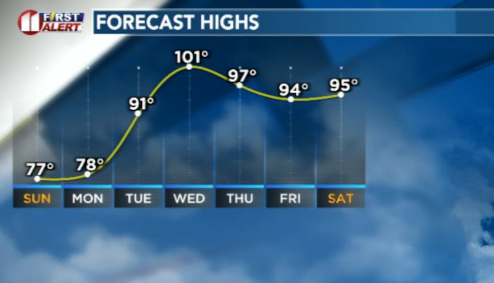 Highs will fall into the 70s for most tomorrow/Monday before rebounding rapidly next week(Dylan Smith)
Rain wraps up Monday morning, making way for a rapid warm up heading into the middle of next week. We could see more rain develop by late next week that could drop temperatures once again.
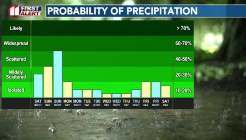 Rain chances peak over the next 36 hours, through Monday morning before we return to a mostly dry forecast for next week(Dylan Smith)
Copyright 2026 KCBD. All rights reserved.