
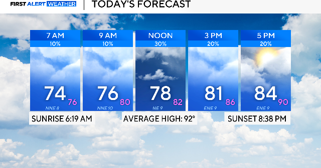
After rain in parts of North Texas on Sunday, scattered storms are expected once again in some areas.
Most activity will remain along and south of I-20 in the late morning and afternoon due to a stalled front and a disturbance. A flood watch is in effect for those counties until 7 p.m. The biggest concerns will be lightning and flooding from training showers.

Temperatures will be warm today, but will fall short of the highs seen over the weekend. Expect cloudy skies with winds from the northeast around 5 to 10 mph, with a high of 84 in the Metroplex.
The heat kicks back on for Tuesday. Highs will rebound into the 90s with a heat index value 5 to 10 degrees warmer. Anyone who is planning on being outside for an extended period of time should be sure to drink plenty of water.
Tuesday through Thursday there is a lull in rain and storms, the sun will shine and temperatures will be on the rise. On Thursday, highs will reach the upper 90s with a heat index value of over 100.
Another front will swing through Thursday night, bringing a higher chance of precipitation for this holiday weekend. Outdoor festivities celebrating Juneteenth and Father’s Day may be impacted.
