
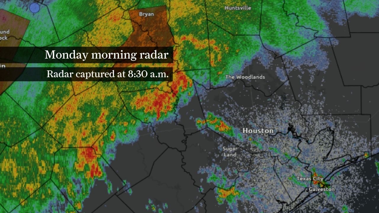
A flood watch remains in effect across much of Southeast Texas, including the Houston area, through Wednesday morning as a slow-moving weather pattern funnels deep volumes of atmospheric moisture from the Gulf of Mexico into the region.
Thunderstorms are expected to repeatedly develop along the same corridor through Wednesday, increasing the risk of flash flooding and rises on area creeks, streams and bayous. Rainfall rates of 2 to 4 inches per hour will be possible in the strongest storms, with isolated rates approaching 5 inches per hour.
The watch covers more than two dozen counties across Southeast Texas, including Harris, Fort Bend, Montgomery, Brazoria, Galveston, Liberty and Waller counties.
Radar estimates show a corridor of 3 to 5 inches of rain across areas north and west of Houston during the past 24 hours, with isolated pockets exceeding 5 inches.
Much of the Houston area has received 1 to 3 inches of rain so far, though locally higher amounts have occurred beneath persistent thunderstorms.
Those early totals reduce the amount of additional rainfall needed to trigger flooding. Areas that have already received several inches of rain will be especially vulnerable if storms continue training over the same areas during the next two days.
NOAA’s Weather Prediction Center has placed portions of Southeast Texas under a level 3 of 4 risk of experiencing flooding rainfall each day through Wednesday, particularly near the Gulf Coast.
The designation gives at least a 40% chance of rainfall exceeding flash-flood guidance within 25 miles of a given location, making it one of the agency’s highest flood outlook categories.
Level 3 risk days are relatively rare and typically signal the potential for numerous flash floods. The concern this week stems from an unusually deep plume of Gulf moisture and repeated rounds of thunderstorms that could track over the same areas through midweek.
The flood threat extends beyond urban areas. Repeated heavy rainfall could also trigger rises on rivers, creeks, streams and bayous across Southeast Texas, especially in areas that have already received several inches of rain.
Most locations should receive another 2 to 4 inches of rain through Wednesday morning, but isolated communities could see storm totals of 6 to 8 inches where thunderstorms repeatedly move over the same area.
The greatest flood risk will develop where multiple rounds of storms occur rather than a single heavy thunderstorm.
Residents should closely monitor forecast updates and never attempt to drive through flooded roadways.