
Tuesday is the second day of a multi-day flood threat for the Greater Houston area.
The Flood Watch that we have been under has been extended through Thursday morning. This is due to what forecasters are calling a dangerous setup of a stalled front, deep tropical moisture, and a disturbance near the Gulf that will multiple rounds of heavy rainfall to the region.
The National Weather Service warns that excessive rainfall could lead to flash flooding, flooded roads, and rising water levels in creeks, bayous, rivers, and other low-lying areas.
The flood threat ramps up Tuesday as deep tropical moisture continues streaming into Southeast Texas. Periods of heavy rain and thunderstorms are expected throughout the day, with the greatest flooding concern focused near and south of Houston. Rainfall rates could be intense at times, leading to localized street flooding and rapidly changing road conditions.
Harris County Emergency Management Director Mark Sloan made clear that the danger is far from over.
“This is not over. We still anticipate some heavy rains with street issues, especially overnight into the morning hours,” Sloan told our TV partner Channel Two.
Closures:
As of Tuesday morning, there is one school closure to report:
Aldine ISD (summer school programs)
Gulf Threat
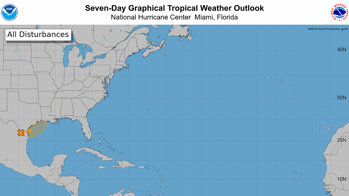
On top of what the area is already stating at, the National Hurricane Center is monitoring a system with a realistic chance of becoming a named tropical storm.
A disturbance currently located over northeastern Mexico is expected to move toward the northwestern Gulf over the next couple of days. Right now, the National Hurricane Center gives it a 60% chance of development over the next seven days.
The system’s best chance to organize would come after it emerges over the Gulf sometime late Tuesday or Wednesday. Even then, environmental conditions may only be marginally favorable, and the system is expected to continue moving east toward Louisiana rather quickly.
That means it has a fairly narrow window — likely late Wednesday into Thursday — to strengthen enough to become a tropical storm. If that happens, it would be named Arthur, becoming the first named storm of the 2026 Atlantic hurricane season.
Keep checking back here for the latest developments, and for continued coverage on KTRH and the free iHeartRadio app.