

The National Weather Service (NWS) is urging residents across deep South Texas to prepare for dangerous flooding as torrential rain is expected Monday night into Tuesday, June 16.
Parts of the Rio Grande Valley could see 5 to 10 inches of rain, with isolated totals of 12 inches or more, according to the National Weather Service in Brownsville. Forecasters said rainfall rates could exceed 3 to 5 inches per hour, raising the risk of life-threatening flash flooding.
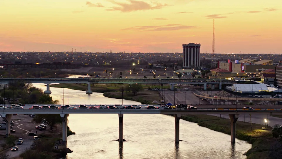
The Rio Grande river at Laredo is under a flood warning through Thursday, June 18, 2026, due to heavy rainfall that is expected to cause the river to crest. Aerial view of Laredo, Texas at sunset over looking the Rio Grande River. Authorization was obtained from the FAA for this operation in restricted airspace. (halbergman/Getty Images/iStockphoto)
Meteorologists said conditions are serious enough that they may need to issue flash flood emergency alerts, one of the most urgent weather warnings used by the NWS.
“We do expect that there will be a few flash flood emergencies in some of these locations,” Barry Goldsmith, a meteorologist with the NWS, said during a Monday webinar with media and local officials.
“Those mean trouble. That means swift water rescues are underway. You’re looking at 4 feet or more of water in some areas. It can literally kill you if you’re out there and not taking precautions,” Goldsmith said.
When will the heaviest rain hit South Texas?
The worst of the rain is expected to begin after sunset Monday in Zapata and Starr counties before spreading east across Hidalgo, Cameron and Willacy counties overnight and Tuesday morning.
The Ranchlands, including areas from Laredo eastward through Jim Hogg, Brooks and Kenedy counties, are expected to see heavier rainfall beginning around 11 p.m. Monday, June 15.
Forecasters said it remains too early to know exactly where the most severe flooding will occur.
Why is South Texas facing a flash flood threat?
The flooding threat is being fueled by a low pressure system moving east from the Sierra Madres into Texas. That system is pulling moisture from the remnants of a Pacific tropical system while colliding with a stalled cold front over deep South Texas.
The combination is expected to produce bands of heavy “training” rain, where storms repeatedly move over the same area and quickly overwhelm roads, drainage systems and low-lying neighborhoods.
The National Weather Service said localized catastrophic flooding cannot be ruled out if persistent showers produce rainfall rates near 5 inches per hour.
Rio Grande Valley roads already seeing flooding
Heavy rain had already begun causing problems Monday morning in Hidalgo County. About 3 inches of rain fell over parts of the Mid-Valley, according to forecasters with KRGV Channel 5 News.
The rain prompted closures along Interstate 2 frontage roads in Weslaco, where streets quickly became submerged, according to the Texas Department of Transportation.
“This morning’s torrential rain in the Mid-Valley is just the beginning,” Tim Smith, KRGV’s chief meteorologist, said in a Facebook post Monday morning.
“Tropical moisture will continue to stream into the Valley from the south the next couple of days while a dying front will move into the RGV from the north. Flooding is likely today through early Wednesday,” Smith said.
Flood watch in effect for deep South Texas
Much of deep South Texas, from the border to the coast, is under a flood watch through Thursday morning. The watch includes Hidalgo, Cameron, Starr and Willacy counties, as well as Kenedy, Jim Hogg, Brooks, Kleberg, Live Oak and parts of the Coastal Bend.
Areas with poor drainage could see floodwaters as high as 3 to 4 feet, Goldsmith said. In some places, water could take days or even weeks to fully recede.
Rio Grande and South Texas rivers under flood warnings
Several South Texas rivers are also under flood warnings through Thursday afternoon.
The Rio Grande at Laredo in Webb County is expected to rise above flood stage Tuesday morning and crest at 10.5 feet early Wednesday, according to the National Weather Service in Corpus Christi.
The Aransas River near Skidmore in Bee County is expected to rise above flood stage early Wednesday and crest at 13.2 feet.
The San Antonio River at Goliad is also expected to crest later in the week, potentially affecting Goliad State Park and areas in Victoria, Calhoun, Goliad and Refugio counties.
This article originally published at South Texas faces dangerous flooding threat. Here’s where.