
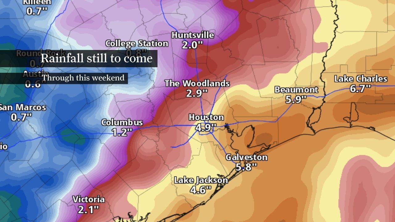
Life-threatening flooding remains possible across the Houston area as more rounds of heavy rainfall move through Southeast Texas through at least Thursday.
A flood watch remains in effect for the entire region as tropical moisture, a stalled front and a tropical disturbance near the Texas coast continue to fuel repeated thunderstorms capable of producing rainfall rates of 2 to 5 inches per hour. The setup favors multiple rounds of rainfall over the same areas, increasing the risk of flash flooding in urban areas with poor drainage and low-lying spots.
Parts of Southeast Texas have already received 2 to 4 inches of rain since Monday, with some localized totals exceeding 4 inches. Another 4 to 7 inches is expected through early Thursday, but some isolated communities could see 10 to 15 inches where storms repeatedly track over the same places.
Tuesday morning: Bands of heavy rainfall have developed along the coast and offshore waters, with the greatest flooding risk focused along and south of Interstate 10 as storms moved inland.
Tuesday afternoon: More showers and thunderstorms are expected across Southeast Texas. Localized flash flooding could develop where storms repeatedly move over the same areas.
Tuesday night into Wednesday morning: This could become one of the more active periods of the event as another widespread round of heavy rainfall moves through the region. Soaked soils and repeated downpours will increase the risk of flash flooding, especially in low-lying and urban areas.
Unlike a typical summertime thunderstorm pattern, the atmosphere will remain saturated with water vapor overnight, allowing storms to continue produce rainfall after sunset.
Wednesday: Periods of heavy rainfall are expected to continue, particularly south of Interstate 10, where a moderate risk of excessive rainfall remains in place. Flooding concerns will likely persist, even between rounds of rainfall as soils become increasingly saturated.
Southeast Texas remains trapped beneath a pattern favorable for efficient tropical rainfall. Deep volumes of atmospheric moisture, a stalled frontal boundary and a nearby tropical disturbance will continue supporting multiple rounds of showers and thunderstorms through at least Thursday.
That means flooding concerns won’t be tied to a single line of storms. Instead, the greatest risk comes from repeated downpours moving over the same area, especially where several inches of rainfall has occurred since Monday.
Comparisons to Tropical Storm Allison and Hurricane Harvey have circulated on social media, but current forecasts do not indicate a flood event of that magnitude. While isolated areas could still experience significant flooding if thunderstorms soak the same areas, forecast rainfall totals remain well below the widespread 30- to 60-inch rainfall amounts that occurred during Harvey and the double-digit totals that inundated parts of Houston during Allison.
That doesn’t mean the threat should be dismissed. With multiple rounds of heavy rainfall expected through at least Thursday, it would take only one or two slow-moving bands of thunderstorms to turn a routine commute or low-lying roadway into a dangerous flood zone.