
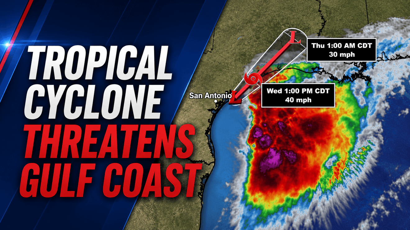
A developing tropical system in the Gulf of Mexico is bringing heavy rain, dangerous flooding and the threat of tropical-storm-force winds to parts of the Texas and Louisiana Gulf Coast as forecasters expect it to become the first named storm of the 2026 Atlantic hurricane season.
Potential Tropical Cyclone One was churning in the northwest Gulf of Mexico Wednesday morning, about 35 miles southwest of Port O’Connor, Texas, and 255 miles southwest of Lake Charles, Louisiana. The system was moving northeast at 6 mph with maximum sustained winds of 30 mph, just below the 39 mph threshold needed to be classified as a tropical storm.
Forecasters expect the system to strengthen and could name it Tropical Storm Arthur as early as Wednesday.
While San Antonio is expected to avoid the worst impacts, communities along the Texas Gulf Coast are already experiencing heavy rain and increasing flood concerns as bands of tropical moisture continue moving inland.
The main hazard with these types of systems is largely the flooding from the heavy rainfall,” National Hurricane Center Director Michael Brennan said. “We could see potentially life-threatening flash and urban flooding across the Texas coast eastward into central Mississippi through Thursday.
A Tropical Storm Watch remains in effect for the Texas Gulf Coast from Sargent to Sabine Pass, while portions of coastal Louisiana are under a Tropical Storm Warning. Tropical storm conditions are expected to develop across portions of the warning area within the next 24 hours.
The National Weather Service has issued a Flood Watch covering the entire Texas Gulf Coast, from Brownsville to Beaumont, including the Houston metropolitan area. Houston has already been under flood warnings as rounds of heavy rain continue to move through the region.
The Weather Prediction Center has placed much of the Texas coast, including Houston, Galveston, Corpus Christi, Victoria and Beaumont, under a Level 3 out of 4 risk for excessive rainfall and flash flooding.
Forecasters warn the storm could produce widespread rainfall totals of 5 to 10 inches through Thursday, with isolated amounts approaching 20 inches from the Texas coast eastward through Louisiana, Mississippi, Alabama, western Georgia and the Florida Panhandle.
In addition to the flooding threat, isolated tornadoes are possible from the upper Texas coast through Louisiana, Mississippi, Alabama and the Florida Panhandle. Storm surge of 2 to 4 feet is also possible from Port Bolivar, Texas, to Morgan City, Louisiana, while dangerous surf and rip currents are expected along Gulf beaches.
Although South Central Texas will remain largely removed from the storm’s direct impacts, the system is helping create a different hazard inland. As tropical moisture shifts eastward, temperatures are expected to surge across the region, with heat index values between 105 and 115 degrees possible Thursday afternoon across San Antonio and surrounding communities.
Forecasters say the combination of recent rainfall, high humidity and temperatures climbing into the upper 90s will create dangerous heat conditions, making Thursday a Weather Alert Day across much of the San Antonio area.