
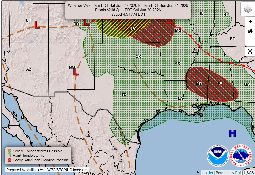
A slightly cooler start to the weekend is on tap across Central Texas. A lingering frontal boundary — think of it as the edge of a cooler air mass — and nearby upper-level area of low atmospheric pressure will keep temperatures in check, but also keep chances going for a few showers and thunderstorms.
After several days of hotter weather, Saturday’s afternoon temperatures across the region will top out in the upper 80s to lower 90s, which would be slightly cooler than our mid-June average.
While the bulk of the rain and thunderstorm activity will shift east with the departure of an atmospheric disturbance, scattered showers and storms will remain possible, particularly along and east of the Interstate 35 corridor.
With plenty of moisture-rich air from the Gulf of Mexico still in place, any showers or thunderstorms that develop on Saturday could produce locally heavy rainfall. As a result, the flood forecasters at the National Weather Service’s Weather Prediction Center have placed portions of Central Texas under a low-end level 1 of 4 risk, or at least a 5% chance, for flooding rainfall.
By Sunday, the weak upper-level atmospheric disturbance will move away from the region, leading to a drying trend and warmer temperatures. Afternoon temperatures in Austin will climb back into the mid-90s, and heat index readings will reach 104 to 108 degrees. The wind will be a bit breezy out of the south, with gusts topping 25 mph.
High air pressure will build across Arizona and New Mexico early next week while a trough of low pressure will be situated across the southeastern United States. This will keep Central Texas within a west to northwesterly air flow that will steer some weak atmospheric disturbances into the Lone Star State.
While the current forecast keeps the highest rain chances in North and Northwest Texas, we’ll need to monitor the possibility of any storm complexes or outflow boundaries diving farther south into the region.
“A persistent south to southeasterly flow will help to keep temperatures holding above average with elevated heat indices with the humidity also factored in,” meteorologists at the regional National Weather Service office for Austin wrote in their weather discussion. “Afternoon highs will reach into the mid-90s with the peak heat indices reaching into the 105-to-110-degree range for areas along and east of the Interstate 35 corridor and over the Rio Grande Plains.”
Overnight temperatures will drop only into the upper 70s to near 80 degrees, providing limited relief from the daytime heat. After several days of persistent heat and warm nights, the National Weather Service might need to issue more heat alerts as we head into early next week.