
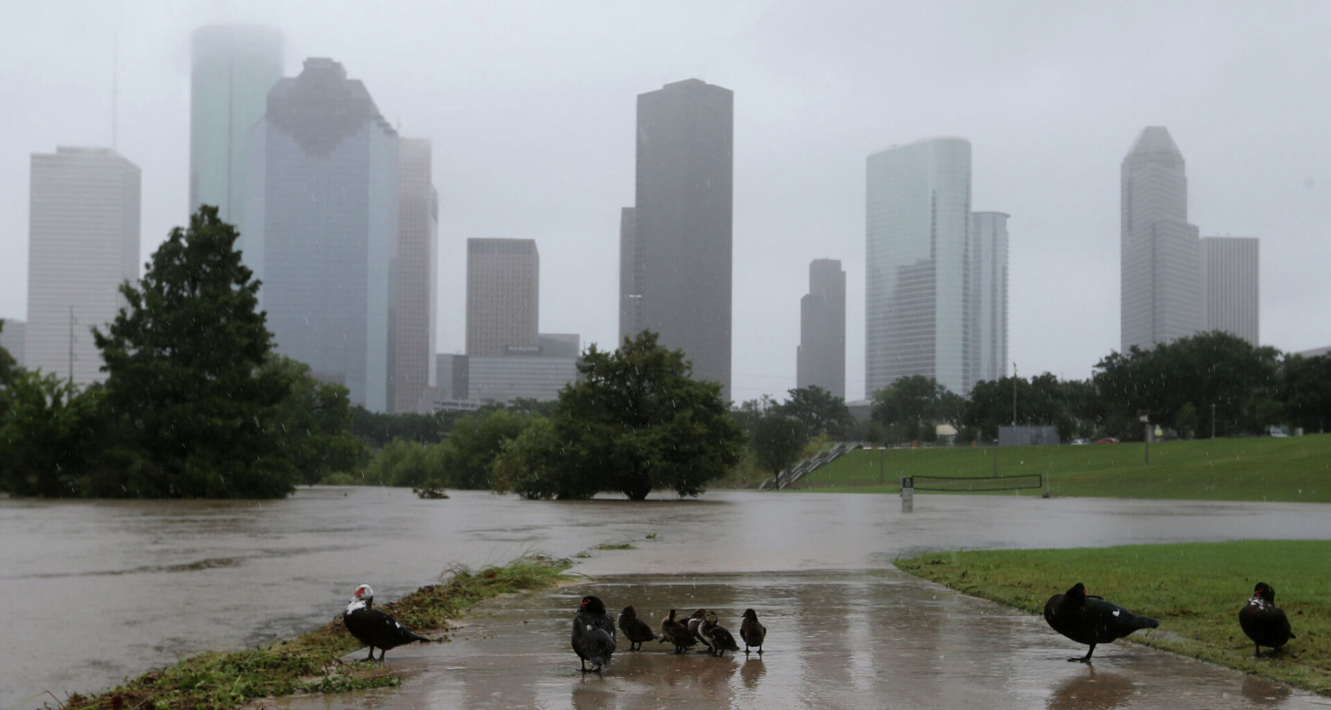
Harris County is no stranger to extreme rainfall events, storms that are often more difficult to prepare for than hurricanes or tropical storms.
Elizabeth Conley/Houston Chronicle
Houston is finally drying out after up to six inches of rain fell in the area since Tuesday. The center of the first named storm of the year — Tropical Storm Arthur — passed near Houston though the worst of the wind and rain were well to our east.
There was enough of a gap between downpours this week to keep the water from spilling over the banks of our bayous and waterways.
I’ve still got my guard up.
Article continues below this ad
We’re entering a hurricane season with federal weather and emergency management agencies operating at less than full strength following the chaotic DOGE cuts. And the volatility of our climate is leading to more unpredictable weather than before.
A year after the Trump administration eliminated more than 600 National Weather Service employees, the agency is now racing to hire hundreds of employees by September. The Federal Emergency Management Agency is severely hamstrung with a 14% reduction in its workforce, managing a backlog of more than 600 open disaster declarations. And the National Oceanic and Atmospheric Administration is reeling from hundreds of millions of dollars in cuts to its forecasting and public alert programs and climate research.
All in all, not what you want to hear as a tropical storm is bearing down on the Gulf Coast. The last thing we need is for the next big one to be the “screwworm” storm — a natural disaster made worse by the gutting of federal agencies that are supposed to help with the response and recovery. The hollowed out federal programs that could have done more to slow the infestation hurting Texas ranchers offer an object lesson for our weather systems.
But at least we can see tropical storms and hurricanes coming. Forecasters may not always know the exact path of those mega-storms, but we know enough in advance to be prepared with go-bags at the ready.
Article continues below this ad
What I worry about are the “black swans” — the sudden rainstorms that dump 10- to 15-inch bullseyes in a matter of hours.
Ask any of the families who lost children and loved ones during the Hill Country floods last summer. The scariest storms aren’t the ones you see coming. It’s the nebulous radar blobs that keep forecasters and first responders up at night — the systems that can elude a weakened federal forecasting apparatus.
After the Hill Country floods last summer, I attended a 13-hour marathon of a disaster recovery hearing in Kerrville. John Nielsen-Gammon, the state’s climatologist, told lawmakers that a weather balloon launch from the only upper air observation station on the Texas-Mexico border was the “key tipoff” to heavy rain potential in Central Texas.
I thought about that fact when I read that the Trump administration’s cuts to the National Weather Service drastically reduced the number of balloon launches.
Predicting rainfall in Texas is already difficult enough. The National Weather Service doesn’t have the capacity for detailed weather observations in the Gulf or northern Mexico, where most of the heavy rain comes from. And in a climate where the odds of extreme rainfall will spike in the next ten years, we are more susceptible to getting caught flat-footed in disaster response.
Article continues below this ad
Last month, I attended a conference at the Baker Institute for Public Policy on the new FEMA flood maps for Harris County. One of the panelists, Dominic Boyer, the co-director of Rice’s Center for Coastal Futures and Adaptive Resilience noted that the FEMA maps don’t properly account for extreme rainfall events in calculating flood risk.
Harris County had its own black swan rain in 2016: the Tax Day flood in which nearly 17 inches of rain fell over 12 hours across the Houston region. The deluge came so fast that it flooded neighborhoods with little warning. In rural areas such as Waller County, the water rose so high that cows drowned in their pastures. Harris County flood officials told Boyer that Tax Day was harder to prepare for than even Hurricane Harvey. Five inches of rain per hour with little advance warning can be a death sentence for flood-prone neighborhoods.
We’re fortunate this time that the heaviest rainfall from Tropical Storm Arthur skirted by Houston along the coast. And I’m thankful that the new FEMA flood maps shook me into buying flood insurance, considering it’s only June and there’s plenty of hurricane season left.
I’d feel better if federal forecasting of extreme weather was reliable enough to allow local officials time to save lives. I’d feel better if FEMA weren’t so overburdened and understaffed that they can’t even respond to their own helpline. I’d feel better if there weren’t so many documented communication breakdowns that cost lives during a massive flash flood a year ago. I’d feel better if the state invested in its own forecasting service.
Article continues below this ad
Until disaster response and recovery become more than political abstractions in Washington, the burden falls on our local officials to be on their toes and for all of us to stay vigilant. Don’t let the next black swan be our screwworm storm.