
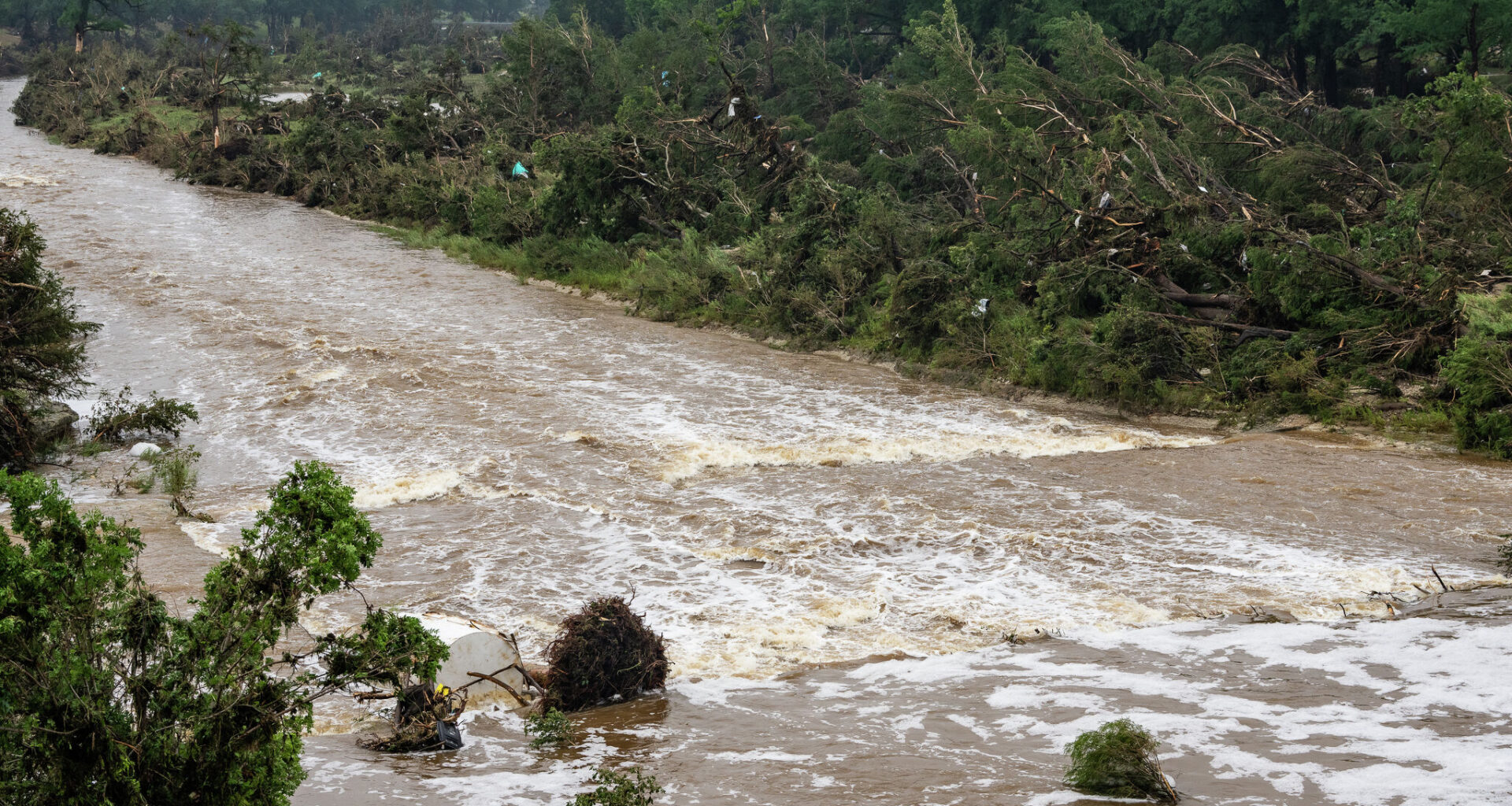
Flooding causes damage along the Guadalupe River in downtown Kerrville on July 5, 2025.
Sara Diggins/Austin American-Statesman
It was an active spring across South Texas, to say the least. Between mid-April and mid-June, a series of cold fronts and low pressure systems swept across the Lone Star State, bringing repeated rounds of heavy rainfall and flooding to San Antonio and the Hill Country.

San Antonio recorded 7.46 inches of rainfall in April, followed by 5.41 inches in May. So far in June, the city has received another 6.57 inches. In total, San Antonio has recorded 19.84 inches of rain since the start of April, making it the second-rainiest April-May-June period in the past 30 years.
Article continues below this ad
Flooding was also a near-weekly concern across the region. Since the beginning of April, the National Weather Service office in New Braunfels has issued 89 flash flood warnings for areas across South-Central Texas. That’s the highest number of springtime flash flood warnings in the past decade.
However, summertime high pressure is starting to settle into the southern Plains, leading to hot and dry weather in San Antonio as June comes to an end. Long-range weather models suggest this quieter pattern could persist into early July as well.
So, does the arrival of high pressure mean South Texas is finished with heavy rainfall and flooding for the year? Not exactly.
Article continues below this ad
While average rainfall typically decreases through the middle of summer, significant flood events can still occur, just like we experienced during the deadly Hill Country flooding in July 2025.
How often does July flooding happen?
May is the most flood-prone month across South-Central Texas, averaging 22.7 flash flood reports, according to data from the Iowa Environmental Mesonet, which tracks National Weather Service flash flood reports.
Article continues below this ad
Historically, the risk of flash flooding decreases significantly in July. However, the midsummer risk does not disappear. The region still averages 8.7 flash flood reports during the month, making July the fifth-most flood-prone month of the year. Only May, June, September, and October bring a higher flood risk.
The decline in flood risk is largely driven by a seasonal shift in the weather pattern. During the summer, the upper-level jet stream retreats northward, while strong areas of high pressure become more common across Texas. High pressure causes air to sink, which makes rain-producing clouds less likely.
However, Gulf moisture levels are typically still very high during July and August. That means if high pressure weakens or temporarily shifts away, the atmosphere can still support torrential downpours and flash flooding.
Article continues below this ad
Although thunderstorms become less frequent during the summer months, they often move more slowly when they do develop. With weaker upper-level winds to steer them, storms can linger over the same area for an extended period, increasing the risk of flash flooding.
Shown are the rainfall totals across Kerr County from July 3-6, 2025. much of this rainfall occurred during the early part of the morning on July 4, 2025, as thunderstorms stalled over the region.
Texas Parks & Wildlife | CONANP | Esri | TomTom | Garmin | SafeGraph | FAO | METI/NASA | USGS | EPA | NPS | USFWS | DOC, NOAA, NWS GIS Mutual Aid, National Water Center
This was particularly detrimental during last year’s July 4 flooding, when storms hovered over Kerr county for several hours and dropped more than 10 inches of rain near the headwaters of the Guadalupe River.
Article continues below this ad
Tropical systems can also contribute to summer flooding across South Texas. In 2003, Hurricane Cladette brought flooding rain to parts of South-Central Texas, while Tropical Storm Erin (2007) and Tropical Storm Charley (1998) each brought more than 5 inches of rain to the San Antonio area during August.