
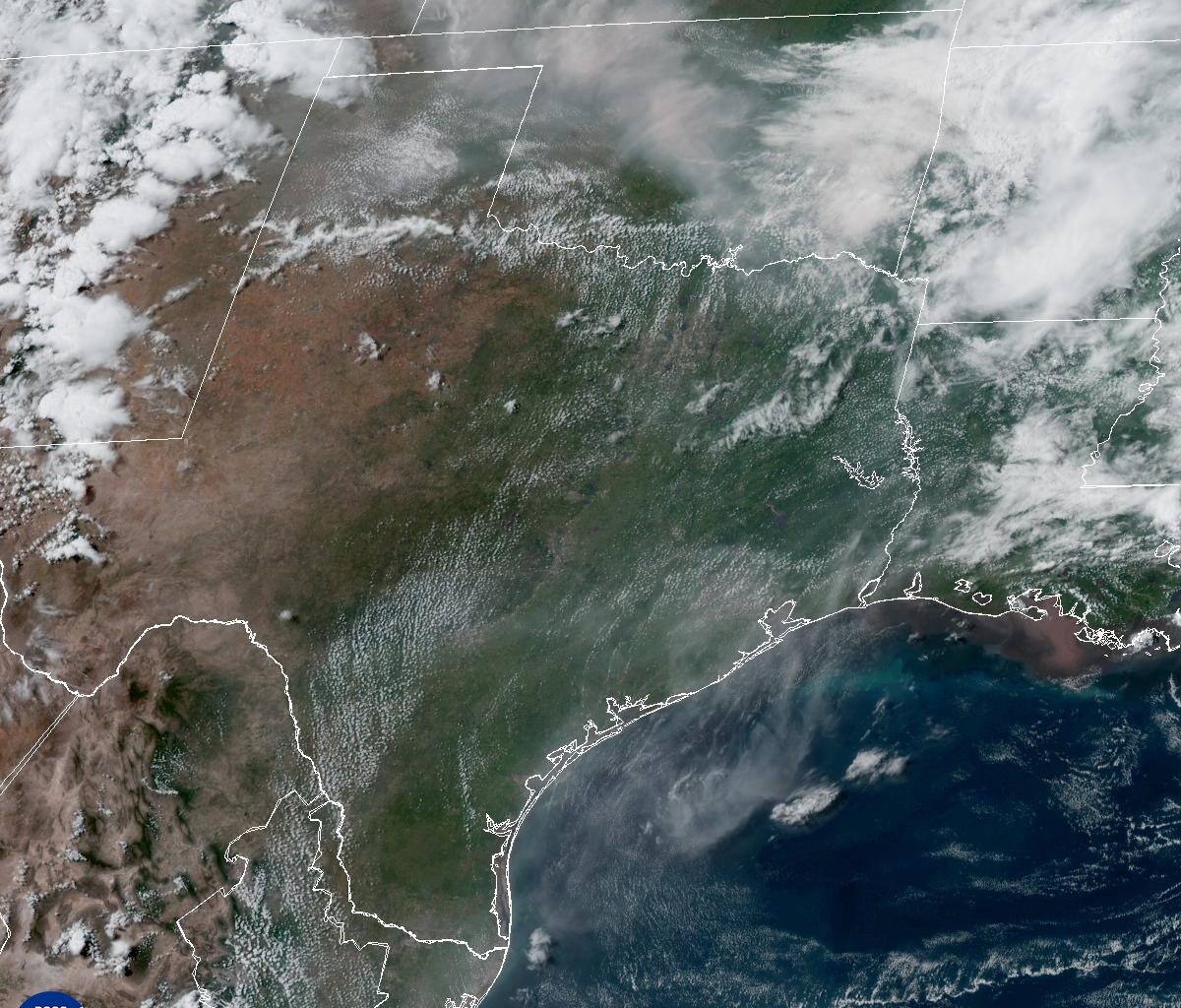
Saharan dust spreading across Texas will be Thursday’s most notable forecast feature, bringing hazier skies and potentially more colorful sunrises and sunsets through the end of the week. The plume isn’t expected to be especially dense, but it could push air quality into the “moderate” category around Houston, according to the Texas Commission on Environmental Quality.
Looking ahead, the weather pattern might begin to show signs of change this weekend as the ridge shifts east and atmospheric moisture gradually returns to Southeast Texas.
High air pressure will continue dominating Southeast Texas weather on Thursday, keeping skies mostly sunny and rain chances near zero. Afternoon temperatures will climb into the lower to mid-90s, while overnight temps settle into the lower to mid-70s.
The more noticeable change will come from a plume of Saharan dust spreading across Texas. While not especially thick, the dust should create hazier skies and could enhance sunrise and sunset colors through the end of the week. Air quality may occasionally slip into the “moderate” category, meaning the level of particulates in the air could trigger coughing or itchy eyes and throats for those with asthma or other respiratory problems.
Yes, but weekend rain chances remain on the lower side.
The ridge of high air pressure responsible for Houston’s recent stretch of hot and dry weather is expected to gradually shift east this weekend. As that happens, atmospheric moisture will begin returning to Southeast Texas, creating a more favorable environment for scattered afternoon showers and thunderstorms.
Rain chances do not appear especially high, but the forecast should begin looking more like a typical summer pattern, with isolated storms developing during the hottest part of the day. Temperatures are expected to remain in the lower to mid-90s even as humidity slowly increases.
Remember that Saharan dust we’ve been tracking this week? It’s helping keep the tropics quiet, too.
The National Hurricane Center does not expect tropical cyclone formation anywhere in the North Atlantic, Caribbean Sea or Gulf of Mexico during the next seven days. While several factors are helping keep the basin calm, dry and dusty air moving west from Africa can make it more difficult for tropical disturbances to organize by limiting thunderstorm development.
That same desert dust is expected to bring hazier skies to Southeast Texas through the end of the week, offering a reminder of how what happens thousands of miles away over the Sahara can influence both local weather and tropical activity across the Atlantic basin.