
It’s been four days since Central Texas last recorded measurable rainfall, making this the longest dry stretch since May. The last significant dry period lasted 11 days, from May 8 through May 18, and we’ll likely match that stretch with little to no rain expected over the next week.
Temperatures will run several degrees warmer than the late-June average of 94 degrees, with afternoon temps topping out in the upper 90s but feeling like 102 to 107 degrees because of the humidity. It will be the hottest stretch of the year so far, with projected highs near 98 degrees from Friday through Sunday. It is also possible that temperatures could reach the 100-degree mark at some point this weekend.
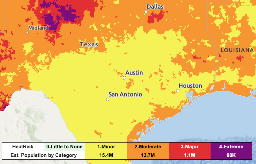
However, heat risk levels are expected to increase to the higher “moderate” and “major” levels Friday and continue there through the weekend. While no heat advisories have been issued yet, that could change as temperatures continue to rise.
Residents are encouraged to take precautions, including limiting strenuous outdoor activity during peak heat, taking frequent breaks in the shade or air conditioning, and staying well hydrated. It’s also important to recognize the signs of heat-related illness, and to check on family, friends and neighbors to ensure they are staying safe and cool.
Recent rains helped keep temperatures in check and left soil saturated across the region, but any new rain chances are now fading. As the ground dries out, temperatures can climb more easily because dry soil heats up faster and more efficiently than moist soil.
At the same time, a subtropical system of high atmospheric pressure, often referred to as a heat dome, will remain in place over the region through the weekend. The heat dome acts like a lid on the atmosphere, keeping warm air with water vapor from rising and suppressing the development of rain clouds.
While it is expected to shift east early next week, Central Texas will remain under its influence with more hot and dry weather with afternoons in the upper 90s and morning temps in the upper 70s for the first few days of July.
The weather service’s Climate Prediction Center calls for a drier and warmer July than normal for Texas. Looking ahead, the long-range forecast models suggest the potential for some tropical activity somewhere along the U.S. East Coast or in the Gulf of Mexico by the second week of July, although details remain uncertain for now.