
The first weekend since the summer solstice and the final weekend of June will feature a classic Texas weather pattern: plenty of sunshine, hot afternoons, and no meaningful chance of rain.
A strong ridge of high atmospheric pressure will remain firmly in control of our weather across the Lone Star State on Saturday. Morning clouds will clear quickly after sunrise, with temperatures starting in the 70s. By the afternoon, temps will climb into the upper 90s, which would be about 4 to 5 degrees above the late-June average of 94 degrees. South winds will also increase during the day, becoming gusty at 15 to 25 mph.
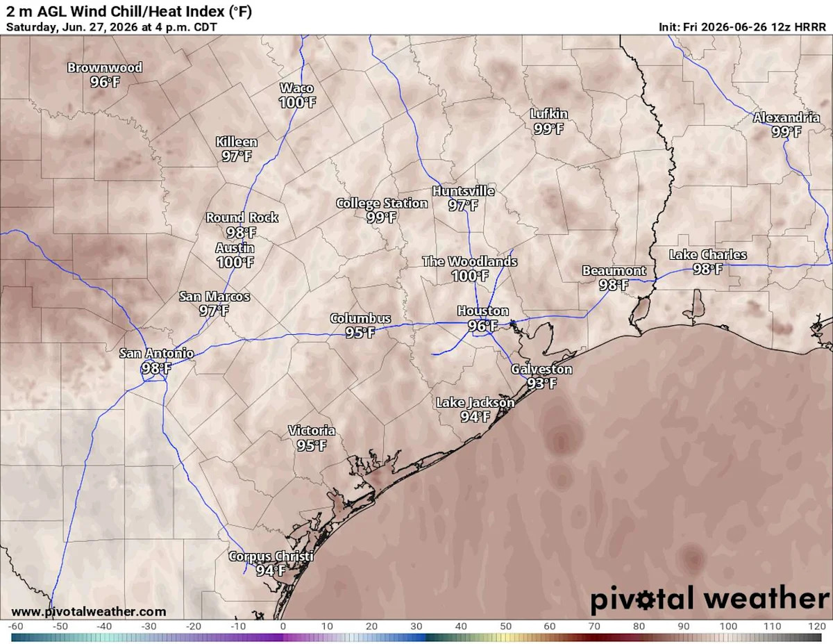
Those gusty winds will provide at least one benefit: mixing the air in the lower atmosphere and preventing humidity from becoming overwhelming during the hottest part of the day. As a result, heat index values, or humidity-driven “feels like” temperatures, will stay below the National Weather Service’s heat advisory criteria, ranging from 97 to 102 degrees through Saturday.
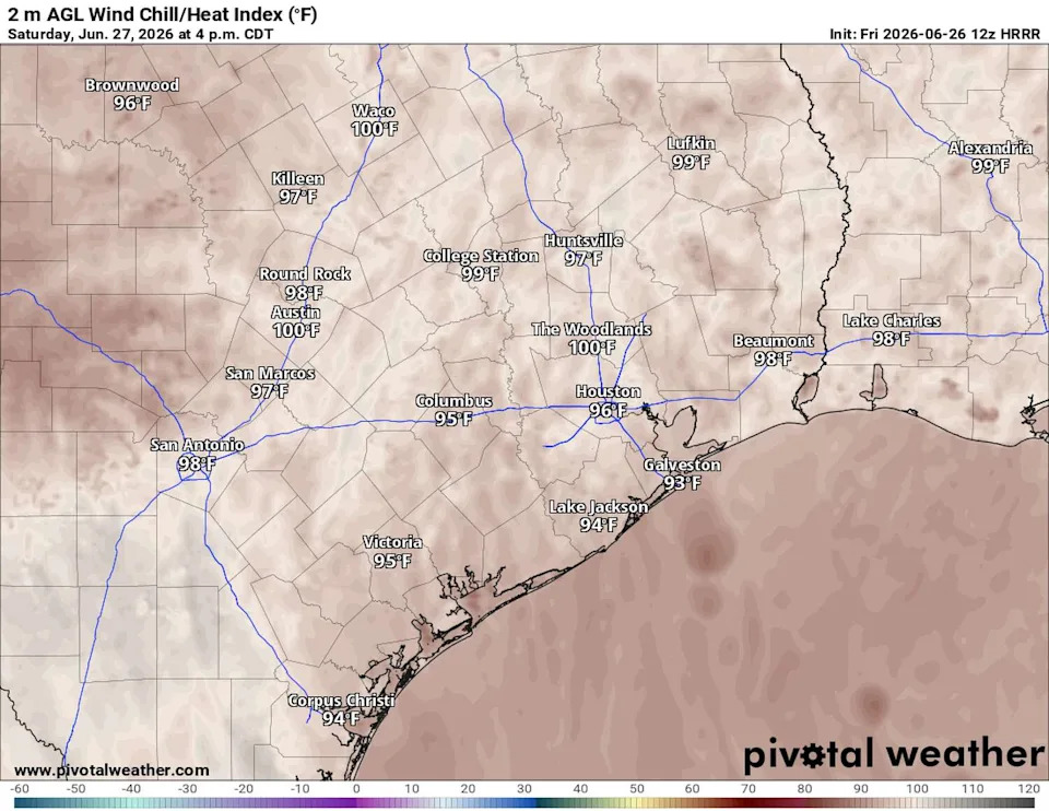
Afternoon air temperatures will be in the middle and upper 90s but heat index values, or humidity-driven “feels like” temperatures, will likely hit the 100-degree mark. (Pivotal)
The center of the subtropical high will gradually shift eastward while a trough of low air pressure develops over the western United States. This pattern shift won’t change our weather much, except that temperatures could warm up by another degree or two on Sunday and into Monday.
TEXAS WEATHER: The heat dome is here. What does that actually mean for Texas and summer temperatures?
While it may not be hot enough for the weather service to issue heat alerts, Central Texas will be – according to the weather service’s HeatRisk map – under a level 3 of 4 heat risk, or facing a “major” public health risk from heat on Sunday and Monday.
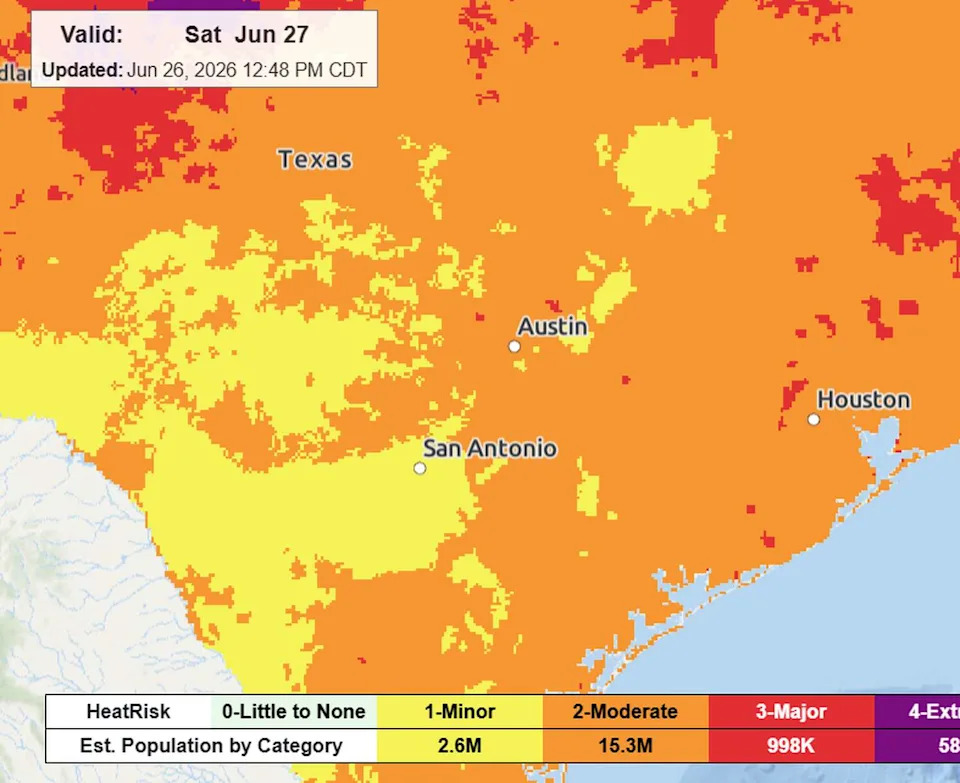
The National Weather Service’s HeatRisk map indicates a “moderate” public heat health risk on Saturday across Central Texas. (National Weather Service)
Around the same time as the heat peaks, a plume of Saharan dust is expected to move into Texas by Sunday evening and linger for several days. The dust will create hazy skies and reduce air quality, while aggravating allergies for some people. If you’re looking for an excuse to spend a little extra time in places with air conditioning, these next few days may be good ones.
Later next week, the heat dome will shift east and become centered over the mid-Atlantic. As it does, its clockwise circulation will allow a few weak disturbances to rotate around the southern edge of the high and move westward into Texas. Those disturbances could be enough to spark scattered coastal showers and thunderstorms, especially Thursday and Friday, with a few showers drifting farther inland.
Beyond that, the weather pattern may become a bit more active during the second week of July, with increasing chances for scattered showers and thunderstorms. Even with more clouds and occasional rain, temperatures are expected to remain seasonably hot.
This article originally published at Heat isn’t the only weather concern for Central Texas. Here’s what else is coming..