
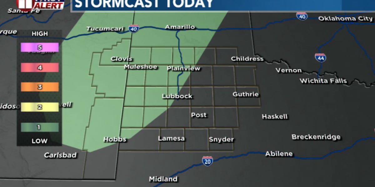
LUBBOCK, Texas (KCBD) – There’s another opportunity for scattered showers and storms this afternoon before the forecast turns noticeably hotter and drier heading into the Fourth of July weekend. There were some heavy downpours, continuing this trend of welcome rain in recent weeks.
Here are some of the top 24-hour rain totals from the Texas Tech West Texas Mesonet, timeframe through 7 this morning:
O’Donnell 1.89″, Lamesa 1.86″, Tahoka 1.59″, Welch 1.12″, Wolfforth 1.11″, South Lubbock All Saints School 1.10″, New Home 1.03″, West Lubbock Reese Center 0.94″, West Lubbock LCU 0.93″, NW Lubbock Texas Tech 0.93″, Smyer 0.88″, Slaton 0.79″, Brownfield 0.77″, Shallowater 0.74″, Olton 0.68″, Muleshoe 0.64″, Jal 0.54″, Denver City 0.53″, SE Lubbock South Plains Food Bank 0.53″, Morton 0.51″, Post 0.51″.
Some storms continued overnight thanks to leftover boundaries from earlier storms. Coverage should continue decreasing as the sun rises.
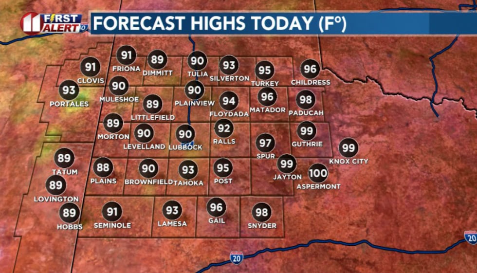 High temperatures today(KCBD)
Wednesday morning, skies will partially clear, allowing temperatures to climb back into the upper 80s and 90s by afternoon. A few spots to the east may top out at 100 degrees.
As temperatures rise, the atmosphere will become unstable enough for another round of storms to develop, especially across the Caprock.
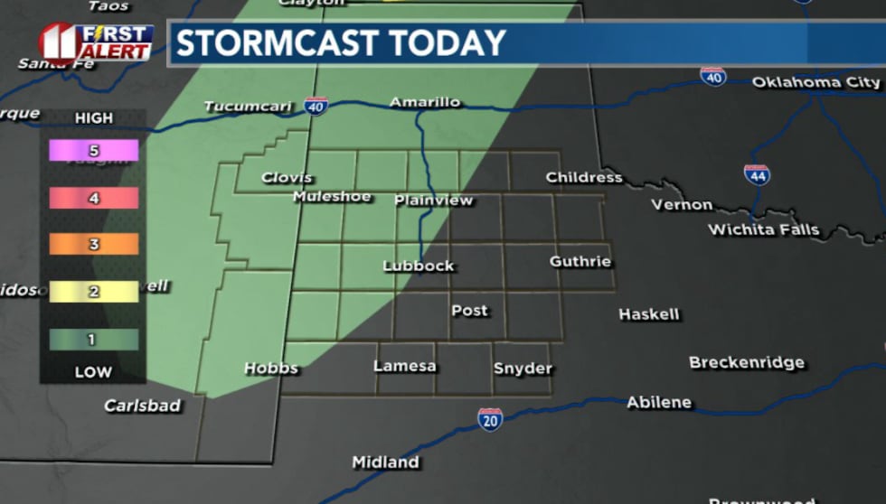 Chance for isolated storms this afternoon and evening(KCBD)
These won’t be all day rains or a widespread washout. Instead, expect isolated to scattered storms to pop up during the afternoon before tracking east through the evening.
While not everyone will see rain, any storm that develops could quickly become strong. The primary concern will be damaging straight-line winds, which could reach up to 70 mph in the strongest storms. Brief heavy rain, frequent lightning, and small hail will also be possible.
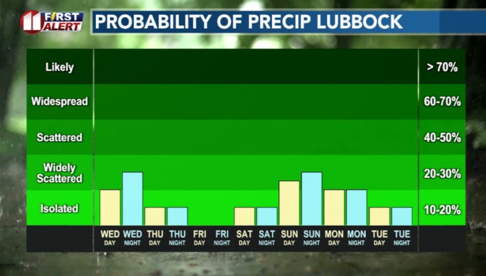 Rain chances taper off by Friday(KCBD)
Storm chances decrease Thursday as a strengthening area of high pressure start expanding westward over the southern Plains. A stray storm can’t’ be ruled out near the Texas-New Mexico state line, but most communities will stay dry.
That same high pressure will send temperatures climbing through the end of the week. Highs will reach the upper 90s to near 100 Friday, with many locations expected to top out in the triple digits by Independence Day.
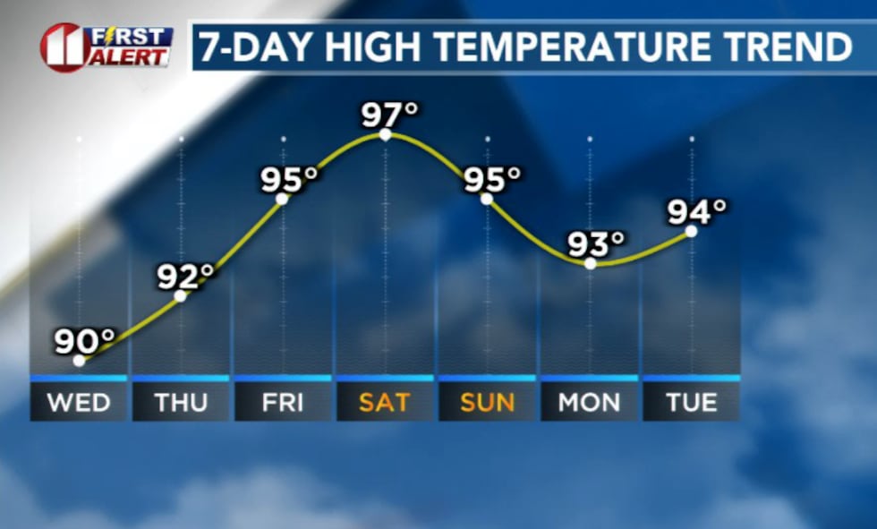 Temperatures will ramp back up by this weekend(KCBD)
This hotter, more stable pattern should keep rain chances low through much of the holiday weekend.
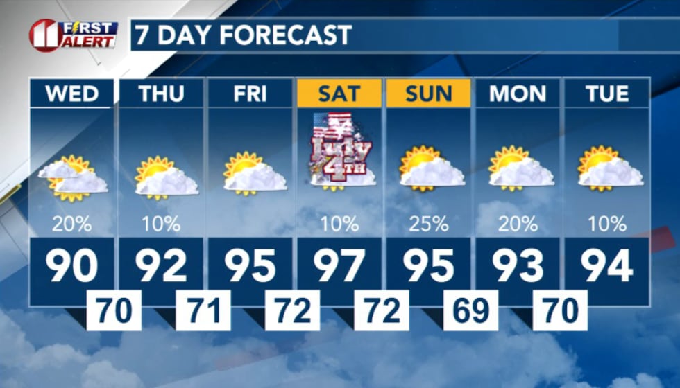 7 Day Forecast(KCBD)
Copyright 2026 KCBD. All rights reserved.