
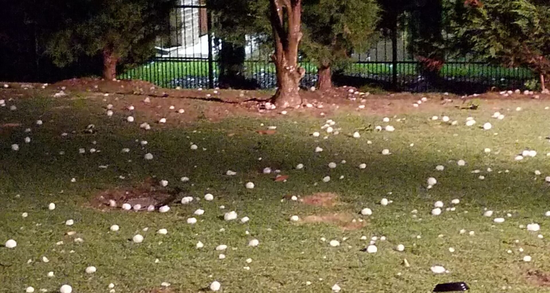
Numerous large balls of hail in the backyard of a home in Prosper, Texas. Hail, rain and lightning are all possibilities for parts of Texas. (Photo credit: Rob Sipll)
Rob Sipll/Dallas Morning News
If you have outdoor plans for Fourth of July weekend, you might want to bring an umbrella. A period of unsettled weather is moving towards much of the Lone Star State, with storm chances lasting through the weekend.

Much of Texas faces an on-and-off chance of storms beginning Thursday, with some regions set for frequent lightning, large hail, high winds and flash flooding hazards.
Article continues below this ad
A chance of storms persists in the DFW metro this weekend.
NWS Dallas-Fort Worth
North Texas
Heading into Fourth of July weekend, isolated storm chances are forecast in North Texas daily, bringing high winds and lightning. Chances increase heading into the late weekend.
On Thursday, the eastern portions of the Dallas-Fort Worth metro area have a slightly higher chance (between 15 and 25 percent) of a late-day shower or storm developing, according to the National Weather Service Dallas-Fort Worth Office.
Article continues below this ad
“Even if storms form well to the east of the Metroplex, any outflow boundaries that propagate towards the north or west from any convection may produce gusty winds of 25-35 mph, even if storms aren’t directly located over DFW,” Dallas forecasters wrote in their outlook.
Similar storm chances continue Friday and on Saturday; isolated thunderstorms could hit north of I-20 and east of I-35.
“Any residual outflow boundaries may result in erratic changes in wind speed and direction which can still pose a hazard for any festivities even if thunderstorms aren’t directly located over the area,” according to the outlook.
Article continues below this ad
Storm chances increase on Sunday and Monday for North Central Texas, mainly south of I-20. Scattered storms could bring locally heavy rainfall, gusty winds and frequent lightning.
The Panhandle could see storms with gusty winds and frequent lightning this weekend.
NWS Amarillo
Panhandle
After a bout of severe weather, including large hail and 75-mile-per-hour wind gusts, was forecast to hit the Panhandle on Wednesday, a chance for storms persists into the weekend.
Article continues below this ad
Meteorologists are predicting Thursday’s weather will be similar to Wednesday, with a possibility for severe hail and damaging winds, but with less overall coverage.
Storms could pass through the Panhandle again this weekend, with a 30 percent chance on Saturday and a 40 percent chance on Sunday.
“Currently the chance for severe weather is very low due to the lack of wind shear and very weak winds aloft, but can’t rule out some gusty outflow winds or brief downpours,” forecasters with the NWS Amarillo Office wrote in their outlook.
Rainstorms could push into Southeast Texas Thursday, with a chance of rain lasting through the weekend.
NWS Houston-Galveston
Southeast Texas
While rain chances are low, they aren’t out of the question in Southeast Texas, according to the NWS Houston-Galveston Office. A few showers and storms could sweep through the region over the next several days.
Article continues below this ad
“Streamer showers could also pop up at times during the morning in areas over the Gulf/along the coast,” forecasters wrote in their outlook.
In good news, meteorologists predict the weather on the Fourth of July will be drier, but forecasters warn that residents should prepare for the hot weather if they intend to spend some time outdoors.
West Texas
In West Texas on Thursday, residents could see isolated rain in the afternoon, mainly over the Davis Mountains north of the Guadeloupe and Delaware mountains, according to the NWS Midland-Odessa Office.
Article continues below this ad
“Just like (Wednesday), localized flash flooding will be a threat, particularly in areas that have already received rain over the last few days,” forecasters wrote in their outlook.
Between Friday and Tuesday, shower and thunderstorm chances between 20 and 40 percent persist, likely confined to higher terrain west of the Pecos.