
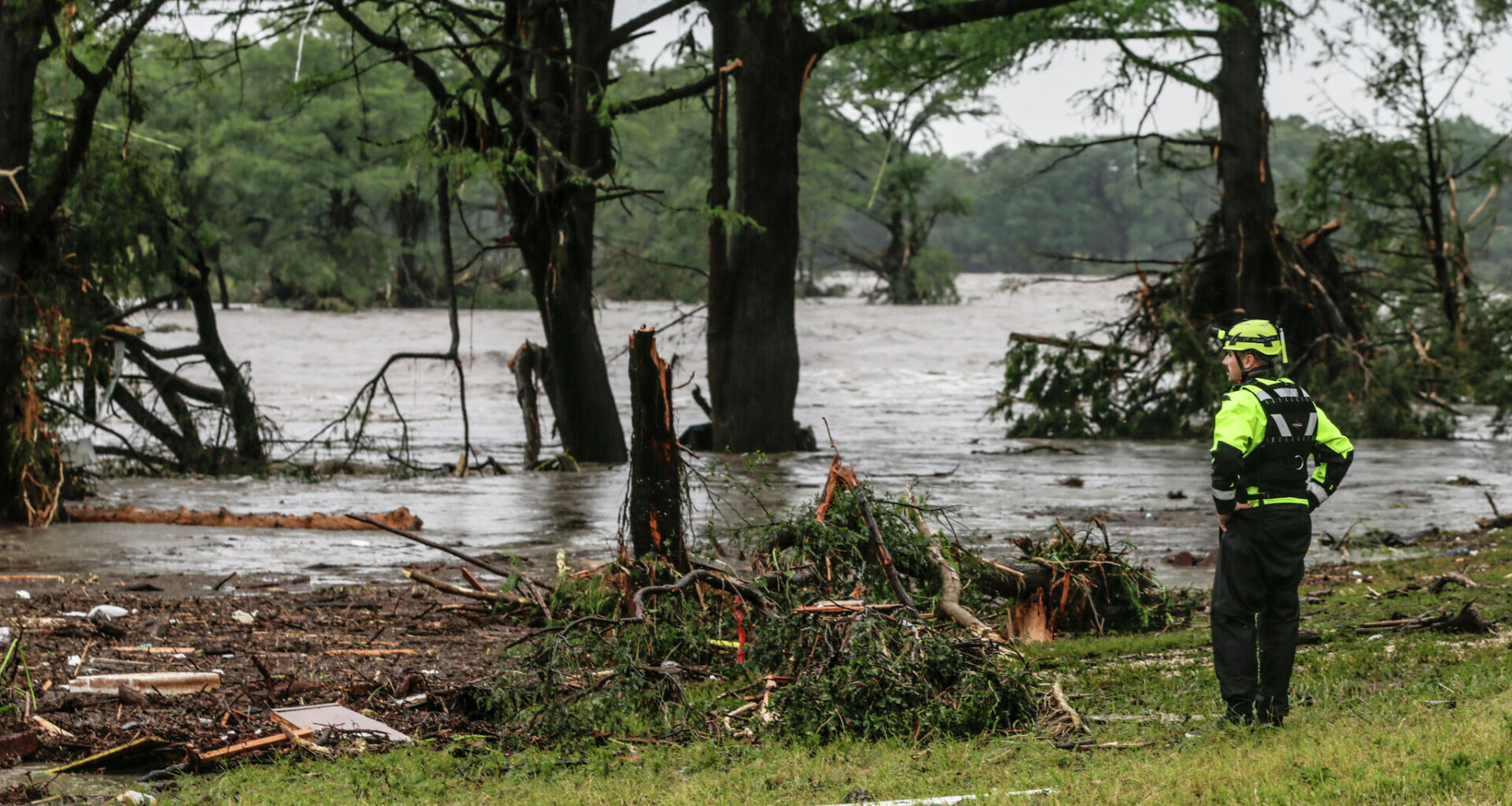
A Kerrville firefighter looks over the swollen Guadalupe River on July 4, 2025, hoping to spot survivors near Ingram, Texas, just south of Blue Oak and HTR RV parks where dozens of RV?s and homes were swept away by the current, many with occupants still in them.
Michel Fortier/Staff Photographer
One year ago, tragedy struck the Texas Hill Country.
Before dawn on July 4, 2025, torrential thunderstorms pushed into Kerr County, with the heaviest rain falling across the headwaters of the Guadalupe River. In less than an hour, the river rose by 26 feet, sending a massive flood wave that surged through small communities and summer camps in the middle of the night.
The flooding killed 139 people across Central Texas and the Hill Country, including 119 in Kerr County alone. It was Texas’ deadliest flooding disaster in more than 100 years.
Article continues below this ad
But how could something like this happen, meteorologically?
No single factor caused the disaster. Instead, it resulted from the combination of an unusual atmospheric setup, the unique geography of the Hill Country, and months of severe drought that preceded the event. Here’s how the pieces came together to create the catastrophic flooding.
The weather pattern
Abnormally high moisture: Tropical Storm Barry made landfall along Mexico’s Gulf Coast near Tampico, about 300 miles south of the Texas border. While Barry did dissipate quickly over land, leftover moisture from the storm moved northward over the next few days, bringing a tropical air mass into South Texas.
Moisture levels were extremely high across South-Central Texas during the first few days of July 2025, as the remnants of Tropical Storm Barry, a second atmospheric disturbance in the western Gulf of Mexico, and Hurricane Flossie in the Pacific Ocean all brought moisture into the area.
National Weather Service/National Oceanic and Atmospheric Administration
At the same time, a separate tropical wave over the western Gulf of Mexico supplied even more moisture-rich air, while Hurricane Flossie in the eastern Pacific also contributed moisture to the unusual atmospheric pattern.
Article continues below this ad
Together, these systems produced near-record levels of atmospheric moisture.
FACT CHECK: Can cloud seeding cause severe weather such as the Texas Hill Country flooding?
Precipitable water represents the total moisture contained within the atmosphere at a given time. On the morning of July 4, the precipitable water value at Del Rio measured 2.52 inches, which ranked as the second-highest morning value ever recorded at that location.
MCV develops: With high moisture levels already in place, a system of low air pressure over northern Mexico began producing scattered showers and thunderstorms. By July 3, the system had moved into parts of West Texas and evolved into a mesoscale convective vortex, or MCV.
Article continues below this ad
A mesoscale convective vortex developed across parts of West Texas. It slowly moved into the Hill Country during the night of July 3, heading into the early morning of July 4.
National Weather Service/National Oceanic and Atmospheric Administration
An MCV is a small-scale area of circulation that forms because of heating from condensation within a complex of thunderstorms. On satellite imagery, MVCs often resemble mini tropical cyclones over land. And like tropical cyclones, MCVs can be self-sustaining, lasting much longer than individual summertime thunderstorms, all while producing prolific rainfall rates.
Late on July 3 and into the early morning of July 4, the developing MCV moved into the Texas Hill Country. At the same time, southerly winds increased as the low-level jet stream strengthened. This carried even more Gulf moisture into the region, fueling new thunderstorm development overnight.
The result was a series of slow-moving, intense thunderstorms that repeatedly tracked across Kerr County between roughly 1 and 5 a.m. At one observation site 6 miles southwest of Hunt, 5.22 inches of rain fell in just one hour.
The heaviest rainfall occurred across central and southern Kerr County, particularly along the south fork of the Guadalupe River. There, radar estimates indicate that 10 to 15 inches of rain fell in just a few hours, equal to about 40% of the area’s average annual rainfall.
Article continues below this ad
Shown are the rainfall totals across Kerr County from July 3-6, 2025. much of this rainfall fell during the early morning hours on July 4, as thunderstorms stalled over the region.
Texas Parks and Wildlife, NASA, USGS, EPA/NOAA
Rainfall totals in Kerr county were significantly higher than forecasters predicted. That is largely because weather models often struggle with rainfall totals associated with MCVs. These systems are typically disorganized, lack strong upper-level support and don’t have a well-defined center, making it difficult for models to accurately predict how they’ll move and evolve.
It’s also nearly impossible for models to pinpoint where the heaviest rain bands will develop within an MCV. A shift of just a few miles can mean the difference between an area receiving light rain or experiencing life-threatening flooding.
Hill Country geography
The Texas Hill Country is one of the most flood-prone areas in the entire country, mostly because of its geography and local terrain.
Article continues below this ad
This region has very shallow and rocky soil, situated over limestone and granite bedrock. Because these underlying rock layers are nearly impermeable, much of the rainfall runs off the surface instead of soaking into the ground.
The Hill Country also features dramatic elevation changes, with steep hills and narrow valleys spread throughout the region. When heavy rainfall occurs, the large amount of runoff funnels downward into creeks, rivers, and low-lying areas.
The Guadalupe River valley is also narrow and winding, which accelerates the flow of water and causes it to rise much faster than if it were in flatter terrain. It’s similar to placing your thumb over the end of a garden hose — the narrower the exit, the faster the water moves.
The higher elevations along the Balcones Escarpment also enhance rainfall. When southerly winds push up against the terrain, it forces air upward and creates rising motion in the atmosphere. Water vapor-rich air cools and condenses as it rises, amplifying rainfall rates.
Drought made matters worse
Before the July 4 flooding, the Hill Country had gone through months of hot and dry weather. By early July 2025, data from the U.S. Drought Monitor showed most of Kerr County was in exceptional drought, the highest level of dryness as measured by the U.S. Drought Monitor.
Data from the U.S. Drought Monitor collected the week of July 3, 2025, just before the historic Hill Country flooding, showed much of Kerr County was dealing with exceptional drought.
U.S. Drought Monitor/National Drought Mitigation Center
This left the region especially vulnerable to floods, as extended drought had hardened the soil, greatly reducing its ability to absorb heavy rainfall. Vegetation was also more sparse after months of dry weather, further limiting the landscape’s capacity to slow runoff.
As torrential rain fell during the early morning hours of July 4, very little water was able to soak into the ground. Instead, much of it rushed directly into creeks and tributaries feeding the Guadalupe River, producing one of the deadliest flash floods in Texas history.