
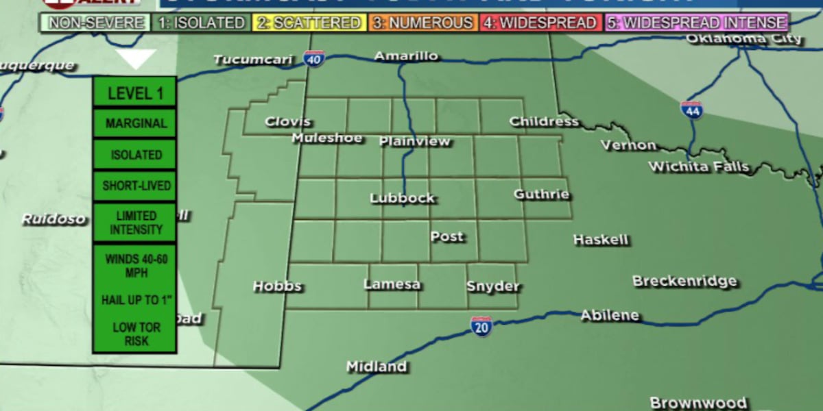
LUBBOCK, Texas (KCBD) – After a mostly quiet Fourth of July, thunderstorms are expected to return to the South Plains this afternoon and evening, with a few storms capable of producing damaging wind gusts.
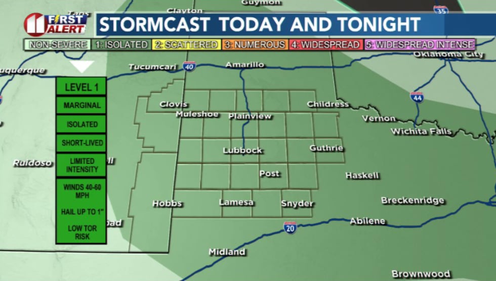 Chance for isolated storms this afternoon(KCBD)
A weak front moving through the area Sunday morning will provide the focus for storm development later in the day.
While a few showers are possible early in the day, the best shot at storms arrives during the afternoon and evening hours as temperatures warm.
Not everyone will see rain, but any storm that develops could produce damaging wind gusts.
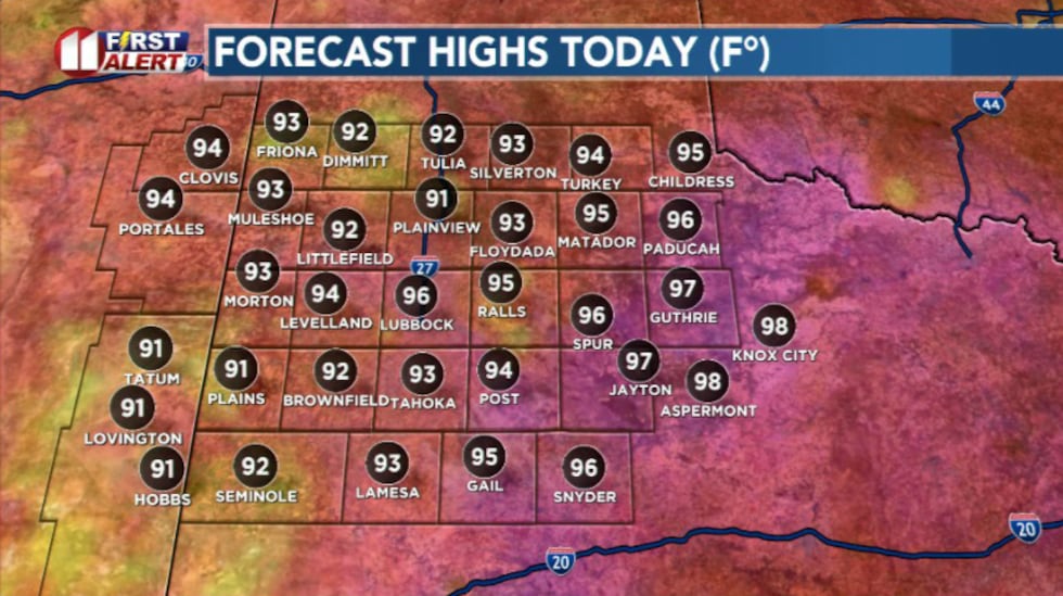 Forecasted highs today will be in the mid 90s(KCBD)
Temperatures today will be a few degrees cooler than yesterday, mostly due to cloud cover, with highs generally in the 90s.
Storm chances continue Monday before the overall weather pattern shifts.
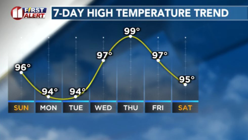 Temperatures will increase starting mid next week(KCBD)
High pressure will strengthen across West Texas through the middle of the week. This will limit storm chances and boost our temperatures into he upper 90s and low 100s.
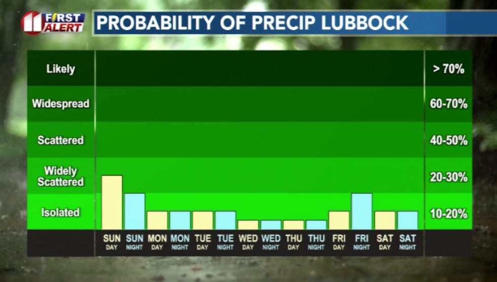 Rain chances this week(KCBD)
By late week, the ridge is expected to shift west, allowing another series of disturbances to move into the region. That will bring back daily chances for isolated afternoon storms heading into next weekend.
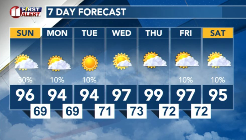 7 Day Forecast(KCBD)
Copyright 2026 KCBD. All rights reserved.