
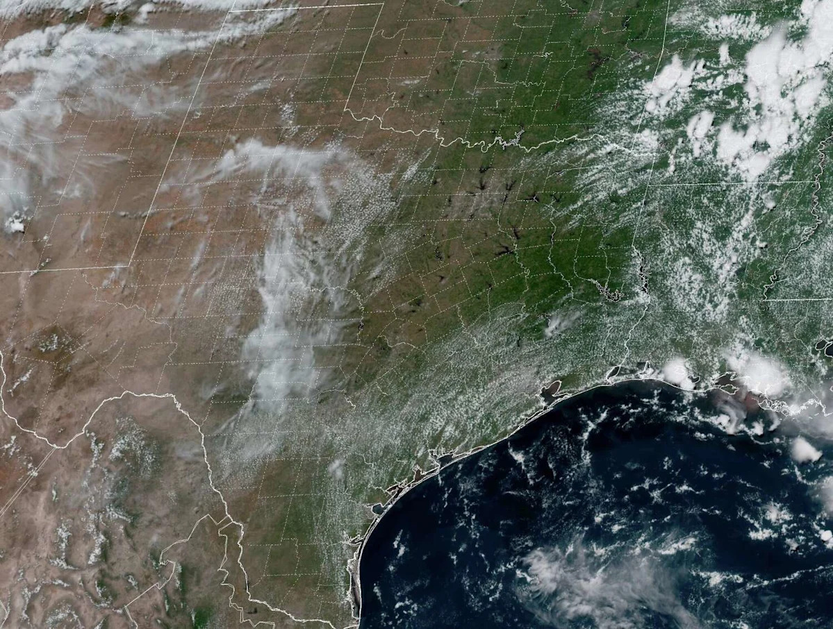
During the first half of the year, Houston experienced a very active weather pattern, which brought ample rainfall to the region. Through the summer solstice on June 21, Houston had recorded 30.08 inches of rain – about 32% more rainfall than average through that point in the year.
However, summer has brought a major shift to Houston’s weather pattern, as no rain has been recorded in the city in the past 13 days. Much of Texas has experienced similar dry weather over the past two weeks, with also no measurable rain in Dallas, Austin, Waco or San Antonio.
On Sunday, a slight shift in the weather pattern is expected, as a weak low-pressure system over the Midwest will dip southward toward Texas. The change will bring scattered thunderstorms to parts of the state, but will Houston see any rain chances at all? Here’s what to expect.
Sunday’s forecast
Sunday will start very similarly to the past several days, with partly cloudy skies overhead and temperatures hovering in the upper 70s to near 80 degrees. Temperature will rise steadily through the morning hours, likely reaching the 90-degree mark sometime between 11 a.m. and noon.
Afternoon high temperatures are expected to reach about 95 degrees by 3 p.m. The humidity will still play a major factor, though, causing “feels like” temperatures to soar to 105 degrees. If you plan on spending time outdoors, be sure to drink plenty of water, wear lightweight, loose-fitting clothing and take frequent breaks in the shade or indoors to cool off.
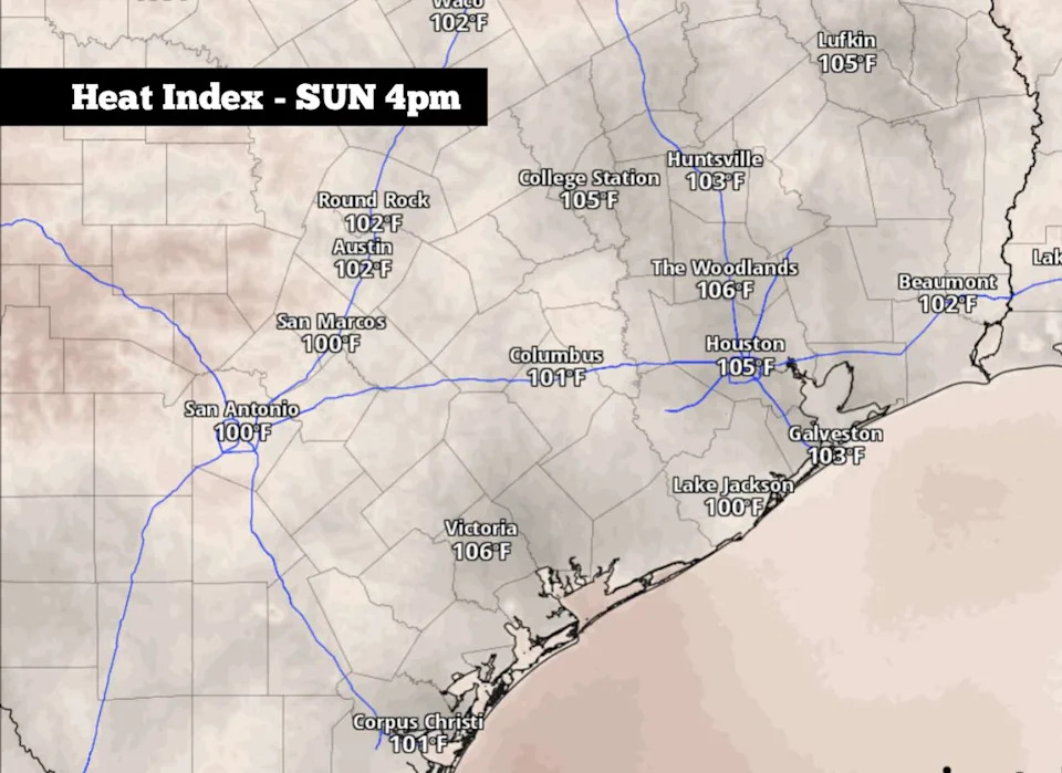
Shown is a look at the expected heat index values across the region at 4 p.m. Sunday. Houston will see “feels like” temps between 104 and 106 degrees. (Pivotal Weather)
By the late afternoon and early evening, an isolated shower or weak storm may develop near the Houston metro area. However, overall storm coverage is only expected at 10% to 20%, so much of Southeast Texas will stay dry. The best chance of rain will come between 5 and 8 p.m.
Elsewhere, more widespread storms are expected across North Texas, with about a 30% to 40% chance of thunderstorms across the DFW metroplex. There, a few storms could be strong, bringing brief downpours, frequent lightning, and wind gusts up to 50 mph.
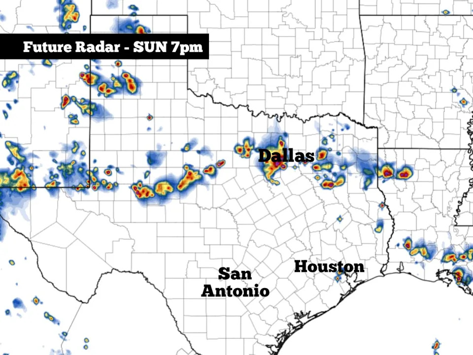
Shown is the future radar at 7 p.m. Sunday, as a few clusters of thunderstorms develop in the northern half of Texas. An isolated shower or weak storm is also possible near Houston. (Pivotal Weather)
This week’s forecast
With a general high pressure trend continuing across the region, very few changes are expected in Southeast Texas this week. On Monday and Tuesday, high temperatures in Houston are expected to stay near 95 to 96 degrees, with heat index values at 105 degrees or higher. In addition, low chances of isolated rain will also stay in the forecast.
By Wednesday and Thursday, a slight warming trend is expected, with highs rising to around 97 to 98 degrees. Still, most of the Houston metro area will avoid 100-degree heat.
Long-range weather models are split on what will occur the following week, during the July 12-16 timeframe. The American GFS weather model shows that high pressure will build across Texas, allowing for potential triple-digit temperatures. However, the European ECMWF model suggests high pressure will break down, giving way to cooler temps and higher rain chances.
Be sure to stick with houstonchronicle.com/weather for updates as the long-range details become more clear in the coming days.
Subscribe
There’s more to Houston with the Chronicle. Subscribe today for just 25¢.
This article originally published at Scattered storms will form over Texas on Sunday, but will Houston see any rain?.