
EL PASO, Texas (KTSM) — After three days of downpours across the Borderland, a drying-out period is on the horizon. After Tuesday night and Wednesday, the region will see calmer conditions.
Tuesday night, remaining moisture coupled with an unstable atmosphere set the stage for potential thunderstorms that can potentially be severe in El Paso and Las Cruces late in the night. With heavy rain comes the risk of flooding so continue to be weather-aware and turn around, don’t drown if you are out on the roads. Overnight in El Paso, the low will be near 65 with winds blowing 5-10 mph.
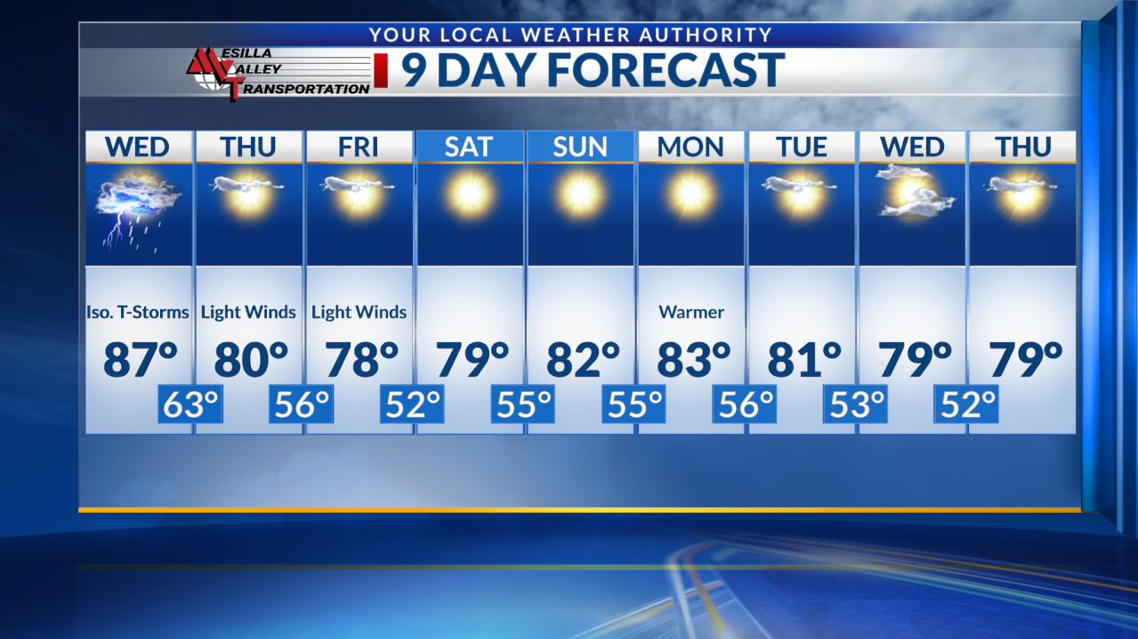
Wednesday, we can expect a warmer high in the upper 80s with mostly sunny skies during the day. Winds will be around 10-15 mph with gusts reaching speeds near 20 mph at times. In the evening, isolated storm chances remain with a low in the low 60s.
On Thursday and Friday, the highs will be around the upper 70s to lower 80s with light winds and mostly sunny skies. Lows will be in the 50s with clear skies.
At this time, the weekend appears calm with temperatures near average. The lows will be in the mid 50s.
A warm high near the mid 80s is expected for Monday with plenty of sunshine. Tuesday forward, highs will be close to average in the upper 70s and lower 80s range.