

SAN ANTONIO – El Niño and La Niña can have a major influence on weather patterns across Texas, especially during the cooler months. But when it comes to July rainfall in San Antonio, the connection is much less clear.
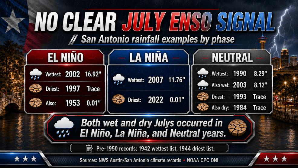
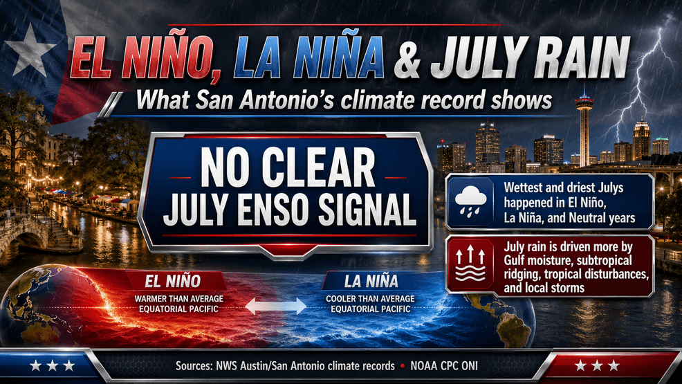
A lookback at San Antonio’s July precipitation records shows a simple but important pattern: July rainfall is highly variable, and the wettest or driest Julys do not fall neatly into one El Niño-Southern Oscillation (ENSO) category.
In other words, El Niño does not automatically mean a wet July. La Niña does not automatically mean a dry July. Neutral years can produce both extremes.
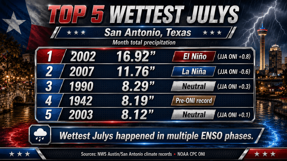
San Antonio’s wettest July on record was 2002, when 16.92 inches of rain fell during the month. That occurred during a developing El Niño pattern. The second-wettest July, 2007, brought 11.76 inches of rain during a developing La Niña pattern. The third-wettest July, 1990, produced 8.29 inches during a neutral pattern.
El Niño and La Niña can have a major influence on weather patterns across Texas, especially during the cooler months.
San Antonio’s biggest July rainfall events have happened during El Niño, La Niña and neutral years. That means ENSO alone is not a dependable predictor of July rainfall in South Central Texas.
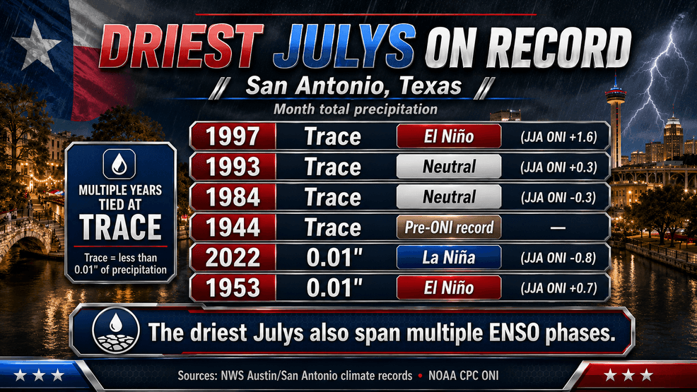
The dry side of the record tells a similar story. July 1997 recorded only a trace of rain in San Antonio during a strong developing El Niño. July 1993 and July 1984 also recorded only a trace during neutral conditions. July 2022 produced just 0.01 inches during La Niña. July 1953 also recorded 0.01 inches during El Niño.
El Niño and La Niña can have a major influence on weather patterns across Texas, especially during the cooler months.
So what drives July rain in San Antonio?
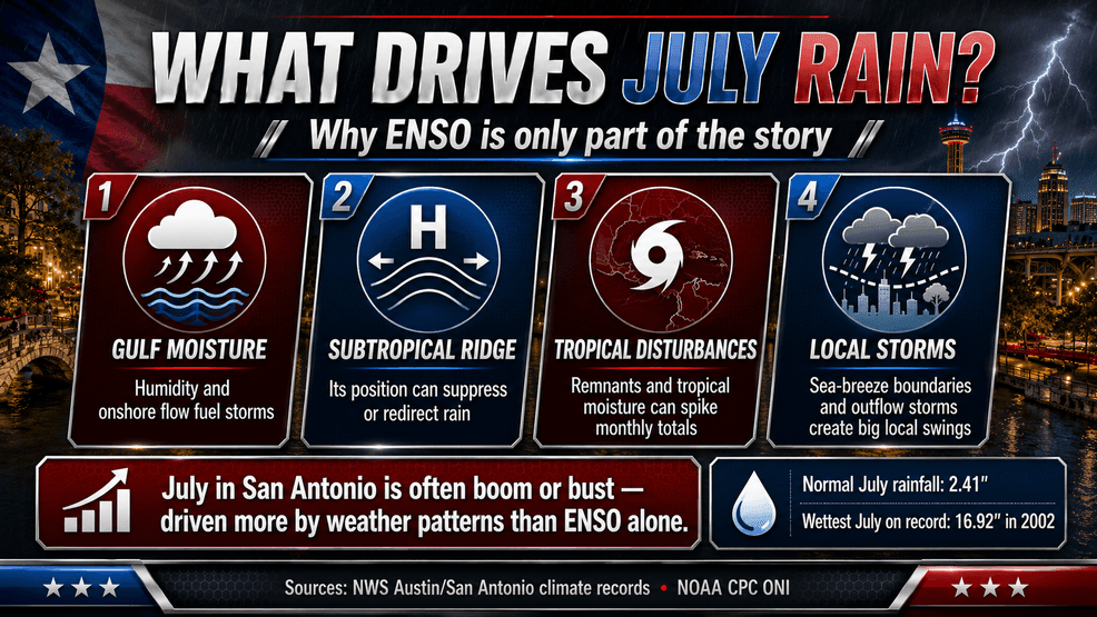
At this time of year, local and regional weather patterns often matter more than the broad Pacific signal. Gulf moisture, the position and strength of the subtropical ridge, tropical disturbances, weak boundaries, sea-breeze/outflow interactions and localized thunderstorms can all dramatically change the outcome.
El Niño and La Niña can have a major influence on weather patterns across Texas, especially during the cooler months.
That is why July rainfall in San Antonio is often a boom-or-bust pattern. A large part of the month can be hot and dry, then one tropical plume or slow-moving storm cluster can suddenly push rainfall totals far above normal.
San Antonio’s July normal rainfall is 2.41 inches, but the record shows that monthly totals can swing from a trace to more than 16 inches. That range is why single-month precipitation trends are harder to interpret than temperature trends. July temperatures tend to show a clearer long-term warming signal. July rainfall is much more chaotic.
El Niño and La Niña can have a major influence on weather patterns across Texas, especially during the cooler months.
July rain in South Central Texas depends more on the exact weather setup over the Gulf, Texas and northern Mexico than on ENSO alone.
That makes July one of the more unpredictable rainfall months in the local climate record. The best way to describe it is this: San Antonio July rainfall is not controlled by one climate switch. It is a boom-or-bust pattern shaped by moisture, ridging, tropical activity and local storms — with ENSO operating in the background, not as the main driver.
El Niño and La Niña can have a major influence on weather patterns across Texas, especially during the cooler months.