
Flood experts have long argued that Harris County’s flood maps are wildly outdated and give homeowners a false sense of security. But instead of expanding, developers and property owners across the county have used a little-known appeal process to push the maps in the opposite direction.
Over the past decade, they have removed at least 6,556 Harris County homes from official floodplains through 456 appeal cases. They did so by raising the land beneath them or showing that the structures sit just high enough to be taken out of FEMA’s special flood hazard area – which covers properties with a 1% or greater chance of flooding per year.
For those accustomed to building and buying near the county’s web of creeks and bayous, the process is a familiar way out of the floodplain. But outside those circles, experts said, many homeowners do not know it exists at all.
“You often have to spend money on a surveyor or engineer, and that’s out of reach for a lot of people,” said Sarah Pralle, a Syracuse University professor who focuses on environmental policy. “Just the paperwork involved, the time it takes, the knowledge these processes require … these things are unevenly distributed in our society.”
A Houston Chronicle investigation found that in Harris County, successful appeals have clustered in newer subdivisions and more affluent neighborhoods. That pattern has practical consequences, Pralle said, because floodplain designation can determine if a homeowner is required to buy flood insurance, if a property is subject to stricter building rules and what future buyers are informed about the risk.
Floodplain exemption are most common in Harris County’s higher-income neighborhoods
Neighborhoods with the most successful map challenges were concentrated in affluent suburbs and along the Houston Arrow. Search the map to explore exemptions in your area.
The analysis covers all unique Letters of Map Amendment and Letters of Map Revision Based on Fill cases involving single-family lots since March 2016, when FEMA records began including sufficiently precise coordinates.
Map: Yilun Cheng • Source: Federal Emergency Management Agency, Harris County Appraisal District, U.S. Census Bureau’s American Community Survey 2020–2024 five-year estimates.
Overall, the median market value of the removed homes is $383,300 — around $100,000 higher than the median single-family home in Harris County, according to the Chronicle’s analysis of Harris County Appraisal District data and FEMA map change records from 2016 to the present.
Over 40 exempted properties — owned by oil and gas executives, lawyers and real estate investors — have market values of more than $1 million. More than 1,500 are worth at least half a million dollars, data shows.
One of the highest-valued properties is a west Houston mansion owned by Melissa McNair, a director of the Houston Texans Foundation and a member of the family that founded and owns the NFL team. Its 2026 market value is $4.6 million, according to the appraisal district.
Flood experts warn that some removals make homes appear safer on paper even when they remain flood-prone on the ground. McNair’s house, for instance, was exempted from the special flood hazard designation in 2022, records show, even as FEMA noted that portions of the property still fall inside a FEMA floodway — the most dangerous designation.
The vast majority of these properties, including McNair’s, were removed through fill, meaning the owner had brought in dirt to raise the ground under the house. It is a particularly controversial method that floodplain managers, independent advisers and environmental groups have long criticized for undermining flood protection and shifting the danger to nearby properties, the Chronicle’s analysis shows.
McNair did not respond to questions about whether she was aware of the map change affecting her property or its remaining flood risk.
Chad Berginnis, executive director of the Association of State Floodplain Managers, said many property owners overlook the nuances of the remaining risk and instead see a successful appeal as “their golden ticket out of the burden of flood insurance.”
“I have seen property owners and developers spend thousands or tens of thousands of dollars to argue about an inch of elevation,” Berginnis said. “People are more afraid of the insurance requirements than they are of the flood disaster.”
FEMA did not directly respond to some experts’ concerns that the map changes could mislead homeowners or worsen flood risk, but an agency spokesperson acknowledged that the physical danger of flooding does not change as a result of these determinations.
“Flood maps help communities manage risk, but they are not a promise that flooding will not happen,” the FEMA spokesperson said. ”We know from experience that whether a property is inside or near a high-risk flood zone, it may still be at consequential risk of flooding, even when it’s elevated.”
Rising risk
The flood mapping process dates back decades and reflects FEMA’s own recognition that its maps are not always accurate.
Flood boundaries can be difficult to draw precisely on a map, according to federal regulations. They can also shift as a result of natural changes in the landscape, human alterations to the terrain and improvements in technology that better predict how water moves.
To correct and update the maps, owners can submit technical evidence, often elevation data, and ask FEMA to reconsider whether a home or a larger stretch of land really belongs in a special flood hazard area.
Homeowners with federally backed mortgages are generally required to carry flood insurance if their houses are in a special flood hazard area.
When FEMA exempts a home, the mandatory purchase requirement no longer applies. With the rising cost of flood insurance, that can easily save the property owner over $1,000 a year.
But a map change does not mean the danger is gone, experts said. A home might be just above the flood line, but if the area around it still floods, that small margin offers little protection.
Over time, LOMR-F requests became especially controversial.
FEMA itself has repeatedly acknowledged the concern that fill can reduce the floodplain’s ability to store and carry water. In a 2006 FEMA-funded report, researchers from the American Institutes for Research suggested abolishing the LOMR-F category altogether.
“Their sole purpose is to avoid the mandatory purchase requirement,” researchers said, adding that this type of exemption is inconsistent with the floodplain program’s purpose of guiding development away from areas threatened by flood hazards.
In 2023, FEMA’s Technical Mapping Advisory Council considered recommending that owners of LOMR-F properties still be required to buy flood insurance. It argued that the use of fill-based revisions can potentially increase the risk of death, create hazards for nearby properties and lead owners to drop flood insurance, which would shift more of the financial burden to taxpayers when floods occur.
Members of the advisory committee, however, ultimately backed away from the idea. It would be too difficult to implement, they decided, and unfair to owners who had purchased their properties with the expectation that they would not be asked to buy flood insurance.
Homes in the Elyson subdivision are photographed in Katy on June 23, 2026. Elyson has seen the most property-level removals from flood maps in the past decade. Raqual Natalicchio/Houston Chronicle
Many flood map removals also came with warnings.
Of the 456 unique appeal cases, about two-thirds included notices that the land was in an area subject to ground subsidence. That means the land could sink over time and narrow the margin that put them above the floodplain in the first place.
In more than half the cases, FEMA removed only the structure, not the entire lot. The house was no longer subject to the mandatory flood insurance requirement, but parts of the property around it remained in the floodplain, and in some cases, a floodway. On FEMA’s official maps, some of those homes appear to be buried deep inside a floodplain, surrounded by land that the federal agency continues to classify as high risk.
Homeowners and potential buyers need to carefully weigh the specific circumstances of any exempted property, according to Larry Dunbar, a longtime water resources engineer who has advised Houston-area local governments on drainage regulations. Simply having a notice of successful removal does not, by itself, say much about the actual danger, he said.
“Really all this does is it allows you to not be required to have flood insurance,” Dunbar said. “And it then allows you to show a potential buyer, ‘oh, hey, see my house isn’t in the floodplain.’”
Uneven access
The Chronicle’s investigation found that successful map changes have not been evenly distributed across Harris County neighborhoods.
The ZIP codes with the most property-level map changes were largely concentrated in well-resourced suburban communities in Katy, Cypress, Humble and Tomball, where median household incomes are higher than the county’s average.
Within Houston, map changes have clustered along the Houston Arrow – the often-cited corridor of wealth that starts in west Houston near the Addicks and Barker reservoirs and runs east toward downtown. Large parts of the rest of the city saw few exemptions.
Travis McGee, president of the South Park Super Neighborhood, said many families in his area have never heard of the process, much less know where to start. The neighborhood is 98% Black and Hispanic and has a median household income of $34,700, compared to the county average of roughly $75,000, according to the latest census data.
“It’s complicated. It is expensive,” McGee said. “The only people that really get this type of information are the developers and people in affluent neighborhoods.”
Pralle, the Syracuse University professor, said these patterns align with what she has observed nationally. In a 2021 study of 255 counties across the country, she and a colleague found that communities with higher median home prices, new buildings and a higher percentage of white residents saw significantly more flood zone removals.
Workers build a house in the Bridgeland master-planned community in Cypress on Nov. 10, 2025. Bridgeland is one of the many Houston-area communities that have used a FEMA process to remove flood-prone properties from designated floodplains. Brett Coomer/Houston Chronicle
Having closely tracked FEMA’s map changes, she said she has seen how that unequal access can leave some residents out of the loop on key community decisions.
When FEMA redrew Syracuse’s flood maps in 2016, for instance, many homes newly mapped into the 100-year floodplain were located in the city’s poorest neighborhoods on the South Side. And some families, she said, only learned they were in a flood zone when they received a letter from their mortgage lender telling them they had to buy flood insurance.
“Even though FEMA held public hearings and meetings, and they were trying to do the right thing, a lot of residents were taken by surprise,” Pralle said. “This is even with a nonprofit organization that’s been in that community for a very long time trying to educate people about it. It just shows how challenging that can be.”
Across the U.S., tens of thousands of buildings have been taken out of flood zones through these appeals. Pralle said she is concerned by that trend, especially because flood maps already underestimate risk in many places. But as long as the process remains in place, she said, local and federal governments need to better inform and assist lower-income families.
“We should have more homes and structures in flood zones, not fewer,” Pralle said. “But if we’re going to make this appeals process available, we should make it available to everyone equally.”
More to come
FEMA records do not list the applicants for these appeals, but a number of cases cover dozens or more individual lots at once and appear to be initiated by community developers.
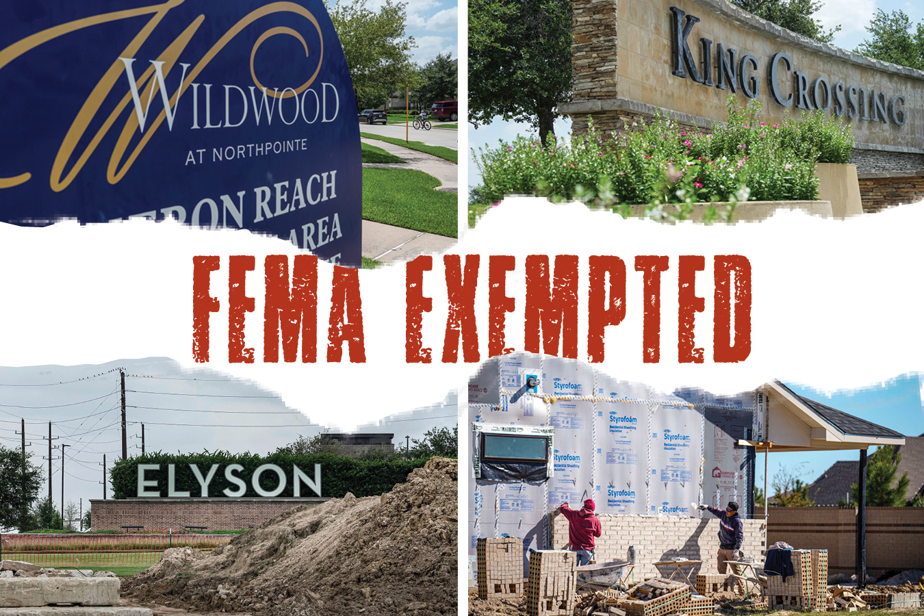
They include some of the most popular master-planned subdivisions in the region, such as Bridgeland in Cypress, Elyson and King Crossing in Katy, and Willow Springs and Wildwood at Northpointe in North Houston.
Elyson, a roughly 3,600-acre community, had the largest number of property-level map changes in the county over the past decade, accounting for about a third of the total.
Homes in the Elyson subdivision are photographed in Katy on June 23, 2026. Elyson has seen the most property-level removals from flood maps in the past decade. Raqual Natalicchio/Houston Chronicle
The sprawling community, built on land crossed by three floodplains, first opened in 2016. Newland Communities, the original developer, told the Chronicle at the time that engineers had assured them that the use of fill, combined with other drainage measures, would provide sufficient protection. But flood experts criticized the project from the beginning, saying its floodplain location “sent the wrong message.”
Since then, the developer has continued to add new sections on former floodplain land. Records show Elyson is responsible for 2,167 of the 6,556 property-level flood map changes in Harris County over the past decade. All of them were done through fill-based revisions.
Though Elyson is not the most expensive subdivision in the analysis, its typical home value had reached $550,000 by 2025, data shows, almost double the county’s median single-family home value of around $286,500 in the same year.
Bill Cook, a local advocate whose house flooded during Hurricane Harvey, said he has been dismayed to watch new residential sections continue to rise on vulnerable land west of Houston.
Driving west on FM 529 from the Grand Parkway into Elyson, Cook said, the impact of the fill is visible from the road. Older buildings to the left lay closer to the ground level, while newer sections to the right have been raised above surrounding properties.
“The road is still where it is, The existing structures are still where they are,” Cook said. “But all of a sudden you’ve got new communities, and they’re being built on dirt that’s elevated several feet off the ground surface.”
Brookfield Properties, which acquired Newland Communities in 2021, did not respond to the Chronicle’s request for comment on the thousands of flood map exemptions in Elyson and concerns that they undermine flood protection.
Developers of Bridgeland, King Crossing and Wildwood at Northpointe also did not respond to requests for comment.
Cara Kane, a spokesperson for KB Home, the developer of Willow Springs, said since the community was built over 10 years ago, her team does not have specific information about various FEMA changes and is not aware of the process.
In Harris County, local regulators require developers to offset the impact of fill. But Berginnis said the current level of protection might not be enough.
“Mother Nature does not care about our statistical calculation,” Berginnes said. “There is absolutely flood risk at those sites.”
In February, FEMA released a draft of the first comprehensive update to Harris County’s flood maps in nearly two decades. It shows sweeping expansions of high-risk flood zones across nearly every bayou and waterway, with the number of properties that at least partially fall within a 100-year floodplain doubling from about 160,000 to nearly 320,000.
Before the new flood zones are finalized, property owners and communities will have a chance to challenge FEMA’s proposed boundaries.
The new maps could trigger a flurry of appeals in the years to come, Berginnis said. Those challenges, too, could require knowledge and resources that are easier for wealthier homeowners to access.
“It seems like with almost every aspect of society, those with more money have more ability to change things,” Berginnis said. “It isn’t fair necessarily, but that is a reality.”
How we did it
The Chronicle used Federal Emergency Management Agency flood map change records (LOMCs) and Harris County Appraisal District parcel data to identify single-family homes that were removed from floodplains across the county.
We limited our analysis to FEMA LOMC requests that have been approved since March 1, 2026, because data predating that date did not contain detailed enough geographic information to be included in our analysis. We also manually reviewed FEMA determination letters for each LOMC to confirm approvals, note important flood-risk caveats, identify cases that covered multiple parcels and remove cases superseded by later requests.
We matched each LOMC to a corresponding Harris County Appraisal District single-family home parcel so we could determine the median market value for LOMC-affected parcels. We also analyzed all single-family homes in Harris County to get a baseline median market value for comparison.