
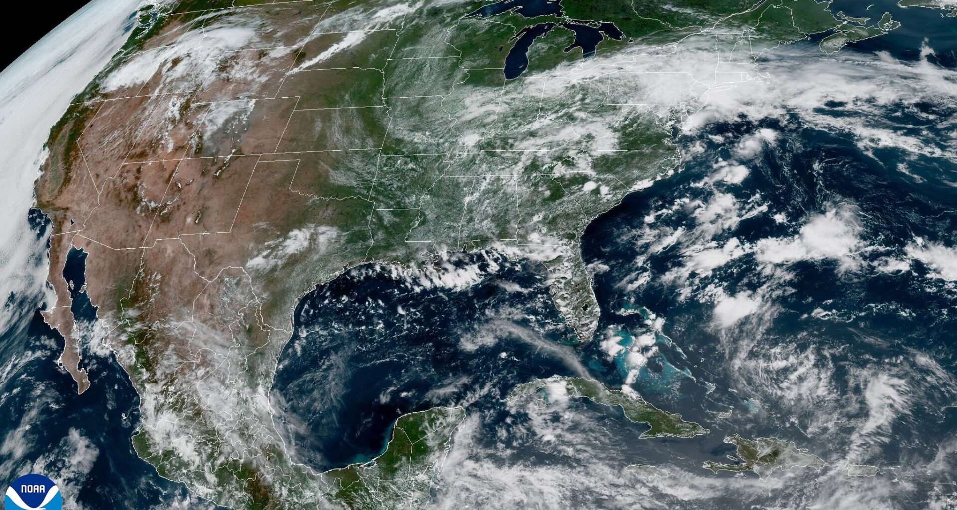
On Monday’s weather satellite image, a weak frontal boundary stretched across Central Texas, but it will be replaced by a broad area of high air pressure on Tuesday, bringing hotter and drier weather back to the region.
National Weather Service
As of Tuesday, Austin is still waiting for its first official 100-degree day of the year. While we’ve already had several afternoons topping out at 97 degrees, the hottest temperature so far has been 98 degrees, recorded a few days ago on July 3. That could change this week, with forecast highs climbing into the 98- to 100-degree range on Wednesday and Thursday.

If the city falls short of the 100-degree mark again, the next opportunity may not come until the middle of next week, as increasing chances for rain and thunderstorms arrive Friday and are expected to continue into early next week.
Article continues below this ad
The closest Central Texas will get to the 100-degree mark this week will be on Wednesday or Thursday.
Pivotal
Another plume of Saharan dust is also expected to move across the Caribbean and reach the Texas coastline by the middle of the week. At the same time, lingering smoke from wildfires in Mexico, Canada, and the southwestern United States may continue to drift over parts of Texas. Most of that smoke will remain high in the atmosphere. But when it is combined with the Saharan dust, the particulates could reduce air quality and put much of the area in the “moderate” category of the Air Quality Index through the rest of the week, according to the Texas Commission on Environmental Quality.
Tuesday forecast
Any lingering showers associated with the weak frontal boundary that pushed south across Texas on Sunday and Monday have ended. In their place, an upper-level ridge of high atmospheric pressure will strengthen and expand over the state, bringing hotter and drier weather for the time being.
Article continues below this ad
Expect a partly cloudy start to the day Tuesday with light south winds of 3 to 5 mph and morning temperatures in the middle to upper 70s. Sunshine will dominate this afternoon, with temps climbing into the upper 90s. Combined with the humidity, those 90-degree temps will feel more like 100 to 102 degrees. South winds will remain light throughout the day at 5 to 10 mph.
Wednesday and Thursday forecast
High air pressure will continue to dominate the weather on Wednesday and Thursday, bringing more heat and rain-free weather.
Very few clouds are likely Wednesday, with south winds blowing at 5 to 10 mph for most of the day. Winds could become a bit more robust during the evening, around sunset, with gusts blowing at 15 to 18 mph. Afternoon temperatures will climb into the upper 90s to near 100 degrees.
Article continues below this ad
High atmospheric pressure will nudge into Texas, leaving us with hot and dry weather Tuesday through Thursday.
Weather Prediction Center
Thursday will be similar, with abundant sunshine and above-average heat. High temperatures will once again approach 100 degrees, with heat index values, or humidity-driven “feels like” temps, hitting around 102 degrees. The biggest difference on Thursday will be the wind, as south winds become breezy during the afternoon, sustained at 8 to 15 mph with gusts of up to 25 mph.
Late-week and weekend forecast
Changes are on the way as rain returns to the forecast. An upper-level disturbance will track along the northern edge of the ridge of high pressure and move into the central United States. As it does, the ridge will weaken across Texas and gradually shift westward.
Article continues below this ad
At the same time, an atmospheric disturbance in the Gulf of Mexico will move west, sending a surge of tropical moisture into the state. The added moisture in the air will lead to increasing cloudiness and a growing chance for showers and thunderstorms beginning Friday and continuing through the weekend.
Rain totals from Friday through Sunday in Central Texas will reach about an inch along the Interstate 35 corridor.
Pivotal
While it may be too early to give any specific rainfall totals, the National Weather Service suggests some locally heavy showers are possible through the weekend. The latest extended rainfall outlook from the weather service’s Weather Prediction Center suggests up to an inch along the Interstate 35 corridor, but between an inch and 2 inches along the Gulf Coast.