
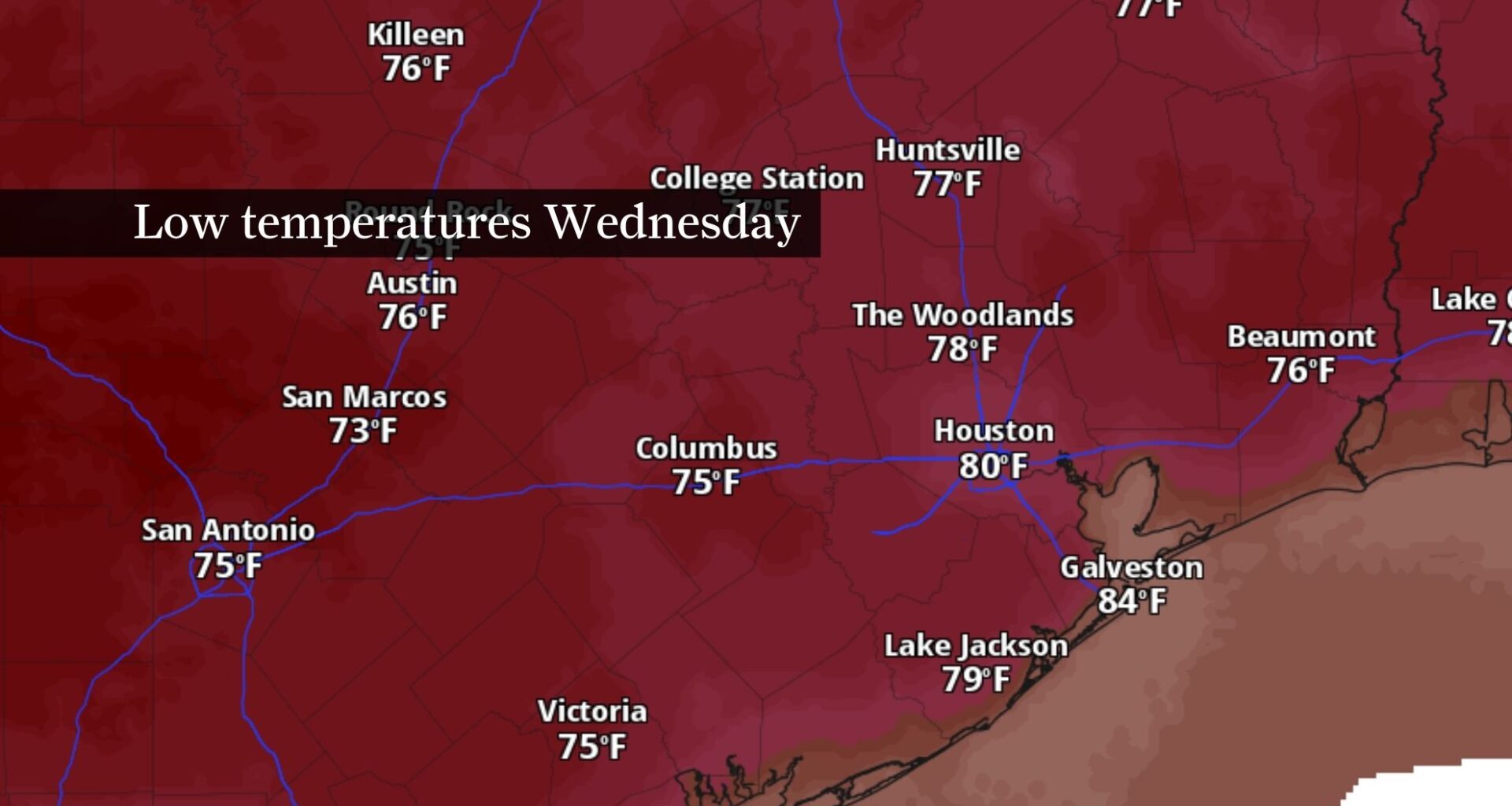
This map shows forecast morning temperatures across Central and Southeast Texas Wednesday. Predawn lows of around 80 degrees are expected in Houston, with upper 70s likely elsewhere.
Pivotal Weather
If it feels like Houston’s nights aren’t offering much relief from the high temperatures these days, it’s because they’re not.
The city has entered the warmest stretch of the year overnight, which means mornings will offer little relief from the daytime heat for the next six weeks. As overnight lows struggle to fall below the mid-70s, the weather pattern through the end of the work week will push heat index values, or humidity-driven “feels like” temperatures, close to dangerous levels.
Houston heat keeps highs in the mid-90s
Expect another hot and humid Wednesday with afternoon temps climbing into the mid-90s across much of Southeast Texas. Combined with the humidity, it’ll feel more like 100 to 107 degrees during the hottest part of the afternoon.
Article continues below this ad
A strengthening ridge of high air pressure over the Rocky Mountains will gradually limit widespread storm development through the end of the work week, even though enough Gulf moisture remains in place for the typical summertime weather pattern. That means a few showers could develop near the coast in the morning before isolated thunderstorms pop up inland during the afternoon as the sea breeze moves inland.
Most neighborhoods will stay dry, so plan for another hot July day.
Houston rain chances increase Friday and this weekend
Although most of Southeast Texas will stay dry through Thursday, a few afternoon showers and thunderstorms remain possible. Rain chances increase Friday before climbing higher over the weekend.
Article continues below this ad
TEXAS HEAT: How hot is it where you live? Use the Houston Chronicle’s interactive tracker to find out.
Another plume of Saharan dust will move farther inland Thursday. Most people will notice hazier skies and perhaps more colorful sunrises and sunsets, but the added dust could also affect air quality for those with sensitive respiratory systems around Houston.
Rain chances through Thursday remain isolated, but more downpours could develop Friday into Saturday. This map, showing potential rainfall totals through Sunday morning, keeps the highest rainfall totals north of Houston.
NOAA’s Climate Prediction Center / Pivotal Weather
By Friday and the weekend, a subtle shift in the upper-level weather pattern will allow deeper volumes of Gulf moisture to return. That combination should support scattered showers and thunderstorms Saturday and Sunday, with daily rain chances continuing into next week.
Article continues below this ad
The added clouds and rain won’t end the heat, but they should keep afternoon temperatures in the lower to mid-90s instead of allowing them to climb closer to 100.
Houston enters its warmest stretch of nights
Houston has entered the time of year when normal overnight lows hold at 76 degrees, the warmest of the entire year. That stretch lasts from July 7 through Aug. 18, meaning the city can expect more than a month of muggy mornings with little overnight cooling.
CLIMATE CONNECTIONS: What would a stronger El Niño mean for Texas hurricane season or the chances of a Houston snowfall?
Those warm nights matter just as much as the afternoon heat. Without much cooling after sunset, homes, roads and other surfaces retain heat overnight, making it more difficult for people to recover before temperatures climb back into the 90s the following day.
Article continues below this ad
So when can Houston expect its first morning below 70 degrees?
Based on long-term climate averages, the normal low doesn’t fall below 70 degrees again until late September, with overnight lows dropping into the upper 60s by the end of the month.
Until then, expect the combination of hot afternoons and tropical nights to remain a defining feature of summer across Southeast Texas.